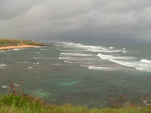
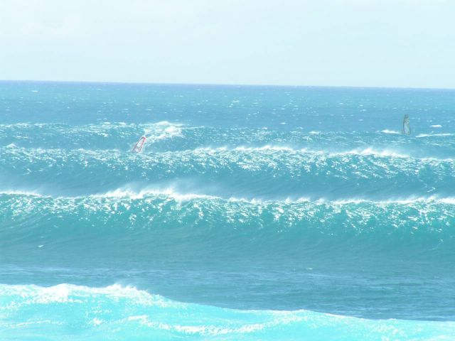
waves (short term): NW buoy: 7 feet, 9sec, plus 4 feet, 14sec; Waimea buoy 5 feet, 8sec, 15-30 degrees plus 3 feet, 14sec, 310-320 degrees. That's still the ugly wind swell, with a small NW ground swell peaking up today. Trade winds still pumping, getting stronger tomorrow into the weekend. Decent wavesailing and poor surfing. Maybe Honolua bay.
waves (long term): Strong trade winds keep blowing, even stronger towards the weekend and make for a high, rough, unrideable windswell. There will be a couple of bumps during the weekend from NW and from NNE during the weekend. Nothing too exciting, though.
South pacific still sending swells towards south America and not us.
wind: Strong trades for the rest of the week. Annoingly stronger in the weekend.
sky: Clouds over the islands today. Pretty squally on the north shore!
Kahului tides: Low 3.18am 0.5 feet, High 5.32am 0.8 feet, Low 11.23am 0.2 feet, High 7.48pm 2.2 feet.
Thursday, March 31, 2005
Wednesday, March 30, 2005
Wednesday 3-30: Forecast
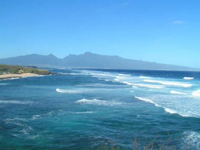
waves (short term): NW buoy: 7 feet, 9sec, plus 4 feet, 14sec; Waimea buoy 5 feet, 8sec, 10-30 degrees plus 2 feet, 15sec, 305-320 degrees. That's still the ugly wind swell, but NW ground swell built up a little bit. Not enough, I would say... Trade winds still pumping. Good wavesailing and poor surfing. Maybe Honolua bay.
waves (long term): Strong trade winds keep blowing, even stronger towards the weekend and make for a high, rough, unrideable windswell. Next storm formed off Japan has been quite weak and should only send a bump from WNW during the weekend. At the same time, another storm is spinning off the coast of Canada and that might send a bump from N, always during the weekend.
South pacific still sending swells towards south America and not us.
wind: Strong trades for the whole next week. Super strong towards the weekend.
sky: The last weekend's front is gone and the leftover clouds are not that many anymore. Still squalls on the north shore, but not as many as last two days!
Kahului tides: Low 1.06am 0.6 feet, High 4.28am 0.9 feet, Low 10.35am 0.1 feet, High 6.32pm 2.2 feet.
Tuesday, March 29, 2005
Tuesday 3-29: Forecast
waves (short term): NW buoy: 7 feet, 8 sec, plus 3 feet, 16sec; Waimea buoy 6 feet, 9sec, 0-30 degrees plus 1 foot, 20sec, 320 degrees. That's still the ugly wind swell, but there's the first signs of the long ago forecasted NW ground swell. This last one, should rise today and peak tomorrow and last thru Friday. Considering the strong trade winds, surf is still gonna suck!
waves (long term): Strong NE wind will blow this coming week and make for a high, rough, unrideable windswell. As said above, there will be a NW ground swell around, but it won't be big enough to overcome the roughness of the ugly windswell. Maybe Honolua bay. The models today show another storm forming off Japan and that will send another NW swell around the end of this coming week... quite small this time.
South pacific still kind of sleepy. Actually it's not sleepy at all. It is just sending swells towards south America and not us.
wind: Strong trades for the whole next week. Super strong towards the weekend.
sky: The front is gone, but there's still a bunch of clouds left. Another squally day on the north shore.
Kahului tides: High 3.51am 1.2 feet, Low 10.01am 0.1 feet, High 5.25pm 2.2 feet.
Monday, March 28, 2005
Monday 3-28: Forecast
waves (short term): NW buoy: 7 feet, 8 sec; Waimea buoy 6 feet, 8 sec, 0-30 degrees. That's still an ugly wind swell. And it's still the only swell recorded by these two buoys! Now I know I don't need to tell you anymore that surf is gonna suck...
waves (long term): as I am writing since a few days, surfers, you're done for a while. Strong NE wind will blow this coming week and make for a high, rough, unrideable windswell. Around Tuesday a medium swell from NW will arrive and last for a few days. But, with that strong wind, it will only be good for wavesailing. The models keep showing another storm forming off Japan in about 24 hours that will send another NW swell around the end of this coming week... just in time for the finals of the PWA contest at Hookipa!
South pacific still kind of sleepy. That decent storm in the Tasman sea that sent a swell to Tahiti and French Polinesia is moving east and looks like it will send some big stuff to south America (Chile, Peru). Nothing for us.
wind: Strong trades for the whole next week.
sky: The front is gone, but it left a bunch of clouds. Squally day.
Kahului tides: High 3.19am 1.4 feet, Low 9.32am 0.1 feet, High 4.29pm 2.2 feet, Low 11.31pm 0.5 feet.
Sunday, March 27, 2005
Sunday 3-28: Forecast
waves (short term): The NW buoy is at 9 feet, 7 sec and the Waimea buoy is 8 feet, 7 sec, 25 degrees. That's an ugly wind swell. And that's the only swell recorded by these two buoys! Do I even need to tell you that surf is gonna suck?
waves (long term): as I wrote yesterday, surfers, you're done for a while. Strong NE wind will blow this coming week and make for a high, rough, unrideable windswell. Around Tuesday a medium swell from NW will arrive and last for a few days. But, with that strong wind, it will only be good for wavesailing. Today I add that the models show another storm forming off Japan in about 48 hours and that will send another NW swell around the end of this coming week... just in time for the finals of the PWA contest at Hookipa!
South pacific still kind of sleepy. Actually there's a decent storm in the Tasman sea, but I think the related swell will only hit Tahiti and French Polinesia in a few days. Good time for a surf trip!
wind: Strong NE for the whole next week.
sky: More rain, but it should start to clear out during the day.
Kahului tides: High 2.49am 1.6 feet, Low 9.07am 0.1 feet, High 3.42pm 2.1 feet, Low 10.22pm 0.4 feet.
Saturday, March 26, 2005
Saturday 3-26: Forecast
waves (short term): shitty onshore conditions will rule today. The NW buoy is at 7 feet and 8 sec and the Waimea buoy is 6 feet, 10 sec. That's a damn wind swell. Wonna surf today? Buy a surfing magazine or DVD, roll one and have fun!
waves (long term): surfers, you're done for a while. Strong NE wind will blow this coming week and make for a high, rough, unrideable windswell. Around Tuesday a medium swell from NW will arrive and last for a few days. But, with that strong wind, it will only be good for wavesailing.
wind: North wind expected to veer towards NE tomorrow and blow trades for the whole next week.
sky: rain, rain, rain.
Kahului tides: High 2.21am 1.8 feet, Low 8.44am 0.1 feet, High 3.01pm 2 feet, Low 9.26pm 0.4 feet.
Friday, March 25, 2005
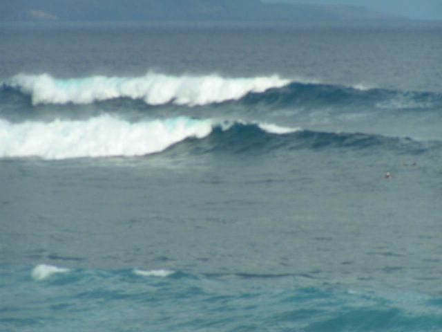
waves (short term): the NW swell arrived Wednesday afternoon has peaked yesterday and now i slowly declining. The Waimea buoy is at 4-5 feet, 13 sec around 4 am and the NW buoy is at 5 feet, 12 sec. Hey, that's still a lot of fun for me! Get on it today. It's gonna be super glassy in the morning and it will be the last good surfing day for at least a week, since the trade winds are about to be back and there's nothing happening on the south shore.
waves (long term): A WNW swell will overlap to the existing swell sometimes Friday and during the weekend, but strong N to NE winds will create unrideable conditions. Then it will came from a more NW during next week. An additional pulse from NNE generated by a low off the Oregon coast will overlap too at the beginning of the week and the breakers will be overly confused.
wind: Kona wind before the pass of the cold front. Strong N to NE winds after it (Saturday).
sky: expect rain towards the end of the day
Kahului tides: Low 8.23am 0.1 feet. High 2.24pm 1.7 feet. Low 8.38pm 0.3 feet.
Thursday, March 24, 2005
Thursday 3-24: Forecast
waves (short term): the new NW swell arrived yesterday afternoon. It will peak this morning and steadily decline during today and Friday. The Waimea buoy is at 7 feet, 15 sec around 4 am and the NW buoy is down to 7 feet, 14 sec (after having recorded 10 feet yesterday afternoon).
waves (long term): The models (and uncle Pat) confirm that a WNW pulse will overlap to the existing swell sometimes Friday and during the weekend, but the bad news is that now they show a fetch of N wind on the east side of an high pressure cell forming after the passage of a front Friday night. This will bring a moderate N windswell and onshore wind that will completely mess up the waves during the weekend. Better get on it today and Friday! It could be the last good winter one...
wind: light SSE with afternoon sea breezes. Kona wind on Friday. Strong N to NE winds during the weekend.
sky: mostly sunny
Kahului tides: Low 8.04am 0.2 feet. High 1.50pm 1.7 feet. Low 7.74pm 0.2 feet.
Wednesday, March 23, 2005
Wednesday 3-23: Forecast
Sorry, by mistake I deleted this forecast on Thursday morning, while I was editing the Thursday forecast. But who cares... it was old anyway...
Tuesday, March 22, 2005


Tuesday 3-22: Forecast
short term waves: the NW and Waimea buoys are down to 3-4 feet, 11 sec. The Laniakea webcam still shows some glassy and fun head high sets. For what I have observed, Laniakea and Hookipa are often similar size... So, there's a chance to keep your paddling muscles greased waiting for the new NW swell that should hit tomorrow (no sign at the NW buoy yet).
long term waves: this morning the models show a storm that will start spinning just east of Japan around Thursday. It will have a fetch of fairly strong winds pushing waves towards us from a very west direction. One of those directions that will be big time shadowed by all the upstream islands. The Wailea coast could get some unshadowed energy, though. This swell should arrive sometimes in the weekend. Too early to get excited now... The organizers of the PWA windsurfing contest at Hookipa should get excited though, because it seems that, after a few more days of light trades, and a couple of days of southerly light winds around Thursday, after the passage of a front the wind should be strong from NE in the weekend and then a high pressure should sit N of the islands at the beginning of next week, giving the best sailors in the world some good trades to play with...
wind: light trades
sky: mostly sunny
Kahului tides: Low 7.30am 0.3 feet. High 12.46pm 1.4 feet. Low 6.29pm 0.3 feet.
Monday, March 21, 2005
Monday 3-21: report
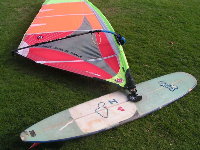
Hookipa in the morning must have been a lot of fun. Unfortunately, I had to work... damn! I sailed in Kanaha on my 12.6 in the afternoon though, and that was quite fun too. Light trades and some still head high sets...
forecast
Sorry, no photo this morning, but here's my forecast. Both the NW and the Waimea buoys are down to 6 feet, 13 sec, which is still a lot of fun (overhead at Hookipa)! After having blown from NNE all yesterday, the wind seems finally from a more E direction, so the waves should be a lot cleaner. It's gonna be light trades for most of the week, with glassy conditions early in the morning. Smaller leftover waves tomorrow and Wednesday, before a new fairly big NW swell will hit. We'll know more about the size as soon as it hits the NW buoy. After that, I don't see any good swell forming for a while. Hopefully the models are wrong... Enjoy the waves till the're here... F--ing summer is on its way!
Sunday, March 20, 2005
Saturday, March 19, 2005

report
Well, Kanaha was still quite disorganized. Peaks everywhere and big sets closing out all the way thru the channel. So much work to get out. Hopefully tomorrow will be better.
Friday, March 18, 2005
report/forecast
I surfed Kanaha and it was allright. A little disorganized, because of the overlapping swells, but better than nothing! Then I tought a lesson and after that I longboard sailed on my 12.6. Pretty light though. When the wind dropped, I replaced the sail with the paddle and... voila': standup paddle surfing session at sunset. Kind of a full day. Tomorrow it should be pretty good too. The main swell is going down but the overlapping is gone, so it should be a little cleaner. Light trades will rule for a long while. Better get on the waves early... BTW, we're in the middle of a big cloud band and that may bring some rain too.

Thursday, March 17, 2005
report + forecast
I surfed Hookipa around noon and I sucked! Waves were a little disorganized and I could not read them. Geez, I'm so spoiled by the usual clean conditions we have... Fortunately, a nice swell is on the way and tomorrow it should be fun. The wind will be light trade in the afternoon, but I predict glassy conditions in the morning. At 10pm the NW buoy shows 6 feet (Surfline) and 17 sec and the Waimea buoy 2 feet and 20 sec from around 225 degrees. Unfortunately, there's still a 6 feet, 9 sec swell from 360 that will overlap, but... what the hell, there's waves! Dawn patrol should be not too crowded, considering that someone will be hung over from St. Patrick's day celebration. But, you know, hard core surfers don't get drunk the night before a new swell arrive and go to sleep pretty early. Good night.
forecast
No time for the photo this morning (surf lesson 8am in Kihei). It should be decent surf though (compared to the past few days, at least). No wind at 7am and the Waimea buoy shows about 7 feet 9 sec period from around 360 degrees. This swell has been generated quite close to the islands and it won't be as clean as what we're used to, but... don't complain too much. There's people in the rest of the world that dream about days like this... The wind should be light from N-NE for a few days. Enjoy!
Wednesday, March 16, 2005
report
The wind was onshore in Kanaha. I took advantage of it to try my old beat up 9.0 (actually there's a couple of inches missing on the front), on which I just put a box for the sail (thanks Ulli for the router). Unreal. It jibes in no space. It even planes. Gimme a wave and sideshore conditions!
Tuesday, March 15, 2005
Tuesday 2-16-05 report
I ended up sailing Waiehu in the afternoon. One hour with the 5.0. Quite fun. It was me and a bunch of pro sailors that are here in Maui for the upcoming PWA event (March 28th to April 4th... I'll be judging). The level in the water was incredibly high. Unfortunately, I lowered it a lot with my very poor port tack sailing skill...

Monday, March 14, 2005
Monday 3-14-05
yes, there's waves, but the wind is not helping. First it was SW, then it turned NW and then SW again. The problem is a low that is sittin just NW of Hawaii, a little too close. If the models are right, we're gonna have NW wind for a few days. Tomorrow, the NOAA is forecasting 16 to 20 feet face. Good luck to everybody to find the right spot to sail/surf. Please post a comment if you found it...
Sunday, March 13, 2005
Sunday 3-13-05
the sun is back, but an unusual NW wind messes up the waves. I prefer to work on a project. You’ll know about it later on…
3 out of 7 this week and poor mark:4. Total percentage: 46 out of 56: 82%
3 out of 7 this week and poor mark:4. Total percentage: 46 out of 56: 82%
Saturday, March 12, 2005
Saturday 3-12-05
big time rain. Still I manage to surf Hookipa for a couple of hours before I get too cold. I kind of like to surf under the rain. Waves are slightly overhead and quite heavy (I guess because of the low tide).
Friday, March 11, 2005
Friday 3-11-05
the sun shines again (temporarily) and some super gusty trade wind allow me a sailing session at Lowers with the 5.0 sail. Fun.
Thursday, March 10, 2005
Thursday 3-10-05
more rain. NE up and down wind, kind of cold. You know what? I don’t feel like sailing. Maui spoiled me…
Wednesday, March 09, 2005
Wednesday 3-9-05
rainy morning. Before the wind turns north behind the front, there’s a couple of hours of glassy conditions and I surf Hookipa. Damn, only two days out of the water and I can feel it? Surfing is such a tough sport…
Tuesday, March 08, 2005

Tuesday 3-8-05
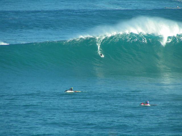
giant waves. Photo session at Jaws first and at Lanes later in the day, with some incredible sailing conditions with Kona wind. Only pro out, still 3 boards on the rocks in 20 minutes…
Monday, March 07, 2005
Monday 3-7-05
beautiful big waves with a light offshore wind. I choose to work all day. Why? Because I wanted to remember what working 8 hours a day mean… One only comment: you guys are nuts!
Sunday, March 06, 2005

Sunday 3-6-05
Wow! Check the above picture taken in Lanes. With a couple of friends we try to surf Pier one, but it’s too big and too windy (offshore). Still nice to be out there and watch those huge waves roll…
7 out of 7 again. Mark:9, specially thanks to Friday. Total percentage on the year: 43 out of 49: 87.8%
7 out of 7 again. Mark:9, specially thanks to Friday. Total percentage on the year: 43 out of 49: 87.8%
Saturday, March 05, 2005
Saturday 3-5-05
I’m busy in the morning, but in the afternoon I try again the longboard sailing at Lowers. Way more offshore than yesterday, I can still catch quite a few good rides, but then the surfers become too many and I have to leave. Tomorrow, giant waves.
Friday, March 04, 2005

Friday 3-4-05
in fact, one more of those days… Great morning surf session at Hookipa. I get in the water at 8am and I catch 5 great rides in the first hour. Then it gets crowded and I only catch one more in the next hour. Guess what, this session will not even be the best of the day. Later in the afternoon some Kona wind start blowing and I can sail with the longboard at lower Kanaha. Head high waves, it’s only me out there. No other windsurfers (too light for them), just a couple of surfers that could not believe their eyes… “what the hell is that thing?” their expression seemed to say. Not tired yet, I manage to have a tandem surf session on the 12.6 at sunset with a friend. Female, of course.
Thursday, March 03, 2005
Thursday 3-3-05
another of those days… Morning surf session at Kanaha with the 10 footer. Head hig and uncrowded (where is everybody, at Hookipa?). At sunset, stand up surf session with the 12.6. Some sets are way overhead. Super glassy waves and incredible colors. Fantastic. Tomorrow should be good too.
Wednesday, March 02, 2005
Wednesday 3-2-05
surf session in the morning at Hookipa, but the waves dropped and got messy. A short sailing session in the afternoon with the 4.7, but I’d rather rest for tomorrow’s new NW swell.
Tuesday, March 01, 2005
Tuesday 3-1-05
one of those days… I park the school van at Kanaha at 9 am. I surf Lowers with a 10 footer for a couple of hours. Not too big (some head high sets), but not too crowded either. After one hour I get back in the water with the 12.6 and the sail (a light wind had picked up) for three more hours of fun. Then, one more break (nap in the van) and final session at sunset of longboard sailing. Nice waves, slightly overhead. I move the van from the parking at 7pm… That’s the kind of day I like.
Subscribe to:
Posts (Atom)


