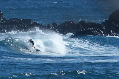
Hookipa yesterday morning.
Hookipa yesterday afternoon.
Just found out that Ty Simpson-Kane is my neighbor and that he rips with the wing too.
4am Surfline
significant buoy readings and discussion.
South shore
Barbers
2.1ft @ 14s from 186° (S)
Check the Lahaina
webcam if interested, for size, conditions and consistency.
North shore
NW101
8.3ft @ 16s from 344° (NNW)
Hanalei
8.7ft @ 17s from 327° (NW)
Waimea
3ft @ 17s from 322° (NW)
1.1ft @ 11s from 344° (NNW)
Kaneohe Bay
3.8ft @ 8s from 70° (ENE)
New large long period NW swell will be on the rise all day. Let's see how Pat Caldwell described the evolution of the fetch:
A low pressure deepened rapidly Monday into Tuesday 9/20-21 near 45N, 175E, or about 2300 nm away from Hawaii. The low tracked steadily east, crossing the Date Line 9/21 and reaching due north of Hawaii 9/22.
The direct aim of seas at Hawaii had seas within 15-20 feet with the head of the fetch about 1300 nm away Wednesday morning 9/22. This places the peak of the event Friday evening from 320-330 degrees. Surf should steadily build Friday morning above the September average as the angular spreading of the longer-period swell fills in locally.
Below are the maps of Sept 20 through 23 that will help follow.

Below are the graphs of NW and Hanalei together with the Surfline forecast. As you can see, this is going to be a pretty solid swell, much bigger than the previous one. The red dotted line is my guess of the local rise. Early morning home guess for Hookipa is shoulder to head and a third high building to double overhead plus throughout the day. Based on the impressive readings of the upstream buoys, the chances that even Jaws will break are pretty high, imo.

Forecast of Pauwela from this
PACIOOS page.
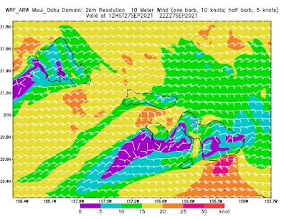
Wind map at noon. The other ones can be found
here
(click on animation of the 10 meter column).
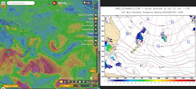
Fetches map (circles legend: red: direct aim, blue: angular
spreading, black: blocked, yellow: possibly over the ice sheet) from
Windy.
North Pacific (about 4 days travel time from the NW corner of
the North Pacific):
South Pacific (about 7 days travel time from east/west of New
Zealand):
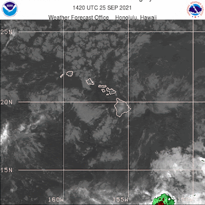
Morning
sky.


