Thursday, April 30, 2020

Thursday 4 30 20 morning call

Yesterday I added three more stick-on inserts on my SUP foiling board (there's now 9 total for 3 different disciplines!) and now I have a decent setup for winging. Tested it, worked good. I also made my first 30 yards ever in fakey/toe-side stance (in any sport). So much fun to learn new skills. I remember a windsurfer customer who, talking about new sports, once told me:"Nah, I stick to windsurfing. I never want to be a beginner again in my life!".
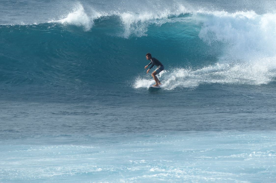
Really? I LOVE being a beginner!


4am significant buoy readings and discussion.
South shore
Barbers
0.9ft @ 15s from 182° (S)
0.9ft @ 13s from 178° (S)

Lanai
1.1ft @ 15s from 177° (S)

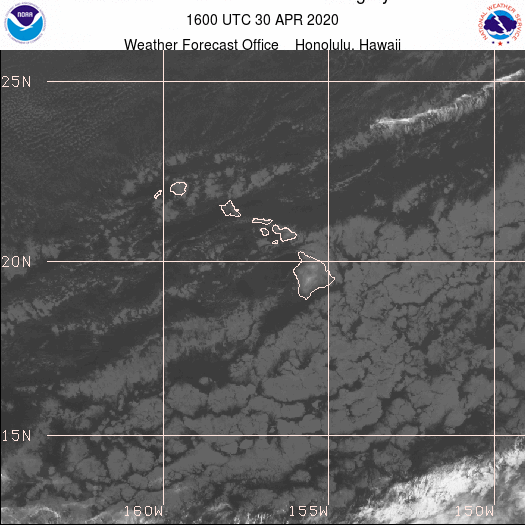
Small but long period southerly readings at the buoys. Below are the maps of April 22 and 23, that show the possible sources.


Unfortunately the Lahaina webcam doesn't show much, but check it out anyway if interested, for size, conditions and consistency.

North shore
NW101
4.1ft @ 10s from 12° (NNE)

Hanalei
3.8ft @ 9s from 335° (NNW)

Waimea
4.7ft @ 8s from 7° (N)
3.4ft @ 11s from 344° (NNW)
3ft @ 9s from 341° (NNW)

Pauwela
5.8ft @ 8s from 8° (N)
4.2ft @ 11s from 332° (NNW)
3ft @ 9s from 334° (NNW)
 
Pretty decent size NNW swell still in the water, I think Maui is getting a bit more than the other islands because this swell is missing us to our NE. Tomorrow there should be another bigger bump. Hookipa should be overhead, but blown out. Waves also down the coast, but you need to find a spot sheltered by the wind.

Wind map at noon (the other ones can be found at link n.-2 of GP's meteo websites list in the right column).


North Pacific fetches map (about 4 days travel time from the NW corner):


South Pacific fetches map (about 7 days travel time from east of New Zealand):


Morning sky.

Wednesday, April 29, 2020

7.30am hookipa is head to occasionally head and a half and moderate trades. 
4.5

Wednesday 4 29 20 morning call

Inspired by Marley (and the other tens of wingers at the harbor) I did session 6 (in 6 months) on the wing yesterday. I was waiting to do my trigger finger surgery before getting into that, but that was scheduled for March 30th and it obviously got cancelled. I learned that I need a board with proper foot straps placement.

5am significant buoy readings and discussion.
South shore
No southerly energy at the buoys, check the Lahaina webcam if interested, for size, conditions and consistency.

North shore
NW101
5.3ft @ 7s from 46° (NE)
5.3ft @ 11s from 3° (N)
3.9ft @ 10s from 357° (N)

Hanalei
3ft @ 11s from 340° (NNW)

Waimea
3ft @ 12s from 337° (NNW)
2.2ft @ 11s from 339° (NNW)
2.1ft @ 9s from 340° (NNW)

Pauwela
3.7ft @ 13s from 340° (NNW)
3.3ft @ 7s from 60° (ENE)
2.4ft @ 8s from 56° (ENE)

Little NNW bump is at the buoys, here's Pat Caldwell description of the evolution of the fetch.
A compact gale low formed near 40N just east of the Date Line early Sunday 4/26. By early Monday, the system had tracked over 1000 nm under the zonal jet, creating short-lived fetches over the 310-360 degree bands relative to Hawaii. ASCAT satellite 4/26 did show winds to severe gales within 36-42N as the system approached the longitudes of Hawaii. A JASON altimeter late 4/26 reading showed combined seas and swell over 20 feet. The highest seas were aimed NE of Hawaii. The head of the fetch of near gales was to 32N to the N to NNW of Hawaii, or about 600 nm, Sunday night.
Proximity ups the odds for some surf in Hawaii. The event should build Wednesday morning centered from 345 degrees, peak below the April average Wednesday PM, and drop steadily back to tiny to small levels by Thursday from 330-360 degrees.

Below is the map of the 27 (0h) that shows the fetch. As you can see most of the energy of this swell will miss us to our NE, but 3.7ft 13s from 340 will provide fun size waves (at least head high) at Hookipa. Beach report later.


Wind map at noon (the other ones can be found at link n.-2 of GP's meteo websites list in the right column).


North Pacific fetches map (about 4 days travel time from the NW corner):


South Pacific fetches map (about 7 days travel time from east of New Zealand):


Morning sky.

Tuesday, April 28, 2020

Tuesday 4 28 20 morning call

Not much to photograph in the water yesterday, Jimmie Hepp posted this wonderful shot of upcountry Maui.


5-6am significant buoy readings and discussion.
South shore
Barbers
0.7ft @ 12s from 186° (S)
0.7ft @ 15s from 160° (SSE)

Lanai
0.8ft @ 14s from 177° (S)
0.7ft @ 11s from 190° (S)

Slivers of southerly energy at the buoys. Check the Lahaina webcam if interested, for size, conditions and consistency.

North shore
Pauwela
3.4ft @ 8s from 51° (ENE)
2.6ft @ 6s from 55° (ENE)

Small windswell at Pauwela, Hookipa and eastern exposures might still have some ripples breaking, everywhere else is flat.

Wind map at noon (the other ones can be found at link n.-2 of GP's meteo websites list in the right column).


North Pacific fetches map (about 4 days travel time from the NW corner):


South Pacific fetches map (about 7 days travel time from east of New Zealand):


Morning sky.

Monday, April 27, 2020

8am hookipa has waist to shoulder high weak short period waves. Light trades. 
2

Monday 4 27 20 morning call

Plenty action at Hookipa yesterday.


4am significant buoy readings and discussion.
South shore
Barbers
1.2ft @ 13s from 189° (S)

Lanai
1ft @ 11s from 205° (SSW)
0.7ft @ 13s from 194° (SSW)
0.6ft @ 15s from 198° (SSW)

Not much else in the water, so the buoys can register slivers of southerly energy, which will make for tiny waves. Check the Lahaina webcam if interested, for size, conditions and consistency.

North shore
Pauwela
4ft @ 9s from 42° (NE)
3.2ft @ 7s from 62° (ENE)

NW energy is completely gone, but 4ft 9s of windswell will still give Hookipa and the eastern exposures some small waves. A couple of days like this, then a moderate NW bump from the angular spreading fetch you see below late Wednesday.

Wind map at noon (the other ones can be found at link n.-2 of GP's meteo websites list in the right column).


North Pacific fetches map (about 4 days travel time from the NW corner):


South Pacific fetches map (about 7 days travel time from east of New Zealand):


Morning sky.

Sunday, April 26, 2020

8.15am hookipa is head high and windy. 
3

Sunday 4 26 20 morning call

Plenty action also yesterday, the last days with decent size waves. April has been totally epic so far, with both North and South Pacific behaving as if it was winter for both. Now they're behaving like if it was summer for both, so we're gonna see a lot less waves until that changes.

As obsessed with the chronological order of things as I am, I have to start the photo story of the day with one of my sessions.


This is Hookipa around 5.30ish. For a moment the wind looked like it was going to clean up the conditions nicely.


But instead it kept blowing inesorably.


Imai DeVault is used to that and didn't care.


Challenging surfing conditions, I like this shot a lot.


5am significant buoy readings and discussion.
South shore
Barbers
1.1ft @ 15s from 213° (SW)

Lanai
1ft @ 15s from 219° (SW)

The fact that there's no other significant energies in the water allows the local south facing buoys to feel that 1ft 15s from the SW, most likely coming from the Tasman Sea fetch  (between 210 and 220)circled in red in the below map of April 18. Nothing the day after, so I wouldn't expect much at all in the water. That's what the Lahaina webcam shows, but check it yourself  if interested, for size, conditions and consistency.

     
North shore
NW101
5.7ft @ 10s from 37° (NE)

Hanalei
3.2ft @ 9s from 348° (NNW)
3.1ft @ 11s from 329° (NW)

Waimea
2.9ft @ 11s from 325° (NW)
2.7ft @ 9s from 339° (NNW)

Pauwela
4.2ft @ 9s from 40° (NE)
3.4ft @ 11s from 335° (NNW)

NW energy disappeared by the NW buoys and you guys know what that means. Still lingering around the upstream buoys instead, there should still be some leftover energy today, but definitely fading out. The readings at Pauwela make me think about chest to head high waves at Hookipa at best. Possible beach report later, but not sure.

Wind map at noon (the other ones can be found at link n.-2 of GP's meteo websites list in the right column).


North Pacific fetches map (about 4 days travel time from the NW corner):


South Pacific fetches map (about 7 days travel time from east of New Zealand):


Morning sky.

Saturday, April 25, 2020

7.30am hookipa is head and a third to head and two thirds. Bit of wind, texture and windswell but some occasional clean faces. 
5.5

Saturday 4 25 20 morning call

This epic shot by OneMoreFoto was taken on Thursday. I love it because it represents Maui, its variety of conditions and its incredible pool of talents. In this particular instance we have Jesse Richman flying with the kite, Matt Meola throwing an aerial and Kai Lenny filming the whole thing on his foil. I asked the photog "what's that line behind Jesse?". "Tow rope for Kai", he replied... kidding me?


4am significant buoy readings and discussion.
South shore
No southerly energy at the buoys, check the Lahaina webcam if interested, for size, conditions and consistency.

North shore
NW101
4.4ft @ 12s from 335° (NNW)
4.4ft @ 10s from 347° (NNW)

Hanalei
7ft @ 12s from 330° (NW)

Waimea
5.7ft @ 13s from 314° (NW)
3.7ft @ 9s from 331° (NNW)

Pauwela
4.4ft @ 13s from 329° (NW)
3.8ft @ 9s from 48° (NE)
3ft @ 10s from 345° (NNW)

Below is the graph of the NW buoy showing the slow but inexorable decline of the NW energy that has pleased us in the last few days. The 7ft 12s at Hanalei makes me think that there'll be waves also all day today, but starting tomorrow it looks pretty grim for a while.  Here's how Pat Caldwell described what happened.

The long-lived Aleutian low pattern NNW of Hawaii 4/18-22 gave the abundance of wintry surf locally this week. The pattern weakened 4/23 as the upper level cyclonic gyre faded and the associated trough moved east.
NW Hawaii buoys 51001 and 51101 noon Friday 4/24 show the dominant wave period has steadily shifted down to 10-14 seconds. The wave energy suggests continued above average conditions into Friday night.
By Saturday morning, surf is expected to fall to near April average heights. The dominant direction should hold centered near 330 degrees. The tail of the fetch of the aforementioned low had near to marginal gales about 1600 nm away late 4/22-23 and should keep small surf with a dropping trend 4/26-27.
Models show the north Pacific jet stream to shift north and become more zonal 4/25 into next week. Such patterns are associated with below average surf conditions locally. A compact marginal gale is modelled to intensify to the N of Hawaii as it tracks rapidly E near 40N 4/26-27 aiming highest seas NE of Hawaii. Angular spreading could make for small breakers Wednesday 4/29 from 340-360 degrees. It should be short-lived.

Hookipa will probably be head to possibly head and a half to start with (possible beach report later).


Wind map at noon (the other ones can be found at link n.-2 of GP's meteo websites list in the right column).


North Pacific fetches map (about 4 days travel time from the NW corner):


South Pacific fetches map (about 7 days travel time from east of New Zealand):


Morning sky.

Friday, April 24, 2020

Friday 4 24 20 morning call

Yesterday was another day of great action on the north shore of Maui. This is Kai Lenny at sunset.


That looks like a new Sailboards Maui.


4am significant buoy readings and discussion.
South shore
No indication of southerly energy at the buoys, check the Lahaina webcam if interested, for size, conditions and consistency.

North shore
NW101
8ft @ 14s from 332° (NNW)
5.6ft @ 10s from 335° (NNW)

Hanalei
9.2ft @ 14s from 327° (NW)
4.3ft @ 11s from 332° (NNW)

Waimea
10.4ft @ 15s from 315° (NW)

Pauwela
6.8ft @ 14s from 320° (NW)
4ft @ 9s from 37° (NE)

Medium period NW energy still at elevated levels, there will be no shortage of waves also today. Hookipa will be around double overhead pretty much all day. With the wind and the related windswell and the high consistency due to the unblocked and relatively close fetch of the source, I expect the conditions to be not particularly clean. Pretty big down the coast too, seek a sheltered spot is my suggestion.

Wind map at noon (the other ones can be found at link n.-2 of GP's meteo websites list in the right column).


North Pacific fetches map (about 4 days travel time from the NW corner):


South Pacific fetches map (about 7 days travel time from east of New Zealand):


Morning sky.

Thursday, April 23, 2020

7.45am hookipa is head and a half. Moderate trades. 
5

Thursday 4 23 20 morning call

The NW swell came up nicely and as expected on the north shore yesterday. This is Hookipa around 9am, already much bigger than at dawn and it kept building all day.


4am significant buoy readings and discussion.
South shore
No southerly readings at the buoys, check the Lahaina webcam if interested, for size, conditions and consistency. Looks like there's waves, but the onshores are already on.

North shore
NW101
8.4ft @ 16s from 335° (NNW)
7ft @ 14s from 340° (NNW)
3.7ft @ 10s from 343° (NNW)

Hanalei
9.2ft @ 13s from 328° (NW)

Waimea
8.1ft @ 13s from 320° (NW)

Pauwela
5.8ft @ 14s from 322° (NW)
4ft @ 8s from 78° (ENE)
 
Plenty energy to play with also today. Below is the graph of the NW buoy, where I circled a second pulse of this swell that happened last night. 18 hours later should happen here too. Notice the change in the direction, which went from NW to NNW. Most Maui spots will like that. Well overhead waves at Hookipa to start with, pushing double plus later in the day, based on the Waimea reading.
 

Wind map at noon (the other ones can be found at link n.-2 of GP's meteo websites list in the right column).


North Pacific fetches map (about 4 days travel time from the NW corner):


South Pacific fetches map (about 7 days travel time from east of New Zealand):


Morning sky.