Saturday, January 31, 2015

Big, lumpy and not inviting because... of what i wrote in the previous post!

1 31 15 morning call

First of all, I'd like to welcome a new sponsor to the blog.You can read the traffic stats on the counters on right.

All went like predicted yesterday.

The early morning hours were glassy. Then around 8-9 you could see a lump in the waves and by 10am you could see a wind line slowly approaching and bringing 5-10mph of onshore wind.
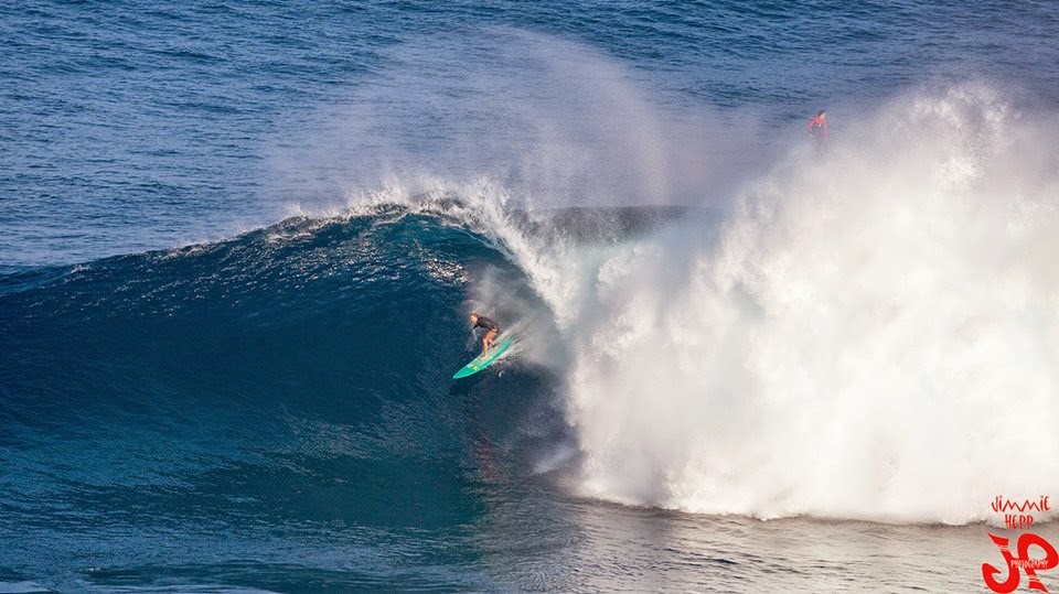
It was still surfable, but definitely not as clean as earlier. The time stamp of the photo below is 9.30 the reason I post it is because it illustrates that lump I was talking about. More than on the wave, look at the back of it...


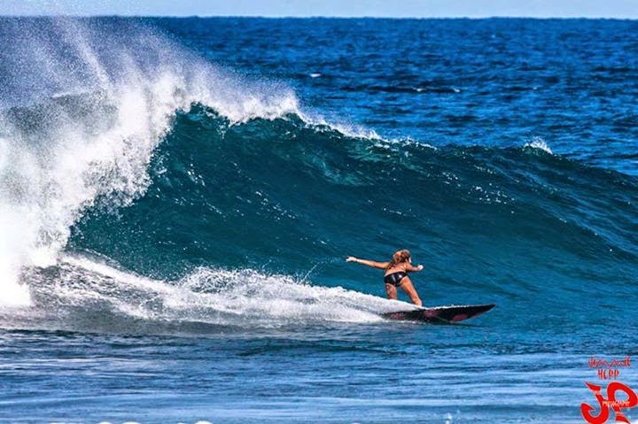
That's how the waves and the water looked yesterday instead thanks to the offshore wind. Wonderful image by Brian Caserio .


On today's buoys graphs, I pointed out the peak time of this swell, so you guys can check the travel time. As you can see, GP's rule of 12h at 16s and 16h at 12s from the NW buoy to Maui did apply well in this case.
Interesting how this swell started with shorter period (11) then it is now (14 at the NW).
The longer the period the faster the waves travel, so how is this possible?
Answer below, because I need the wind map to explain.

Below is today's wind map and to be precise I should have used one from a couple of days ago, but it was very similar so you guys bear with me.
The NW buoy is roughly by the end of that big fetch I circled. That small fetch just NE of Japan is still too far and small to be relevant right now (unless you're in Japan and want to know where all that snow came from...). I didn't check the maps for the next 7 days, but I'm pretty sure that is going to be relevant next week.

So, back to the NW buoy. The period of a swell is a function of many factors. The most important of which, IMO, is the wind strength. In this case it happened that the winds by the end of the fetch were less strong then the winds by the beginning of the fetch. But because the end of the fetch was so close to the NW buoy, the 11s period sets hit it before the 14s ones, that needed time to catch up.
I hope the illustration I added clarifies the concept.


That should make you suspect a very important truth: when a buoy shows a period, that is just the DOMINANT period. The one with which the most energy is associated. But it's NOT the only period in the water! Specially in Hawaii in winter time, when there's multiple storms or even just single storms but with a wide fetch with different wind strengths, it is very common to have different periods in the water that overlap each other.
Same goes with the sizes of course. Mixed sizes and periods is usually not a good thing for the surf (bit still MUCH better than flat!), because the breaking patterns are not consistent. Inside, outside, wide, narrow... you never know where to sit in the lineup in these cases. But it does help spread out the crowd at the same time.
 
Ideally, you wonna have one storm at the time and far away from your surf spot so that the different periods will nicely space out and you can count on the longer period to arrive first and be less consistent and the shorter period to arrive later with more consistency. A place like that is the Indian Ocean and Indonesia. I've been there 4 times and I've not seen overlapping swells and mixed breaking patterns that I can remember. I'm sure it happens, but it's rare. That's why I keep going back.

Of course for the surf to be good, you have to add the local wind component. And that's why, we now get back to our morning call and analyze that. Well I hope that after all I said above, it's clear now for you guys that this swell is not going to be as clean as the previous one. But the early morning of today will offer light offshore to no wind, so that will still make it a better than average day.
Later on, light trades will pick as the noon MC @ 2km map shows below (not enough for windsurfing)


Have fun in the sun everyone!

PS. All the sources for this post are permanently linked in the links section on the right of this blog.

Friday, January 30, 2015

The beautiful overhead lines are still there and the wind is not on them yet.

1 30 15 morning call


I have a bunch of photos of yesterday's action, but I'll have to do that later, since I want to start putting the call online for the early birds... and I want to be a early bird myself today!

I can't resist posting a photo of the blog author though, who was the one to open the dances at the Lane yesterday, only to be joined by the likes of Kevin Pritchard, Robby Swift and Morgan Noireaux.
Thanks Brian Caserio for the photo. He has a great album on his facebook page. Not sure if the privacy rules will allow you to see it, but you should check it out.


Waves.
Below is the three buoys graphs from which you can see that:
- the swell in Maui is declining, but it still pretty solid at 4f 13s. Maybe no need for a stepup for me today.
- the NW buoy has been hit by the new NW swell that clocks in at 10f 11s. It lookslike it peaked at midnight. Unfortunately, check also the other periods and sizes that are shown and you'll understand that the situation is not clean at all.
According to my rule of the 12 at 16 and 16 at 12, this swell should take approx. 17h to peak in Maui, which means around sunset. But all this is all irrelevant for the reasons I'm about to discuss below.


The NW buoy is IN the that big fetch, towards the end of it. That's why so many periods, and that's why it's going to be disorganized.


The closeup shows a sudden change of wind direction very close to Maui. It actually shows it already on Maui, but the wind sensors are not yet feeling it at 6am.


So when is the wind going to change? All the models I checked say around 9-10am. I think it could happen even earlier or at least the lump in the water could be already here, so it is absolutely key to surf at dawn today, because the rest of the day is going offer very poor conditions with onshore winds.

There could be some clouds too, since the front that caused the beautiful Kona conditions yesterday is finally upon us. Not a strong one though.


Have fun in the sun everyone!


PS. All the sources for this post are permanently linked in the links section on the right of this blog.

Thursday, January 29, 2015

Freaking paradise out here!

Overhead and beautiful

1 29 15 morning call


The MC @ 2km forecast yesterday called for more wind than it really was. Despite being the most reliable model, this shows that a forecast can ALWAYS be wrong.
But it was glassy both at dawn (for many hours, actually) and at sunset and both of them saw same really clean waves to be ridden.
Tons of people in the water thanks to the non scary size, which was averaging around the head and a half mark. Some DOHeader occasionally.

The photo of Jimmie Hepp below illustrates the average size quite well, even though it was taken in the windy central section of the day.


The graph of the three buoys below shows that the swell should hold pretty steady throughout the day (smaller than yesterday though). Pauwela is reading 4.5f at 15s and that's still overhead and fun.


Wind conditions will be ideal (light offshore) in the early morning and probably a bit stronger SW in the afternoon. The wind map also shows a northerly wide fetch that will provide waves in next few days. The original direction of the swells will turn from WNW that has been dominant for the last couple of weeks to a more common NW and even NNW towards the beginning of next week.


In the closeup we can see that small aread of slightly strnger Konas that might move over Maui in the afternoon.


As a result, both the MC @ 2km at 3pm and the NAM model on Windguru call for some wind that could be possibly sailable. Port tack specialists, stay ready.
If it's not today, it looks that it will be next week.


Have fun in the sun everyone!

PS. All the sources for this post are permanently linked in the links section on the right of this blog.

Wednesday, January 28, 2015

Head and a half sets like this, but also just as frequent flat spells. It's the nature of the wrap.

1 28 15 morning call

Yesterday went pretty much like predicted. Some surfing in the morning (back to normal: plenty wind, chop, windswell and backwash in the lineup) and some sailing in the afternoon.
I chose to sail extremely late because:
- the wind was offshore and very gusty (like 10 to 30 kinda gusty) and I wanted it to get much lighter
- only in the last part of the day, some sets of the new swell showed up
- the number of sailors went down.
Didn't last long, because of course the surfers paddled out, but I got a couple in my favorite conditions: light to almost no wind, offshore and uncrowded.
I just like the challenges that this kind of sailing offers, from the no wind tacks, to emergency uphauling in front of the rocks, to positioning, etc.

Nonetheless, I'd like to start today's call not with a windsurfing photo, but with a beautiful image of a Maui wave from John Patao. That barrel is so square, that wave should be called The Maui Box.


Today it should be a lot more about surfing... but not only.
Below is the graph of the three main buoys of interest for us. Notice how the swell did turn west as predicted (at the NW buoy) and notice also how consistent the directions at the other two buoys are.
It doesn't matter how west a swell is at the NW buoy, the directions at the Waimea and the Pauwela buoys will always be around 310 and 320!
That's because those buoys register the swell AFTER it has refracted on the upstream islands.
What changes depending on the original direction is the size AND the consistency (this last one not reported by the buoys).
You guys remember the sizes of the last huge one? They're somewhere down on this blog, but I'm just gonna try to go by heart. I think there were around 20, 14 and 10 or something like that.
This one instead is offering 8, 6 and 4. Not exactly the same proportion, but almost!
The more of these examples you try to memorize, the more able you will be to tell what the next swell is going to do.
ANYWAY, 4f 18s.... I'll take them any day!!!
I don't hear much noise out of my window (and there's no wind), so I'm expecting it to be inconsistent.


Local wind conditions are key for the quality of the waves.
Below is the wind map that shows a fetch that moved in a more northerly position (good, I dig north swells) and the local wind direction that will be ESE. That's a great direction for some glassy dawns, but (specially if it's sunny), it will allow some easterly flow to fill in in the afternoon. Maybe not Hookipa (too many surfers), but someone might attempt to sail/kite Lanes.


The noon wind map from MC @ 2km does confirm that.

Have fun in the sun everyone!


PS. All the sources for this post are permanently linked in the links section on the right of this blog.

Tuesday, January 27, 2015

At 6pm there's some 20 seconds lines coning through. Still some wind and windswell, but both should go down. Tomorrow could be inconsistent but good.

Waves are still shoulder to head high but poor conditions.

1 27 15 morning call

After wasting some time and gas to go check Honolua yesterday morning, I went back home, watched a Napoli game live online and went sailing at Hookipa.

I give the conditions a 2.5, because of the windswell and the bumps, but I realize that I am an extremely spoiled brat. For any European yesterday it was probably epic and german visitor Michael seems to agree. He also seems to love his new Hot Sails Maui KS3. Photo by Jimmie Hepp.


New swell on the rise today. I like the NW buoy reading a lot: 4f 19s is a beautiful start. I know it's not 20f at 20s like the previous one, but still...
Below is the graps of the NW and the Waimea buoy.
These are the 6am readings of Pauwela and Lanai instead:
Pauwela
3.9ft @ 8s from 56° (ENE)
3.6ft @ 11s from 329° (NW)
2.7ft @ 7s from 61° (ENE)
1.2ft @ 5s from 70° (ENE)

Lanai
2.2ft @ 12s from 264° (W)
0.8ft @ 4s from 159° (SSE)
0.8ft @ 9s from 260° (W)
0.7ft @ 18s from 216° (SW)

The NW shows a direction of 310, which is a lot less west than forecasted, even though the direction seems to have gone more west since it started being recorded. I put red arrows on the graph so you guys can follow.
Nothing at the Pauwela buoy yet, but at the speed 20s waves travel, we are going to see something in the afternoon. Nothing in the morning.

Below is a snip from the NOAA website of the Waimea buoy. As you can see, the new long period swell is not even detectable there. That's why I love the breakdown of all the different swells that Surfline does.
 

So what are we doing today?
A little surfing in the early morning and some windsurfing in the afternoon! A reader pointed out that the Maui County @ 2km website is not dead, it just changed slightly the url. I updated the links, so now we can check their very reliable forecast again!
This is the 3pm map (sorry, I work till 2) and you can see that it's definitely going to be windy.


Have fun in the sun everyone!

Monday, January 26, 2015

Honolua has occasional chest high waves (at the cave) and six guys out. Maybe it will get better with a lower tide, but seen the inconsistency, i would not recommend the drive.
I suck at calling the bay!

1 26 15 morning call

4am main swell buoy readings:

NW
6.2ft @ 12s from 296° (WNW)
3.5ft @ 10s from 303° (WNW)

Waimea
5.6ft @ 13s from 317° (NW)
3.9ft @ 10s from 325° (NW)

Pauwela (indicative of what's in the water on Maui's north shore)
6.7ft @ 13s from 322° (NW)
5.7ft @ 7s from 57° (ENE)

West lanai Maui north shore (indicative of what's in the water on Maui's south shore)
2.6ft @ 13s from 286° (WNW)
   
Nothing to report from yesterday on my side, other than I spent all day booking not one, but two trips to Indo for this summer (!!) and then I caught 8 waves in one hour at Paia bay to celebrate that.
I'm sure the west side was good and that's where I'm going this morning to continue the celebration (which, in my particular case, never really stop every single day of my life).
 
The buoys above are still up, I'm sure I'll find some clean waves over there.

As for the north shore, it's gonna be windy, choppy and mixed up with the windswell which is already significant at the Pauwela buoy.

The wind map below shows a good fetch and a bad one. You guys should be able to tell by now.

   
In the closeup below, I marked three wind directions:
1 is what we had yesterday
2 is what we have this morning
3 is what we're gonna have tomorrow
And that is because that whole circulation is moving east pushed by the approach of the next front.

Windsurfing could and should happen on the north shore this afternoon, but my guess is that Hookipa is not going to look particularly clean. I haven't even looked at it since 48 hours, and I live 1 minute drive from it. What's the point? I know how onshore 6-8 feet look like...

Tomorrow is going to be a relatively small day before the next swell will start to show up late in the afternoon. But Wednesday, Thursday, Friday is when it should be really good, before the wind will turn all the way around the clock and start the cycle all over again.
The weather in Hawaii is so consistent that's sometimes it's not particularly stimulating to try to predict it...


Have fun in the sun everyone!

PS. All the sources for this post are permanently linked in the links section on the right of this blog.

Sunday, January 25, 2015

1 25 15 morning call

In half an hour is going to be 24h that I didn't get in the water... believe it or not, that feels extremely good!
This Saturday afternoon/sunday morning rest was planned since a week and it's going wonderful.
Sorry about the late post this morning, it was part of the plan.

Still, there's plenty waves to catch if you have any energies left in you.

Let's start old school with the buoy readings at 7am.
NW
10.1ft @ 15s from 296° (WNW)

Waimea
8.8ft @ 14s from 305° (WNW)

Lanai
3.7ft @ 14s from 288° (WNW)

Pauwela
7.9ft @ 14s from 318° (NW)
4.4ft @ 8s from 348° (NNW)
2ft @ 10s from 316° (NW) 
1.7ft @ 7s from 21° (NNE)

I don't need to comment, do I?
There's waves, the WNW swell is holding pretty good. Remember the past posts all those fetches I circled on the wind map? That's where these waves come from. Nothing magic, it's "JUST" the friction of the wind on the surface of the ocean that generates them...
Just like the one I circled on today's wind map below.
 
Here's the Hawaii closeup that shows the wind direction right now. That is clearly way more onshore than usual. Important detail: that map only shows the dominant wind direction offshore Maui. Once the wind hits the mountains, it literally hugs them and that is not shown. The Maui County @ 2Km map was great for that, but unfortunately it seems we've lost it...


The two models at the bottom of the page of Windguru show the following directions for the wind at 3pm: 62 and 36. Completely different intensity too.
Whatever it will be, my guess is that if you want to do something in the water, the west side is clearly the call. The north shore is gonna be a mess for a couple of more days while the wind gradually turns more easterly before... yeah, disappearing again!
Here's a weekly winguru table that gets me quite excited.


Have fun in the sun (if you can find some) everyone!

Saturday, January 24, 2015

1 24 15 morning call

 
Yet another phenomenal day of surfing yesterday. How many times have I started my morning call with a similar sentence this month?
January has been truly amazing. It usually is.

Quick recap of my yesterday.
After the SUP lesson, I found the energies to surf Lanes. The buoy was reading 8f 15s and that's as big as I ever surfed it. I might have to get a gun if I want to beat this new record...
Below is a photo of The Point to show you size and pristine conditions with the light Kona. It was so good that John John has been spotted in the lineup... he must have seen the Kona in the forecast. Or maybe he reads my blog...
Time stamp says 1pm, that's when I had to go to work.


But I knew that windsurfing would happen and I knew Jimmie Hepp was going to be there to shoot.
This is Robby Swift and when I first saw the shot I immediately thought it was Polakow... and that is a hell of a compliment!


On tap today more extra large waves. The three graphs below show the new swell peaking at the NW buoy at 6pm yesterday around 18f 15s from 290. Quite a quick drop in size after that though.
Seen the direction, I hope you guys know now that that means shadowing and refracting for both Oahu and Maui and that means less size and consistency (thank god!).
Bit harder than usual to guess with such direction, but my guess is that the peak in Maui will happen around noon. At what size, I'm not even gonna try... it's already 10.7f 15s at 5am.
I didn't buy a gun during the night, so I'm not gonna surf Hookipa and I will probably leave in the dark in search of a surfable spot, so no report from the beach today.


Below is the wind map that shows a good fetch and a bad one.
The bad one is the one close to us, because when it's too close it brings a lot of active components: chop and wind. That's what is going to happen sometimes in the morning today and that's why if you want to end this amazing streak of top class surfing on a good note, you better be out there at dawn today.


The rest of the day will be straight onshore and total shit on the north shore. But this is an island, by definition there will be spots where it will be side shore. I'm putting the windsurf board in the car just in case...

Friday, January 23, 2015

That's a bit set at lanes and i can't believe i just caught 5 waves there... the kona is still lighr but kp is out there sailing.

10.30am and hookipa is going off.
Light kona makes for some very smooth faces and i was thinking about paddling out, but this set closed out the channel...
I dont care. Its too good to pass.

1 23 15 morning call

First shot of the day is this one from Jimmie Hepp that shows what's been called the best female barrel ever done at Jaws. Surfer is Paige Alms.


This other shot instead is from Jason Hall and it shows that there was plenty big wave action not only at Jaws, but pretty much all over the island.

Today's 5am buoys readings:
NW
12.5ft @ 14s from 289° (WNW)

Waimea
7.6ft @ 15s from 309° (WNW)

Lanai
4.8ft @ 14s from 282° (WNW)

Pauwela
8.7ft @ 14s from 318° (NW)

That clearly shows there's plenty swell in the water and we also know that tomorrow it's going to get extra large again! Unfortunately, this time the wind will turn onshore in the afternoon, but let's not get ahead of ourselves and let's first have a look at the wind today.
In the wind map below, we see the close fetch that has been pumping the waves for tomorrow's pulse.
We can already see a new low spinning NE of Japan with already a decent fetch of winds oriented towards us. The wave factory is running full steam.


In this closeup we can admire the local circulation. Not much wind at all in the morning, since we're sitting beautifully in that no wind transition area, but the whole thing is going to shift east as the day progresses. So we should have some Kona winds in the afternoon. It's actually possible that someone will sail Lanes in the afternoon.
And then tomorrow, as I was saying, after a relatively windless morning, the front will pass over us and the wind will turn onshore and ruin everything.
No complains there. We had an incredible run of good to epic waves, the idea of a little rest almost feels good...

Allright, I got to run because I have a SUP lesson at 7am, you guys have fun in the sun.

Thursday, January 22, 2015

1 22 15 morning call

The big swell hit and it did not disappoint.

I timed the first two sessions beautifully. Third one was a mistake and a waste of time/energy. Never stop learning...

This is how Hookipa looked at the end my early morning session. You can guess I had a blast. That was right before the first DOH sets started to hit around 9-10am

And while I only caught three good waves in my second session (timed perfectly before the sunset crowd showed up), they all had - believe it or not - a Fijian feel to it.
Kai Lenny instead did a bunch of disciplines at Jaws and this photo from John Patao is the best SUP shot I've ever seen. That kid is a freak.


Today. Below are the three buoys. On a slow decline, but still waves today. The direction went 10 degrees more north at the NW buoy, maybe that will compensate the decreasing size on Maui's north shore.
Please notice the effect of energy dissipation due to the travelling and the shadowing/refracting. The NW buoy hit 20f, the Waimea one 12, the Maui one 10.


This is today's weather map that shows another impressive fetch. I might have to agree that calling the Jaws contest off today was a good idea (not seeing as much energy in the water in the webcams... sorry, I'm late this morning. Too much surfing yesterday!!!), but Saturday's swell coming out of this puppy will have a much better direction and be much more consistent.
The wind might be an issue though...


This is today's wind map that shows that huge fetch and the lack of wind around Maui. Notice how the ESE flow is east of us and the WSW is to the west. They both are going to move east, so there's a chance for some Kona winds this afternoon. Just in case you like offshore instead of glassy...


Have fun in the sun everyone!


PS. All the sources for this post are permanently linked in the links section on the right of this blog.