Sunday, March 11, 2018

Sunday 3 11 18 morning call

A late start made me miss some fun waves at the harbor yesterday, as the wind picked up as soon as I showed up around 9ish. But I made up with a windsurf session as my favorite conditions consequently materialized on the west side.

No shots of the day, I'll take the opportunity to introduce one of my friend Gianfranco's patents: the FinShot. Here's some shots that speak for themselves, go on the website to find out more.


Here's the two of us in the idyllic setup of one of the many spots we've surfed together.


5am significant buoy readings
South shore

No indication of southerly energy at the buoys, the Surfline forecast calls for 0.7f 10s.

North shore
NW101
5ft @ 9s from 46° (NE)

N
3.6ft @ 10s from 13° (NNE)

Pauwela
5.6ft @ 9s from 37° (NE)

No indication of long period NNW energy at the outer buoys just yet, and that is in line with the Surfline forecast that indicates only 4f 16s at 8pm tonight. As calculated in the post Buoys to Maui travel times and Maui's shadow lines, the travel time for 16s from the NNW buoy to Maui is roughly 16h (maybe a little less in this case, since the predicted direction is 347). That means that the swell might arrive even a little later than that, as there should be already something at the NW buoy, but there isn't. So it's a tomorrow kind of deal for Maui. In the meantime, there's still the declining energy from the NE now down to 5.6f 9s.


Wind map at noon shows fairly light winds on the north shore today. A strong but temporary increase is predicted over the next couple of days.


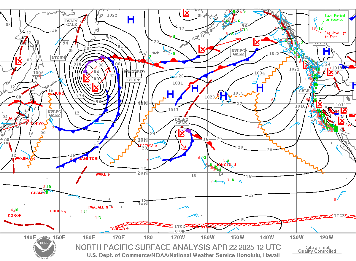
North Pacific shows the fetch of Monday's swell getting closer but weaker. It's going to be a very stormy swell with a lot of energy and multiple periods overlapping. North shore is going to be a huge mess, unless you find a spot that filters the energy, the place to be will be the west side. Even Honolua might have too much energy. In which case, search down the coast.


A small fetch is present in the South Pacific.


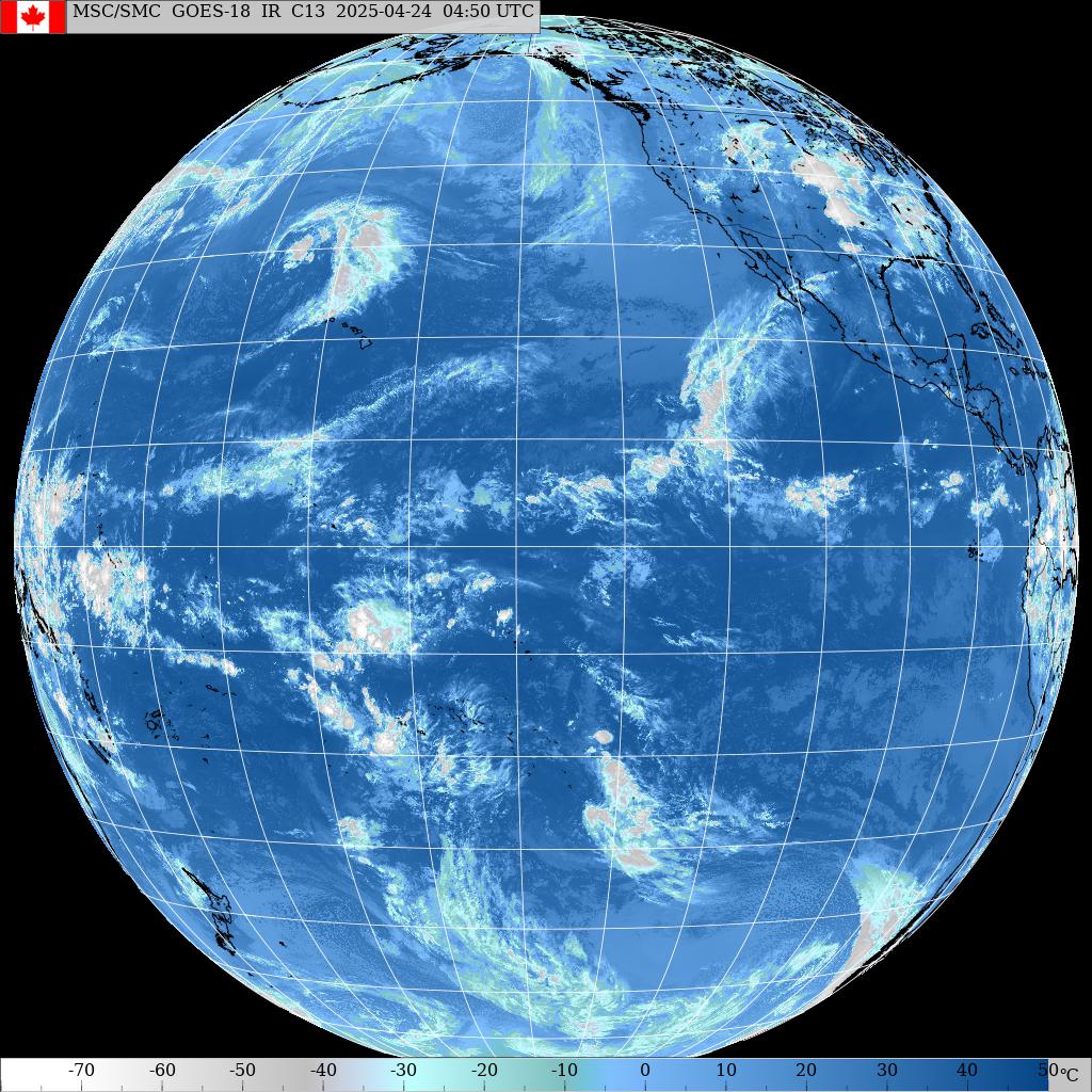
Morning sky.

Saturday, March 10, 2018

Saturday 3 10 18 morning call

A shortboard session for me yesterday. My friend Gianfranco is visiting, we've been scoring fun sessions all over the island. Yesterday it was Honolua's turn again.


Little groms can magically appear in front of you.


I had a quick chat with this surfer visiting from Martha's Vineyard.


On the way back, I passed on a windsurfing session that looked pretty fun, but not exactly my ideal conditions (bit too windy). The easiness with which I did that is a sign of things that are a changing. This photo from 6 years ago came up in my Facebook memories and symbolizes that. That was a day with very strong and gusty wind (the sail is a 3.7) and I would not sail such conditions today.
Every session in every discipline contributes to refining skills and building waves and conditions knowledge and preferences. Such should be life.


Nonetheless, I'm gonna go check out this IWT kick off get together at the Paia Bay Coffee & Bar tonight.


1am significant buoy readings
South shore

No indication of southerly energy at the buoys, the Surfline forecast calls for 1f 11s.

North shore
N
7.8ft @ 9s from 11° (NNE)

Pauwela
6.5ft @ 12s from 19° (NNE)
5.5ft @ 9s from 19° (NNE)
4.6ft @ 7s from 22° (NNE)
 
Third day in a row with very similar overall conditions, even though the energy from the NNE is going to slowly taper down. That is based on the observation of the N buoy reading and on the Surfline forecast which I put together with the Pauwela's graph in the image below. Notice the big swell on Monday.

Wind map at noon.


North Pacific finally shows the fetch of Monday's swell, mostly between 340 and 350. In fact, the Surfline forecast calls for a 2pm peak of 13f 15s from 346.


A very small fetch in the South Pacific.


Morning sky.

Friday, March 09, 2018

11am honolua has inconsistent head high waves with occasional bigger sets like the one in the photo. A little wobbly because of the northerly wind.
Medium crowd.
4.5

Friday 3 9 18 morning call

Shortboard session for me yesterday. No photo of the day, here's an image from my coworker Kavika who's got some great shots on his instagram account.


3am significant buoy readings
South shore

No indication of southerly energy at the buoys, the Surfline forecast calls for 1.3f 11s.

North shore
N
6ft @ 12s from 357° (N)
4.9ft @ 10s from 354° (N)
3.5ft @ 6s from 354° (N)

Pauwela
6ft @ 13s from 20° (NNE)
5.9ft @ 9s from 29° (NNE)
3.5ft @ 11s from 22° (NNE)

Buoys and wind suggest a day very similar to yesterday.

Wind map at noon.


North Pacific shows next Monday's swell's fetch starting to show some teeth. Direction is still not quite right, but it will change. The local northerly fetch is responsible for the stormy look of the current waves instead.


Nothing of relevance in the South Pacific.


Morning sky.

Thursday, March 08, 2018

7.15am Hookipa is overhead and stormy with sideon wind.
1.5

Thursday 3 8 18 morning call

Only a SUP foiling session for me as I was busy for the rest of the day. Though job I have.


5am significant buoy readings
South shore
No indications of southerly energy at the buoys (back online thanks to my email). The Surfline forecast calls for 1.4f 12s. Yesterday it was knee to thigh high and clean in the morning.

North shore
N
7.3ft @ 12s from 6° (N)
4.1ft @ 10s from 10° (N)
2.5ft @ 4s from 354° (N)

Pauwela
5.1ft @ 12s from 16° (NNE)
4.1ft @ 9s from 20° (NNE)
2.4ft @ 5s from 31° (NE)

All about the northerly energy these days. 5f 12s from 16 can be fun. Plenty spots hit by that direction. I'll report from Hookipa later in the morning, but there'll be wind on it.

Wind map at noon shows good conditions for a Kihei downwinder.


North Pacific only offers a weak NNE fetch. The strong one in the NW corner is aiming at the mainland's west coast and we might get a bit of angular spreading. But that low is predicted to move south towards us and it will be responsible for Monday's big northerly swell that is predicted by Surfline to reach 13f 15s, unfortunately it will come with plenty wind.

Here's Pat Caldwell's way to describe what's gonna happen: Models show a deepening low pressure near the Date Line over the Aleutians 3/8. It is predicted to change track sharply to the SSE 3/9 as a long, wide fetch of gales to severe gales sets up over the 350-010 degree band. The system is expected to occlude 3/10 then move slowly to the NE 3/11-12. It should make for a long- lived event.

Long-period forerunners from 340-350 degrees are due mid Sunday. Heights should ramp up sharply Sunday PM, rising above average before sundown. It should peak at extra-large levels, meaning high enough for outer reefs, on Monday 3/12 from 350-010 degrees.


A little southerly fetch in the South Pacific.


Morning sky.


I subscribe to Dr. Greger website's daily videos and this morning there was another eye opener one.

Wednesday, March 07, 2018

6.30am Hookipa is still well overhead, but smaller than yesterday. Kinda clean with not much wind just yet.
5

Wednesday 3 7 18 morning call

A shortboard session at Honolua for me yesterday. I gave it an 8, but I only had time to take a couple of shots. Notice the very unusual presence of a SUP surfer in the lineup. As far as my experience goes, he never was in the way and didn't catch too many waves, so I had no problem whatsoever with him and I actually admired his courage to hit a lineup where very likely someone had something to say about it. In my opinion, everybody should be free to do whatever discipline he prefers, as long as it keep it safe for the others and sticks to the etiquette without hogging waves.


Here's a few gopro shots. I believe that's my friend Marco.


A Fosbury flop over the lip wasn't an option when there were no leashes.


Rail grabs were.


Yet another day without the Surfline buoy readings (I'll send an email to fix it). The forecast for the South shore calls for 1.3f 12s.

The one for the North shore calls for at least 4 different swells with directions all the way from 309 to 95, the biggest of which is 6f 12s from 357.

The diagram of the energy spectrum at Pauwela (this is real data, not the forecast) shows an even broader direction range: from slivers of energy at 260 all the way to 105, but with the dominant energy from 355. The periods range from 8s to 17s+. That is always the case: even if the buoys report only a couple of numbers, they're always only the dominant ones, but not the only ones.

The closer the source is, the more the energy will be spread over a number of different periods all present in the water at the same time. Remote sources have less spread, as each different period has more travel time to space out from the others.

So today plenty energy from the northerly quadrants and lots of consistent overhead waves breaking on the north shore.


Wind map at noon.


North Pacific shows a small NW fetch and the much closer NNE one which will keep providing us with waves from that direction (6-8f 10-12s) all the way to Sunday included. Monday a much bigger swell is predicted to arrive (10f 15s from 350). As I already mentioned a few days ago, after a long hiatus the Bay will be breaking every day for the first two weeks of March. At different sizes and quality, obviously.


Nothing of relevance in the South Pacific.


Morning sky shows cold air coming down to us.


I know this has nothing to do with surfing (it has with the fitness needed to go surfing, though), but I had a few thankful friends that completely changed their diet thanks to the fact that I posted some videos from my favorite human on the planet Dr. Greger. Here's one that illustrates the importance of fiber. Don't juice your veggies and throw away the fiber. If anything, blend it.

Tuesday, March 06, 2018

8.30am Hookipa has head and a half sets with a little wind.
3.5

Tuesday 3 6 18 morning call

Shortboard, longboard and windsurf sessions for me yesterday. I also found the time to snatch these couple of photos to illustrate the lovely clean conditions on the Lahaina side.


Auntie puts it on the rail.


This photo of Jimmie Hepp from this gallery shows the fun sailing conditions at Hookipa.


The Surfline buoys page (link n.11) has no data other than the NW101, so we go mostly by the forecast today. For the South shore, they call 0.7f 15s.

North shore
NW101
6.2ft @ 14s from 9° (N)

Here's a sentence from Pat Caldwell's post yesterday: Long periods swell events from the NW and N are predicted for Tuesday. The latter should be larger.

The buoy reading seems to confirm that. Below is the collage of the maps of March 2,3,4 and 5. You can see how the vicinity of the northerly fetch will be an important factor.


Wind map at noon.


North Pacific shows that the same NNE fetch in the last map of the collage above didn't move much. Steady 7f 11s from around 25 degrees predicted by Surfline for Thu, Fri,Sat


South Pacific doesn't show anything of relevance.


Morning sky.