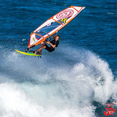
I threw this one on Facebook in the evening and multiple times world champion Kevin Pritchard commented:"he is sailing amazing at the moment.."

He does everything to perfection, but, once again IMO, this is the part where he's better than everyone else: the exit from the bottom turn and transition to the top turn.
The radius he achieves is so tight that he must be putting a hell lot of pressure on the back foot. Yet he manages to use the whole rail of the board and gain speed all the way through the turn and then explode off the top like in the photo above.
A real pleasure to watch.

And that was just the power sailing part. As you can see from the next two shots, he's also very acrobatic above the lip, but that's a place where there's a bunch of other sailors that are just as good.


Amongst them is a 14 yo kid that is coming up real strong: Jake Schettewi in a photo from Jimmie Hepp.

Waves have been below the winter average for a week or so and Pat Caldwell explains why:
A jet stream block east of the dateline has kept surface low pressure systems a long way from Hawaii. The systems have been mostly gale, less than winter-caliber, thus the weaker magnitude and long travel distance has meant small surf for Hawaii this week from within WNW to N.
Yesterday was one of those "small" NW episodes (it's all relative), and today there should be another one as the graph of the NW buoy below seem to confirm.
I put red arrows to show when the swell went from 3 to 5 feet.

NW
5.5ft @ 10s from 81° (E)
5.1ft @ 12s from 322° (NW)
Waimea
2.4ft @ 7s from 41° (NE)
2ft @ 9s from 22° (NNE)
1.7ft @ 14s from 310° (WNW)
1.6ft @ 11s from 333° (NNW)
Pauwela
7.2ft @ 10s from 88° (E)
So only elevated windswell for the moment in Maui, but the NW energy should show up in the afternoon.
Wind map shows a fairly big NW fetch and the usual windswell one. That's as good as that NW fetch is going to get and the peak of related swell id forecasted by Surfline for Monday night (9f 16s).Pauwela
7.2ft @ 10s from 88° (E)
So only elevated windswell for the moment in Maui, but the NW energy should show up in the afternoon.
Unfortunately it will coincide with yet another strong trades windswell episode.
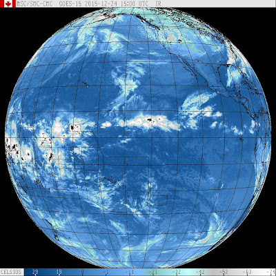
In fact, the associated front will fail to get closer to the islands and kill the wind. I put a blue circle on the area of light wind between the front and the trades generating high pressure, but unfortunately that won't get on top of us. Not until next year, at least.
I know, this is not an impartial forecast. It's a forecast full of opinions and preferences.
The good news is that that big cloudy area also didn't move on top of us, so today should be another gorgeous sunny day.

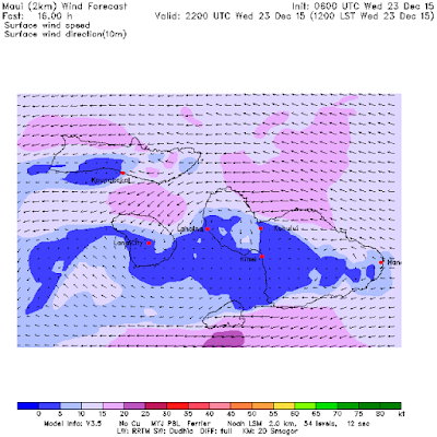
MC2km map at noon below shows the wind that it shows, but the time stamp up in the right corner says dec 23 yet the maps start from the 24, so I'm not 100% sure that is an updated map or not.
Either way, here at my house in Kuau looks like no wind at 7am, go get those glassy waves until they last....


No comments:
Post a Comment