Se here we go, this call is the first of the season, let's hope it's gonna be a good one. It's gonna be hard to beat last winter, but you never know. The start is for sure interesting, since in the following 7 days we're gonna have swells from the east, west and south, which is a very rare mix.
To understand where these swells come from, we need to look at the wind maps from a few days before. This one below is from August 26. I circled the fetch that Typhoon Lionrock south of Japan was offering. As a result, Pat Caldwell is calling for 2f 20s from the west already tomorrow.

Below is the map from the 27th. More waves generated by the Japanese Typhoon and a bit of a fetch down south. You can also see the two hurricanes east of us starting to gain wind speed, but not making waves for us just yet.

August 28. Lionrock still spinning strong and a strong fetch down south will unfortunately be greatly blocked by New Zealand.

August 29. Lionrock still making waves from the west, the fetch down south moved east a bit and that is a much better situation for us. The related south swell is forecasted by Surfline to pick up at 2f 18s on Monday.

Lastly, this is today's map. The Typhoon fetch is now very weak, but as you saw on the previous maps, the small, long period W swell should last quite a few days. Best bets to catch it will be on the Kihei side.
The fetch down south is already shooting at the Americas, so we'll have to rely on the angular spreading.
The two hurricanes are now providing slightly bigger fetches. What will make the related swells relatively big and full of energy is the close distance of course.

This is a close up of tomorrow at noon and that's when the swell of the first hurricane Madeline will peak at 12f 10s according to Surfline.

Hurricane Lester will send us a second punch of 14f 12s on Saturday and as you can see from the map of September 3rd below, it should travel to the north of us.

Lots of interesting weather situations to be observed in the next few days, that is for sure. But let's stay in the present and look at the 4am buoy readings this morning.
Pauwela
4.1ft @ 7s from 58° (ENE)
1.9ft @ 10s from 33° (NE)
1.9ft @ 9s from 27° (NNE)
Mokapu
6.4ft @ 7s from 71° (ENE)
SE Hawaii
6.4ft @ 7s from 71° (ENE)
SE Hawaii
4.9ft @ 10s from 96° (E)
4ft @ 8s from 67° (ENE)
As you can see there's already short to medium period energy from the east in the water. It will increase throughout the day, but the real first punch will be tomorrow. Where to go surf?
Well, of course the easterly exposures will be the ones that get the most energy, but seen the rough nature of such a closely generated swell, it might be a good idea to look for places that offer some filtering of some sort.
Stay tuned for updates from Hookipa later this morning. The "live" updates is something I'd like to do more often this year. No photos (which from Hookipa sometimes just don't upload), just brief texts describing the conditions.
MC2km is not updated at the time of this call, so please check it later if you want to know what the wind is going to do.
The two models at the bottom of the windguru page, do call for some strong wind.

7am update: here's the MC2km map at noon that confirms the wind, but read what I write below before you get excited about the wind related sports. It's not a classic high pressure, blue sky trades kind of wind.

As usual it will depend a lot on the cloud cover and with a storm like this approaching, (4am satellite image), I bet there will be plenty squalls and related up and downs. Specially tomorrow when most of the rain will hit.


Thanks everybody for reading, please support the blog by the means of donations, advertising or simply spreading the voice in the lineup.
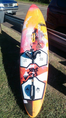
Or buy this great deal 74L windsurfing board! :)
Or buy this great deal 74L windsurfing board! :)


2 comments:
Welcome back! Thank you for the forecast and in depth information. Educational and enjoyable to read as always. Looks like we will be sharing sessions soon wind guru :-)
It's great having you back Dude!! Hopefully I'll catch you in the wind soon
Post a Comment