Wednesday, March 14, 2018

9am honolua has very inconsistent waist to occasionally head high sets. 15 people total, but there's not many waves.
I wrote that the bay was going to be breaking every day for the first two weeks of March, and today is the last one.

lahaina side had knee to occasionally thigh high waves and clean conditions everywhere.

7.15am Hookipa looked still overhead and windy from the distance

Wednesday 2 14 18 morning call

Shortboard session at beautiful Honolua Bay yesterday for me, below are some photos I took.


Doubl hand drag proved to be successful down the line.

Tanner Hendrickson was way up the line and got this barrel there.

And hit the closeout afterwards.


5am significant buoy readings
South shore
No indication of southerly energy at the buoys, the Surfline forecast calls for 0.6f 16f but only in the afternoon. That would be the start of a low, long lasting, long period swell coming from the remote fetches circled in the maps below (6,7 and 8 March).


North shore
N
4.4ft @ 12s from 336° (NNW)
3.9ft @ 7s from 33° (NE)
3.6ft @ 10s from 341° (NNW)

Pauwela
6.4ft @ 7s from 57° (ENE)
4.1ft @ 12s from 349° (NNW)

The NNW energy disappeared at the NW buoy, while it's still at the N one. That confirms what I wrote a couple of days ago about the swell being bigger east of the NW buoy. Still some energy in the water though, on the steady decline for the next couple of days. The Surfline Offshore Swell Heights forecast proved to be extremely accurate again, so below are the next three days. The purple line is the NNW swell, the red is the E windswell. I'll post a Hookipa beach report by 7.30am. Webcam shows still overhead and windy.


Wind map at noon shows easterly trades. So easterly that the early morning hours should see no wind down the coast.


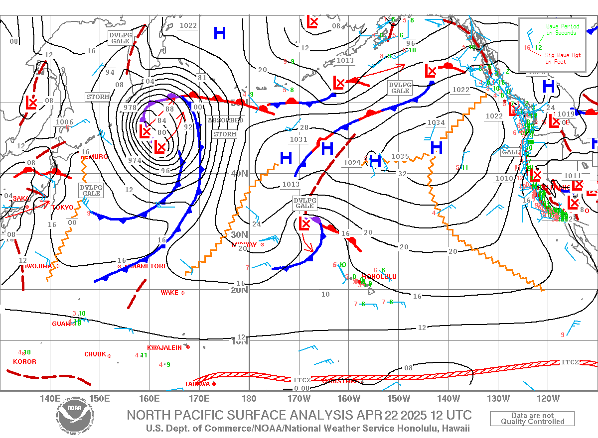
North Pacific looks better than yesterday with a couple of small NW fetches. The related small swells should arrive Sunday and Monday.


South Pacific shows two very remote fetches.


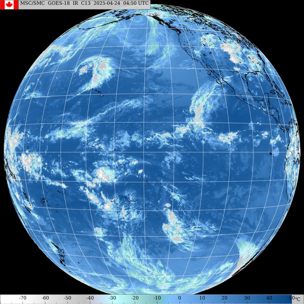
Morning sky.

Tuesday, March 13, 2018

1pm honolua is still beautiful. Little smaller, little less people.

1pm honolua is still beautiful. Little smaller, little less people.

9.30am honolua is head to head and a half. A bit slow, but beautiful. 40 people total.

Tuesday 3 13 18 morning call

A longboard and a windfoiling session for me yesterday. Being able to do multiple disciplines and knowing where to go (most times, at least), helps me maximize the time in the water and the fun.

Here's some examples of what I just wrote: yesterday the Bay was firing and my friend Gianfranco was testing a new shape of his with his FinShot mount. Incredible angle, it's like having a personal photographer one foot in front of your board all the times.


Also Marco was doing the right thing at the right spot.


This windsurfer instead was trying to do the wrong thing at the wrong spot.


4am significant buoy readings
South shore


No indication of southerly energy at the buoys, the Surfline forecast calls for 0.4f 15s + 0.5f 11s.

North shore
NW101
6.9ft @ 13s from 347° (NNW)

Hanalei
9ft @ 13s from 344° (NNW)

Pauwela
7.7ft @ 14s from 353° (N)
5.4ft @ 11s from 358° (N)
3.1ft @ 9s from 9° (N)
2.2ft @ 7s from 47° (NE)

Despite my doubts, yesterday the swell did reach at Pauwela the 12f that Surfline forecasted for Maui. Below are the graphs of the three reported buoys and this must be the first time ever that I see a NNW swell getting bigger locally than at the NW buoy. The only possible explanation (other than a buoy malfunction) is that the energy of the swell was bigger just east of the NW buoy. What is really impressive is that the Surfline offshore swell forecast was once again accurate.
Today we start with a still solid 7.7f 14s from 353 and that should gradually decline all day.


Wind map at noon.


North Pacific is dominated by a massive high pressure and today there's pretty much no waves generated for us. That is in line with what Pat Caldwell wrote: After N swell wanes, below average spell from mid latitudes of north and south Pacific.


There are a couple of fetches in the South Pacific though, and that might be a sign of a season change. That fetch south of Australia is in a position which is not covered by the map on the right. By looking at the great circle rays right next to it, it might seem that it could be directed towards us, but I put a question mark since I'm not sure. That would be one of the most remotely generated southerly swell we can possibly get.


Morning sky.


Get used to the cloudy sky, looks like it's gonna last for a while.

Monday, March 12, 2018

7am harbor has waves

Monday 3 12 18 morning call

A SUP foiling and a windfoiling session for me. The foil saved my day (from the ocean activities point of view, of course), as I would have not been able to find anything fun enough to do without it. Particularly the windfoiling session was a 9 as there were some waist to shoulder high waves at Kanaha that were extremely fun to ride. Here is a video by Jeremy Riggs of a recent downwinder on the Kihei coast. The foil downwinders is a discipline I still have to master, but there will plenty opportunities to learn that in summer time.
Foiling Downwind In South Maui from Paddle With Riggs on Vimeo.


4am significant buoy readings
South shore

No indication of southerly energy at the buoys, the Surfline forecast calls for nothing

North shore
NW101
8.4ft @ 14s from 348° (NNW)
7.1ft @ 10s from 9° (N)

Hanalei
8.4ft @ 13s from 342° (NNW)
4.7ft @ 7s from 10° (N)
4.6ft @ 9s from 8° (N)
2.6ft @ 11s from 355° (N)

Pauwela
6.6ft @ 13s from 351° (N)
4.4ft @ 10s from 4° (N)
2.9ft @ 6s from 26° (NNE)
1.9ft @ 11s from 357° (N)
The NOAA stuck to the WW3 predition and issued a high surf warning, but the numbers at the buoy are barely justifying a high surf advisory as the swell is a lot smaller than predicted. It's true that I sample it only once a day (so I might have missed its best moments), but the fetch of this swell never really impressed me, as it was more of a strong ridge of high pressure than a deep low. The collage below shows the graphs of the three reported buoys, together with the Surfline forecast. As you can see, the swell barely reached 10 feet at the NW buoy, and is peaking at Hanalei at 8.5f. I doubt it will get bigger than 8f in Maui, what perplexes me is that the forecast still indicates a peak of 12f 15s in Maui this afternoon. I would expect their model to adjust its output after the swell hit the NW buoy, but it didn't.

What is confirmed, is the stormy character of it shown by the multiple different periods all arriving simultaneously. That is due to the vicinity of the fetch. Relatively big, stormy, windy and very consistent (borderline dangerous) is my guess for the exposed spots on the north shore, better seek for something sheltered or the west side.


Wind map at noon.


North Pacific shows a sliver of NNE fetch in the Gulf of Alaska and a small N windswell one.


Couple of fetches in the South Pacific.


Morning sky.


5.55am rain radar shows a lot of rain south of us. Some of it should hit us this afternoon, but most of it will hit us tomorrow and Wednesday, according to Windguru.

Sunday, March 11, 2018

7.15am Hookipa has chest to head high short period stormy waves with moderate wind on it.
2