Thursday, January 07, 2016

1 7 16 morning call

Sorry for the late call this morning.
Lots of pics from yesterday, since the conditions on the north shore were good pretty much for any wave riding discipline you can think of.
I took pics most of the day, did a (too) late windsurfing attempt, and finally scored a lovely sunset SUP session with just a couple of friends.
 
Not sure this shot is from yesterday, but it's too good to pass. It shows Maui ripper Will Hunt apparently burning Kelly Slater at the Bay. But instead, that's what he wrote when he posted the shot:
"I was paddling and I seen him under me started to pull back and heard a voice say GO WILL and he looked at me and said ya go Willie some how he came around me on the outside of the barrel and pulled in in front mad props @kellyslater"

What a story that is! How did Kelly manage to go around that barrel, I have no idea. Had it been anybody else, I would have said it's impossible. But it's Kelly, so...
Btw, Will is the son of Doug Hunt who is known for having done the first backloop with a windsurfer back in the days. I had the pleasure to judge my first Aloha Classic together with him in 2004.

Photo by Dave @createandenjoy


These are the shots I took yesterday in chronological order. First two are Pavillions.


Kiter Steve Sadler is on a wave while his sporty car awaits.

Missed the grab, went down, still spectacular. Might be Kai Barger.

Browsinho knows how to close his top turns. He actually spun that into a taka at ease.

Kevin Pritchard was the first windsurfer to launch.

Albee Layer.

Lanes is such an unfriendly launch. Steve knows how to get back in.

Matt Meola bottom turns in front of a pretty fun looking section.

This long sequence shows Matt Meola doing a air 360 (I'm sure there's a more proper name) on the face of the wave without even using a chop. He just put a bit of pressure on the tail and the rest came by using the wind. Probably a piece of cake for him and his buddies, but I still think it's a remarkable feature.


These last two photos show KP laying it down twice on the same wave.

Tip of the mast is 2 inches from the water.


The three buoys are all going down and for a change no reinforcements are expected today (that'll come tomorrow).

At 7am Pauwela reads
4.5ft @ 14s from 329° (NW)
3.8ft @ 7s from 79° (ENE)
3.5ft @ 11s from 329° (NW)
and even though that might seem small compared to the past few days, it's still a really fun size, considering the clean conditions that will grace us today.


MC2km map at noon in fact, shows very little wind. It's my experience that when the trades (or the kona) are not blowing, these maps are less reliable. In other words, the afternoon onshores might be stronger than that, specially if the sun is shining strong. Go get them in the morning if you can.


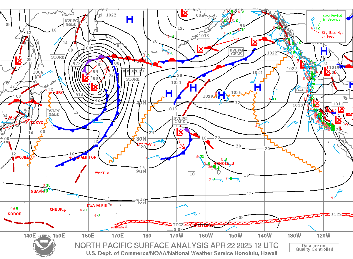
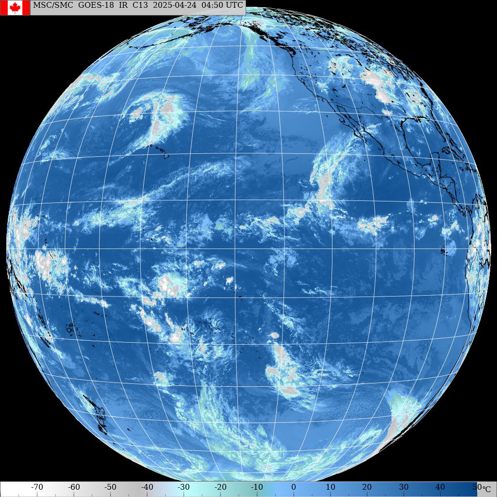
The wind map for a change doesn't show massive fetches making big waves for us. It does show a WNW one that will become better tomorrow. The one right north of us is now shooting at the west coast, but don't forget how intense it was yesterday. I also put a small X to show once again where the Marshall Islands are: in the middle of a low pressure. My friends on a surf trip are not being lucky at all with the weather. The Hawaiian islands instead a beautifully sitting in the middle of a small area with no wind.

Wednesday, January 06, 2016

1 6 16 morning call

A fun day on the north shore yesterday with big waves but not as huge as the day before.
So the photos are still from the Monday Jaws session.

This is a nice closeup of an impressive hit lip by Jason Polakow. He's going for a crazy aerial (the one part of yesterday's post set) and I just can't imagine what it must feel to go straight up a vertical 6 meters wall of water with the intention of getting airborne.
Photo by Jimmie Hepp.

This is Bethany Hamilton.
Despite the fact that catching waves at Pipeline (she won the 2014 Women Pipe Pro contest) with one arm must probably be more difficult than being towed at Jaws by the very knowledgeable Walsh brothers, she's still a source of constant inspiration for many.
Photo by Jimmie Hepp.

Great light in this image of John Patao.

And if you were wondering how Kelly Slater surfed Honolua Bay the other day, here's the answer: impeccably.


Here he is again in this photo by StuVisuals.
Lots of great shots in his gallery, I might have to save some for the next days.


The three buoys graphs show a slow but steady decline of the currents swell(s), but with still plenty size on offer for today.
Notice also a new long period pulse of which I highlighted the readings. Hard to read at the NW buoy, a little easier at Waimea (light green line).

At 5am Pauwela reads:
7.8ft @ 13s from 327° (NW)
3.8ft @ 6s from 57° (ENE)
2.2ft @ 20s from 337° (NNW)

Surfline calls for the new pulse to peak at 7.4f 15s at 8pm in Maui, but with almost 8f 13s still in the water, lack of size shouldn't be an issue in the morning. 
You can keep an eye on the buoys by having link n.11 on the home screen of your phone. It's a very light free page (no subscription needed) offered by Surfline and it loads also in low signal areas.


Wind map shows a very big NW fetch associated with a deep low with a 949 mbar minimum.
The small high that generated yesterday's trade episode (sailing Kanaha was fun, but I'm rusty) will move east and the trades will consequently turn more and more offshore.


MC2km maps not updated yet at 6am, put that page on your phone too.
All I can say is that at 6am the airport sensor is already registering gusts of 28mph, so a SUP session is out of question. I would have been regular surfing instead, but I' not gonna bitch about it, since I can at least go swimming.

Oh there we go, at around 6.45 MC2km maps were updated and here's the noon map that shows the wind that it shows: stronger up the coast as it's always the case when the wind is turning more offshore.
Notice how with this direction the Haleakala creates a cone of shadow from Makena all the way to the West side as the wind fails to get channeled between the mountains.


Tuesday, January 05, 2016

1 5 16 morning call

A big day like yesterday usually means a big morning call post the day after. This one is no exception.

I'd like to thank all the photographers and friends that are so kind to let me use their photos on this blog.

The swell hit during the day and the buoys got up to some massive numbers. I checked them around noon and Pauwela was reading an impressive 12f 18s.

That's what Jaws looked like in a photo by John Patao. Surfer Aaron Gold.


This is from Pat Caldwell's never disappointing three times a week weather discussion.
"The NW Hawaii NOAA buoys 51001 and 51101 and the pacioos/cdip near shore Hanalei, Kauai buoy show wave energy from this event lower than the Waimea, Oahu and Pauwela, Maui buoys. This is an indication of the highest swath of swell aimed NE of the islands. "

Two more Jaws photos, this time by Jimmie Hepp.
Bethany Hamilton continues to amaze everybody.


Later in the day wind sports happened. This is Jason Polakow.


Here's a great shot from my friend Tomoko: Dave Kalama on a beautiful outer reef right hander puts it on the rail by leaning on his paddle.


This is the spot I surfed with my SUP.
I've been out of the water for 2 months and, short board surfing or not, now that I'm out there again, I feel like someone just finally bailed me out of jail.
Nice turn by a really nice guy, who I failed to ask his name.


Same spot, different break, some size squeezing in. Photo by John Patao.


Honolua had moments of epicness, as this photo by my friend Kulia clearly shows. Good enough for Kelly Slater to be out there.


The graph of the three buoys shows a much shorter travel time than usual. The reason is in the sentence quoted from Pat Caldwell above. That's why I insist in not getting too precise when calculating the travel time from the buoy. A reading of whatever size and direction at the NW buoy does not describe the entire swell. It only partially describes it in that specific point of the ocean. It might be quite different just a bit far from it.

I highlighted the rapid growth at the Maui buoy: 10f in 12 hours. It was fun to watch it rise the whole morning. Luckily I had an afternoon work shift.

Anyway, they're all going down today, but that doesn't mean that the waves are going to be small by any means. As a matter of fact, at 4am Pauwela reads
9.5ft @ 15s from 321° (NW)
5.5ft @ 13s from 328° (NW)
First reading is in line with the Surfline forecast which calls for 8f 12s at 8pm. Tomorrow afternoon another pulse of about 10f 16s.


The reason behind all these NW swells are the fetches that have happened in the last 3-4 days. Every day I post the wind map of the north pacific (or the whole pacific if I see something interesting down south), and highlight the fetches generating waves for us.
I don't repeat it all the times, but a fetch like the WNW one I highlighted today will generate waves that will take 3 (front of fetch) to 5 (back of the fetch) days to get here. It not only depends on the position of the fetch but also on its intensity. The stronger the wind, the higher the period of the waves it will generate and the faster they will travel.

It's not worth IMO to spend too much time trying to predict size and arrival times of swells out of observing a fetch. For that there's the WW3 model on which most wave forecasting websites are based. The reason I post these maps is to give you guys a qualitative idea of what's ahead.
You see a fetch like this, you know there will be waves in a few days. Not massive as yesterday's ones, because the wind inside the fetch is not particularly strong.
And if you observed and remember all the maps of the last few days (if not, you can just scroll down and refresh your memory), you can easily guess it's not going flat anytime soon.


Should be another sailable day (yesterday I saw wind and kite surfers out at Kahana in the afternoon).
MC2km map at noon below shows the wind that it shows.

Monday, January 04, 2016

1 4 16 morning call

That's how Honolua bay occasionally looked yesterday.


But that's a closer to reality image. And there were plenty flat lulls too.


Much more of yesterday's action in a album by Jimmie Hepp. Here's a big punt at Lanes.


The buoys graph below shows the peak of the new large NW swell at around 4am at the NW buoy at around 14f 15s, which leads me to predict a peak of the swell in Maui in the late afternoon.
It also shows that that buoy is not as sensitive as the Waimea and Pauwela ones. Or at least, the surfline software can't extrapolate the long period energy out of the raw data as well as it does for those last two. Might have to do with the fact that it's more out there in the ocean and it probably receives more energy from all kinds of swells and directions.
Check instead that 25s readings at the Waimea and Pauwela (I circled them) that started the series of long period readings (I underlined them).

At 6am Pauwela is reading
5.4ft @ 20s from 330° (NW)
5.1ft @ 12s from 324° (NW)
4.6ft @ 13s from 320° (NW)
4.4ft @ 15s from 323° (NW)
which makes me think that the ocean will be a mess. But hopefully not at Jaws, where the only energy breaking should be the new long period one. It should be a good show with surfing in the early hours (Kelly Slater is in town, btw) and wind sports later on.


The messiness guess is confirmed by the Surfline Pipeline cam. You can see the long period waves breaking at the third reef, but the inside is an absolute mess.
So it should be Maui's north shore (other than Jaws, again), so pick the west side if you want to see some cleaner lines.

 
Wind map shows a nice NW fetch for continuous provisioning of waves. Also shows a residual of possible light trades for today.


MC2km map at noon shows that wind.


Injury update: the shortboard test failed. The foam protection worked beautifully though, in fact I was able to paddle all the way out at Kanaha with my lower ribs not touching the board at all. But then when it was time to paddle vigorously to catch a wave, the cartilage started clicking. So I went from "great, I'm back on a short board!" to "damn, I'm not" in a matter of a wave catching attempt.
I had to paddle back in (no clicking in that) without even catching one wave (you guys know how crowded Kanaha is and being on a a 5.10 didn't really help).

So what do you do if you're a semi-depressed passionate surfer who just found out you can't go back to your passion yet? You go to Honolua to take photo, of course...
Fortunately I came back for a sunset SUP session and that one went fine with no clicking.
So out of the three disciplines I practice I can do two (SUP and windsurfing), which is great. Third and favorite one will require more time and more patience. Much better than being in jail.

Sunday, January 03, 2016

1 3 16 morning call

Yesterday was another day with big waves but not clean conditions on the north shore. I don't have an action shot, so I'll post this one from Jimmie Hepp. Here's what he says about it: This shot is from Hookipa with Kahakuloa, Maui in the foreground (midway) and the island of Molokai in the far background..
I don't know what lens he used, but it must have been a very clean day.


Lovely double hump in the buoy graphs below. Wave size should be similar to the last couple of days, maybe a touch cleaner because of the lack of wind, but not much.
At 3am Pauwela reads:
9ft @ 13s from 322° (NW)           
4.1ft @ 9s from 343° (NNW)
and the mix of periods is never a good thing.
But there's waves, so no complains.
No sign of the extra large swell at the NW buoy yet, so that's gonna be a Monday affair.


Wind map shows a new WNW fetch (the Tokio Express is working full steam) and the big, intense one that created tomorrow's swell now aiming mostly to the west coast. We'll still get waves from the very tail of it though.
I did a full run of the windity two weeks and I liked what I saw a lot: plenty waves, very little wind.
It was about time and I'm gonna be in the water looking for action.


MC2km map at noon shows the wind that it shows.


Here's a little update on my physical (and mental!) conditions for whom it may interest.
After yesterday morning's click flurry I figured there's no point at resting if the thing clicks just for a hiccup or for turning in bed. I don't know if it's ever going to heal, but if it does for sure it won't be because of resting. So yesterday morning - quite pissed off - I got on my SUP and surfed Kanaha. Didn't surf it since last year, plus two months without surfing, plus very shifty and hard to read waves made for a horrible start that made me even more pissed off.
Then I finally got a good one and managed to release some of the frustration into the turns.

In the afternoon I went back there with the windsurfer. No problem doing that either, just not particularly exciting conditions.
But what I really want to do is shortboard surfing, so I worked on another design of rib cage padding and I'll test it today. Needless to say, stay tuned if you want to know how went.

Saturday, January 02, 2016

1 2 16 morning call

Poor conditions on most of the north shore spots yesterday because of the light onshore wind and too much energy in the water. Honolua instead looked beautiful. Photo by Jeff Lackey.


Well the energy in the water today will be even more, as the three buoys graphs below clearly show.
NW buoy peaked around noon, Waimea 12h and Pauwela 15h later.
5am reading for Pauwela is
9.4ft @ 14s from 323° (NW)
5.4ft @ 9s from 349° (NNW)
2.3ft @ 5s from 16° (NNE)

That's a hell lot of mixed energy, good luck at finding a clean spot on the north shore (also because of the wind). West side would be my call... if I could surf!
Sorry, it's been 2 months and this morning I woke up to a flurry of  little cartilage clicks inside my rib cage and I got a bit of frustration going.

Barbers point is only reading the massive NW wrap, but I taught a SUP lesson yesterday at Thousand Peaks and the waves were beautiful knee to waist high with the occasional chest high set!
This is the weather map of 7 days ago (dec 26), so I'm pretty sure there is something on that side also today.


Remember on yesterday's wind map that fetch I said it wasn't going to do much for us (yet)? Well, if you don't just scroll down to yesterday's post. Today that same fetch is most definitely going to do something for us. No shortage of waves on the north shore these days. Too much to be enjoyable (unless you surf Jaws), actually.


I also pointed out a small cell of high pressure which will generate some light trades today. Below is the MC2km map at noon and it shows a speed of 10-15 knots. Not enough for the common windsurfers (the planers), also considering the size of the waves.


Friday, January 01, 2016

1 1 16 morning call

Big waves on the north shore yesterday. Here's a couple of shots from the sunset session at Hookipa.
First one is Yuri Soledade.


Today's graph of the three buoys is perfect for tuning those travelling times. The swell peaked at midnight on the NW buoy, 12h later in Oahu and 15h later in Maui.
The period was 14s and if you remember GP's rule of thumb 12h at 16s and 16h at 12s, you can easily insert a new 14h at 14s in there. Actually those numbers are a little small, specially with the lower periods, but they're easy to remember. Mmm... maybe I should change them in 12 at 18 and 18 at 12 with a lovely 15 at 15 right in the middle, but I'd like to verify that with the next swell that will allow me to do so. Always fine tuning, but don't forget that you shouldn't get stuck on too much precision, because the approximations are many.

Anyway, 7f 13s at Pauwela at 5am is pretty solid size and it will slowly decrease throughout the day, but not by much. Not gonna be clean though, because of the onshore wind.


Wind map shows a WNW fetch on the left and a NNW on the right.
First one is not going to do much for us today, but it's shooting nicely at the Marshall islands that are where I put a little x. I got friends going there today, so I wish them plenty waves. Too bad for all that wind they'll be sitting right in the middle of.
Second one is nice and close and is the one responsible for Monday's extra large swell. But it's also so close that we're gonna get the onshores after the pass of the related front.


6am satellite picture shows the main front on Kauai. It's already northerly wind in Maui, but after the pass of that front is going to be definitely stronger. And cooler.


MC2km map at noon shows the onshore wind still on the light side.