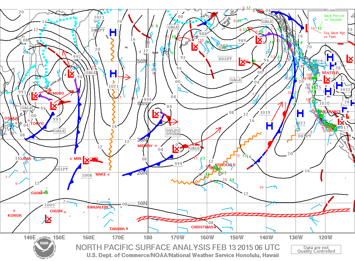
Today's weather map shows two lows that are going to merge and create a big, closely generated swell that (according to Surfline) will peak at around 13f 14s from 324 on Sunday night.
I'm never too excited about closely generated swell, specially medium period ones, but hey there will be waves! Not that we really had too many flat days this AWESOME winter...
Also today, in fact, the buoys show plenty energy. I put two arrows to show how the NW buoy went down about 5 feet in 24h and that's what we should expect all today on our beautiful island too. But the 5am reading in Maui is 9f 13s, so nothing to worry about there...

What's to worry about, as usual, is the local wind. One of those two lows that are going to merge is already close enough to generate a SW flow. I circled the two fetches that are making waves for us (the one off Japan is going to be the main swell provider for next week) and put an arrow to indicate the local Kona wind flow.

The two models at the bottom of the windguru page show very different times for the start of the strong flow. Unfortunately, it seems that the NAM one is correct, since the Kahului wind sensors are already up at 6am. I don't feel much wind outside my window yet, so maybe it hasn't made it all the way up here yet. It will windsurfing at Lanes later for sure.
Notice also the heavy cloud cover and rain predicted by the HRW one for tomorrow.

Have fun in the sun everyone!
PS. All the sources for this post are permanently linked in the links section on the right of this blog.


No comments:
Post a Comment