That's how the waves looked at Hookipa at sunset, in fact.

A quick zoom in allowed me to catch the guy who went left on that wave.

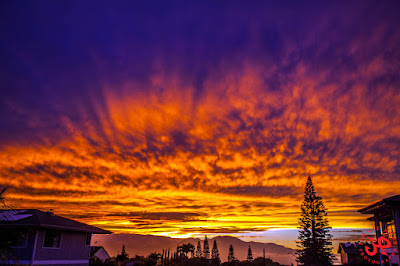
Later on, the sunset went off in spectacular fashion. Photo by Jimmie Hepp.

5am significant buoy readings
South shore
W
3ft @ 13s from 170° (S)
SE
3.4ft @ 13s from 173° (S)
Solid southerly energy readings at the outer buoys, while the Surfline forecast calls for 2f 14s. I have no reports from the south shore, so I don't know what that translates to locally (nobody can predict the blockage from Kahoolawe). But there's a southerly wind flow, so conditions might not be the cleanest.
North shore
Pauwela
5ft @ 8s from 68° (ENE)
4.1ft @ 13s from 12° (NNE)
The very long lasting swell that has delighted us all week is coming down in size and period and going more east, but exposed breaks will still receive plenty waves out of those 5f 8s. What's new is those 4f 13s from 12, which Pat Caldwell and the NOAA don't even mention. As you can see below, Surfline instead had them in the forecast (blue line on the right part of the collage, the left part being the Pauwela graph).
The Surfline forecast is incredibly accurate, as long as you only check the "offshore swell heights" tab. Don't waste your time checking the spot forecasts, they are useless. See what's predicted to be out in the ocean and make your own guess for the spot of your interest.
The Surfline forecast is incredibly accurate, as long as you only check the "offshore swell heights" tab. Don't waste your time checking the spot forecasts, they are useless. See what's predicted to be out in the ocean and make your own guess for the spot of your interest.

I didn't remember seeing a fetch that would justify this new swell, so I retrieved the map of March 22 and noticed I completely overlooked a fetch in the gulf of Alaska corner. I now circled it in black.

Wind map at noon shows light winds on the north shore...

...but wind map at 2pm shows a burst of Konas squeezing through the valley. If it happens, it might be sailable in the late afternoon.

North Pacific shows a weak NW fetch and an E windswell one.

South Pacific shows a SSE fetch (third day in a row, I think).

Morning sky. I might be the only one on the island hoping that those clouds don't move away. A cloudy sky makes for less wind.


No comments:
Post a Comment