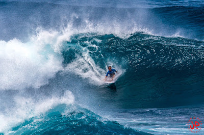
Blog reader Cathy was there because she knows how to read the buoys. She also know how to take off steep.

My friend Jason knows how to read the buoys too and he also knows how to fix credit scores. He's been doing that for years and it sounded very competent in a business phone call I got to listen to. If the customer on the other line would have known that he was sitting on a beach chair, checking the waves after a surf session at Honolua, he would have probably had some kind of negative judgment. If I was the customer instead, I would have thought: "if this guy organized his business so that he can do it from the road, he's smart. I'll trust him". Here's his website.

This longboarder first packed a short barrel...

..and then charged this steep section. As reported in the double beach report, there were some eights out there.

My second session was poor: more people and less waves. I only got one.

Here's a lucky shot, pulling back because someone else was already on the wave.

Meanwhile, at Hookipa Jimmie Hepp was shooting surfers and windsurfers and put the result of his work in this gallery.

I called for excellent surfing and this is the very reliable report from my coworker Russ: "Sailing was really good. Borderline epic! Light side off logo and peeling."
Of course, it takes some skill to enjoy difficult conditions, so it might have not been the same for every sailor. This is Tom Garcia on a wave that the windsurfers smartly call logo high. Using body or sail parts is a non confusing way of calling the size of the waves. Unlike the ridiculous and unscientific so called "Hawaiian scale".

4am significant buoy readings
South shore
Lanai
Nothing at the buoy, check the webcams.
North shore
NW101
5ft @ 12s from 50° (NE)
Waimea

For some reason, iWindsurf won't show the Hookipa sensor this morning, but there is some wind at my window.
This is the NAM3km map at 1pm. Windsurfing will be sketchy today, probably only in the early morning (the maps look better than this one), before the rain hits. Check the MC2km maps when updated for a more reliable prediction.

Photo satellite at 4.30am shows we're back in the clouds (we never really were out of them, as I wrongly called yesterday).

That heavy rain south of us should move north and hit us in the afternoon.

That is what the rain forecast on the HRW model on Windguru shows (red circle).

Current wind map shows:
1) a moderate fetch in the NW corner
2) a windswell fetch

PS. No time to review this post. Sorry about eventual spelling/grammar mistakes.


