Showing posts with label wave wing foiling. Show all posts

Monday, August 05, 2019

Monday 8 5 19 morning call

Sorry for the late call, I had a massive day in the ocean yesterday (surfing, SUP foiling and winGfoiling) and my body needed extra rest. Also sorry for the wrong drone call on yesterday's Koa Smith footage, I got fooled by a hashtag that mention drones... it was a gopro Fusion instead.

This is Dave Kalama whose flawless foiling inspired my to get in the water and try to do the same.


This is another video of the wing foiling kids. This is the most exciting wind related new sport I've seen since I moved to Maui 18 years ago and that's why I did some myself (at Kanaha) on a borrowed HST wing. Lots of fun, but obviously not good for my trigger finger, if it wasn't for which, I'd probably own a quiver of wings already.


5am significant buoy readings and discussion
South shore
Barbers
2.7ft @ 9s from 173° (S)

1.4ft @ 12s from 175° (S)

1.3ft @ 15s from 188° (S)

Lanai            
2.2ft @ 9s from 165° (SSE)   
1.4ft @ 12s from 173° (S)            

1.3ft @ 15s from 187° (S)
 
Just like yesterday, we have long period distantly generated southerly energy and Erick's 9s leftovers. If you wait long enough, you can score one of former kind like this one below. Check the webcam yourself before going.
 
North shore
Mokapu
3.5ft @ 12s from 92° (E)

2.8ft @ 7s from 81° (E)

2.6ft @ 9s from 99° (E)

Hilo
6.8ft @ 10s from 98° (E)       

4.9ft @ 11s from 93° (E)
 
Mokapu's graph below indicates that the long period energy from Flossie peaked yesterday mid morning. Size still up at Hilo, but the period went down too. Maui will probably have something in the middle, so I'm gonna guess small waves at Hookipa and bigger on the eastern exposures. Wind is favorable at the moment (7am).


Wind map at noon... or should I say winG map at noon?


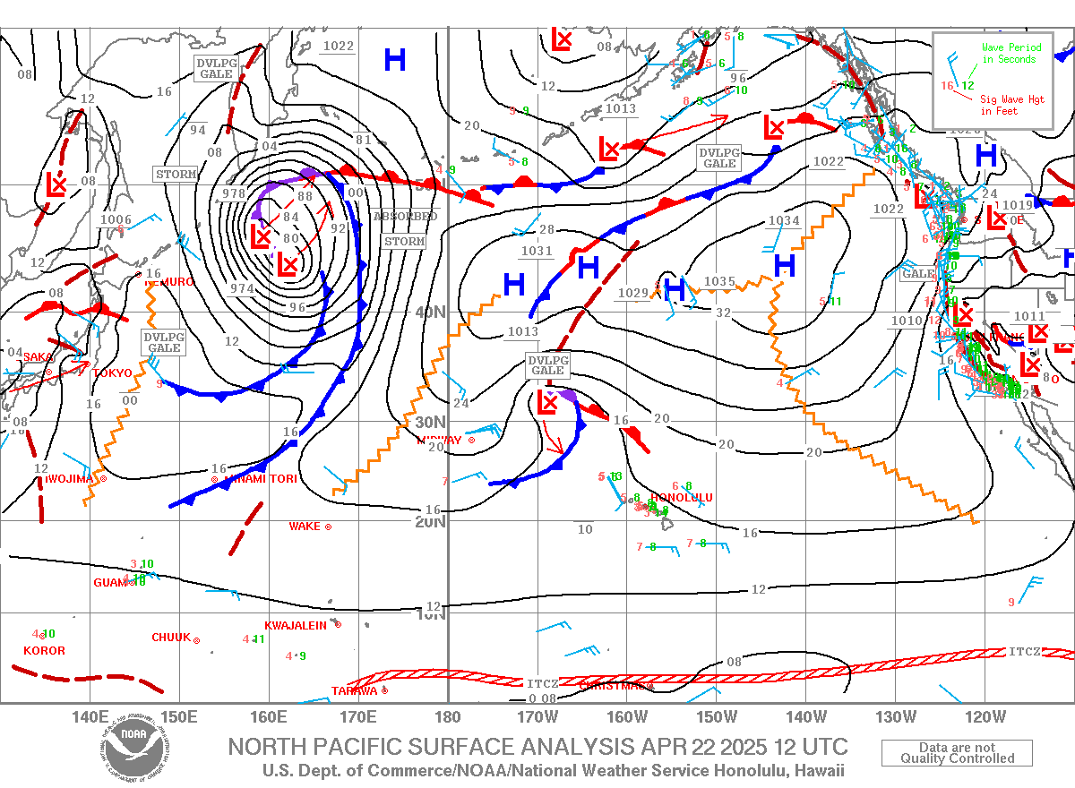
North Pacific has the windswell fetch reinforced by Flossie's wind now extremely close and that very remote west fetch.


The big/strong Tasman Sea fetch has now moved across New Zealand and is now aiming to our east, but we should get some angular spreading.


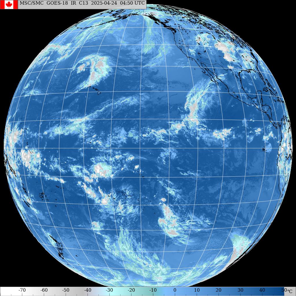
Morning sky shows a peculiarly cloud free storm. You can see the counter clockwise rotation of the winds, but clouds only in the red circle.

Friday, August 02, 2019

Friday 8 2 19 morning call

Yesterday at Hookipa I witnessed this wonderful dance made by wing foiler Titouan Galea from New Caledonia. Message for the future wave wing foilers: if you're in a spot with surfers, stay safely away from them and leave them every wave that they can potentially catch, even if you're on it already.


Here's the moment in which, after having had it low and out of the way behind his back, Titoun moves the wing over his head and tacks into the wind ready to sail out again. Bit of a windsurfing duck tack, just a lot easier... IF you can control the foil while you do that.


3am significant buoy readings and discussion
South shore
Barbers
2.6ft @ 12s from 160° (SSE)
1.5ft @ 10s from 155° (SSE)
0.4ft @ 20s from 192° (SSW)

Lanai
2.3ft @ 8s from 164° (SSE)
1.4ft @ 11s from 172° (S)
1.2ft @ 15s from 185° (S)

Well, I reported everything that the local buoys are registering, but that doesn't make it easier. The 0.4ft 20s reading at Barbers is nice, but it might not turn into much. I like the 1.2ft 15s one at Lanai much better, while the 10-11s energy is probably coming from Erick. It's one of those days in which you have to check the webcam before going anywhere. And keep checking it all day, as the possible increase of southerly energy coming from the storm might happen suddenly and late in the day.
This is a beautiful long period line (nothing to do with Erick) and that one guy is scoring alone. Check the webcam for conditions update, as it looks a bit onshore already, while I'm reviewing the post.


North shore
Mokapu
6.3ft @ 7s from 83° (E)
5.5ft @ 9s from 98° (E)

Hilo
7.7ft @ 9s from 112° (ESE)

SE
8.1ft @ 8s from 83° (E)

Just "regular" easterly windswell for our north shore, Hookipa will probably have waves like the ones in the video, possibly bigger on eastern exposures. Erick is now too south for adding anything. Unfortunately, the wind is blowing pretty hard at my house already but in between squalls there might be moments of decent conditions.

I reported the SE buoy reading because yesterday it went up to almost 15ft 10s from a direction around 115-120. I believe the SE facing shores of the Big Island have big waves. No idea if you can surf there.


What about us? Well, if you're in Hana, there should be something, as the shadow line sits around 137 degrees.


Wind map at noon.


North Pacific has the "extended" wind swell (which includes Flossie's fetch).


There we go, I promised a wham and here it is. That fetch south of Tasmania is massive.


Morning sky shows plenty clouds over the Big Island and some over Maui.


And the rain radar confirms some much needed rain.