Yesterday I got my first vaccine shot... and I did a few other much more interesting things, so I decided to make a video. It contains a brief review of the Jimmy Lewis Destroyer 6.0 and my tip for checking the inflation pressure on a wing, based on the Ratto di Proserpina statue (the one in the thumbnail).
6am Surfline
significant buoy readings and discussion. South shore Barbers
1.9ft @ 12s from 289° (WNW)
1.2ft @ 16s from 179° (S)
Lanai
1ft @ 15s from 195° (SSW)
Small 15s energy at Lanai, it looks quite marginal on the cam. Check the Lahaina
or Kihei
webcams if interested, for size, conditions and consistency.
North shore
N 3.3ft @ 11s from 328° (NW)
Waimea 2.5ft @ 11s from 332° (NNW)
Pauwela
5.8ft @ 8s from 46° (NE)
3.3ft @ 11s from 329° (NW)
Below are Pauwela's graph together with yesterday's prediction and the Surfline forecast. The NW swell picked up as predicted and should hold pretty steady throughout the day with a slow down trend in the afternoon. NE windswell is still up, home guess for Hookipa is around head high.
Forecast and energy spectrum of Pauwela from this PACIOOS page.
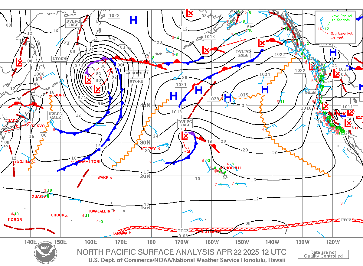
Wind map at noon. The other ones can be found here
(click on animation of the 10 meter column).
Fetches map (circles legend: red: direct aim, blue: angular
spreading, black: blocked) from Windy.
North Pacific (about 4 days travel time from the NW corner of
the North Pacific):
South Pacific (about 7 days travel time from east/west of New
Zealand):
Kai Penny felt like replying to the latest Kai Lenny's video and was all over the island yesterday.
That's what made me decide to go windsurfing.
4am significant buoy readings and discussion. South shore
Barbers 2.9ft @ 14s from 193° (SSW)
Lanai 2.7ft @ 14s from 185° (S)
The numbers are still up at the buoys, check the Lahaina webcam
if interested, for size, conditions and consistency.
North shore
NW001 6.7ft @ 10s from 360° (N)
Waimea
4.3ft @ 10s from 335° (NNW)
3.2ft @ 11s from 343° (NNW)
NNW swell arrived right on the predicted time and today should stay around the level Waimea indicates. Probably head high plus at Hookipa. Wind map at noon (the other ones can be found at link
n.-2 of GP's meteo websites list in the right column).
Fetches map (circles legend: red: direct aim, blue:
angular spreading, black: blocked, yellow: apparent direct aim,
but out of the great circle ray map, so not 100% sure). North Pacific (about 4 days travel time from the NW corner
of the North Pacific):
South Pacific (about 7 days travel time from east/west of
New Zealand):
My intense day of action in Kai Penny's VLOG n9 plus a review of the Gofoil NL160.
4am significant buoy readings and discussion. South shore
Barbers 2.8ft @ 13s from 196° (SSW)
Lanai 2.8ft @ 13s from 180° (S)
Really good numbers at the buoys, 13s is a wonderful period for most Lahaina side breaks, particularly Thousand Peaks. Read Pat Caldwell's description to know about the two sources of this swell(s). Probably overlapping, but in my opinion, the closest one is the one that generated the most consistent energy. Below is the collage of the maps of August 3 to 6 (posted already on Wednesday).
Check the Lahaina webcam
if interested, for size, conditions and consistency.
North shore
Pauwela
2.6ft @ 9s from 41° (NE)
2.4ft @ 7s from 61° (ENE)
Horrible call yesterday (I wrote flat everywhere), as I completely overlooked the 9s NE energy. There were small waves at Hookipa and on the eastern exposures and there will be also today. Let's see how Pat Caldwell described the evolution of the fetch: An upper level low 9/5 anchored near 35N, 145W to the NE of Hawaii has held steady into 9/11. This has made for a large area of gentle ocean surface winds in the primary trade wind belt for Hawaii and split the wind swell sources into two parts.
The first part is the local trades that freshened 9/8 and began weakening 9/10-11 over Oahu. The fetch did not extend more than 100 nm to the ENE. It kept small wind swell 9/9-11. This source should fade Saturday.
The second part was a strong high pressure near 50N, 140W to the west of Vancouver that became established 9/6 and is held into 9/9. Fresh to strong breezes within 40-50N, beyond 1600 nm from Hawaii, over the 30-50 degree band could generate some low, remote wind swell locally within 9/12-13. It should be much smaller than the recent short-period NE event of 9/3-5. The PacIOOS/CDIP Hilo buoy 9/11 AM had a few readings in the 8-12 second band, indicating the start of this low event. Wave Watch III suggests the onset late 9/11 for Oahu. It should rise Saturday and slowly drop Sunday into Monday at levels below average from 30-50 degrees.
Below is the collage of the maps of the fetches of August 6 to 10 (red arrow) that will help follow.
Wind map at noon (the other ones can be found at link
n.-2 of GP's meteo websites list in the right column).
Fetches map (circles legend: red: direct aim, blue:
angular spreading, black: blocked, yellow: apparent direct aim,
but out of the great circle ray map, so not 100% sure). North Pacific (about 4 days travel time from the NW corner
of the North Pacific):
South Pacific (about 7 days travel time from east/west of
New Zealand):
I finally found the time to edit the Kai Penny episode n.8: The bean burritos.
3am significant buoy readings and discussion. South shore
Barbers
1.6ft @ 18s from 192° (SSW)
1.2ft @ 11s from 184° (S)
1.1ft @ 15s from 175° (S)
Lanai
1.7ft @ 14s from 188° (S)
1.3ft @ 20s from 193° (SSW)
1.2ft @ 11s from 188° (S)
Biggest swell since mid July (doesn't take much) is on the rise, here's how Pat Caldwell described the evolution of the fetch. The strongest austral mid- to high-latitude system near the Hawaii swell window in over 6 weeks unfolded 8/28-30. Severe-gale to storm-force winds grew seas within 30-40 feet south of 50S to the S to SE of New Zealand by early 8/29. SW surface winds in this area are closest in proximity to the great circle route of 190 degrees to Hawaii. The brunt of the source was aimed at the Americas. The large source area gives better odds for angular spreading to bring the long-period swell to Hawaii
Below is the collage of the maps of August 29 though 31 which will help follow the above description.
Check the Lahaina webcam
if interested, for size, conditions and consistency. Long travel distance and angular spreading will make the long period ones very inconsistent, but there's also the shorter period leftover ones.
North shore
Pauwela
3.8ft @ 5s from 71° (ENE)
3.6ft @ 9s from 31° (NE)
9s NE energy is on its way down, but there should still be some waves at Hookipa and on the eastern exposures.
Wind map at noon (the other ones can be found at link
n.-2 of GP's meteo websites list in the right column).
Fetches map (circles legend: red: direct aim, blue:
angular spreading, black: blocked, yellow: apparent direct aim,
but out of the great circle ray map, so not 100% sure). North Pacific (about 4 days travel time from the NW corner
of the North Pacific):
South Pacific (about 7 days travel time from east/west of
New Zealand):
The first surfer that I didn't recognize while filming at Hookipa was little brother Ridge! Btw, the sick turn I posted yesterday was by Ian Walsh (thanks Alex).
If you followed the Kai Penny videos from the beginning (all grouped under the kai penny videos label), you should remember that the nickname was given by my Argentinian friends to one of them. I'll keep him anonymous (and crop his face off), but yesterday he got a smoking wave. I wouldn't expect nothing less from The Original!
The windsurfers are still in town and are desperate for wind, so they all jumped on the unexpected opportunity yesterday afternoon. My pick of Jimmie Hepp's album.
4am significant buoy readings and discussion
South shore
Barbers
2.2ft @ 13s from 195° (SSW)
0.3ft @ 20s from 199° (SSW)
Lanai
2.2ft @ 12s from 171° (S)
0.3ft @ 20s from 200° (SSW)
Off season south swell now down to a couple of feet 12-13s. Notice the 0.3ft 20s SSW reading both buoys register. Went to look for the fetch in the collage of the maps of Nov 6 to 9 below, but couldn't find anything significant on the 6th, so I wouldn't be too excited about it.
The Lahaina webcam shows mostly flat, but with some quality small waves once in a while. Check it out yourself if interested.
North shore
Waimea
2.7ft @ 8s from 346° (NNW)
1.3ft @ 13s from 286° (WNW)
Pauwela
4.3ft @ 9s from 25° (NNE)
NW swell went down a low and all we have left now is 4.3ft 9s energy from the NNE. Still enough to make some fun size waves at Hookipa, I might not be able to report as I have a early morning board meeting.
North Pacific has the same two fetches we saw yesterday:
1) the WNW one is intensifying and moving closer to us (Sunday swell)
2) the NW one associated with the very deep low that reached 946mb yesterday (Friday swell).
Check the direction on the map on the right and see how perfect the position of fetch n.2 is for Honolua Bay. It also makes my thing that the first swell is going to be bigger in Maui, as the second one will be partially blocked by the upstream islands.
South Pacific's most relevant fetch is the one in the Tasman Sea.
Fun size on the Lahaina side yesterday, here's the VLOG of the day.
3am significant buoy readings and discussion
South shore
Unfortunately the Surfline page where I read the buoy readings is not available this morning (link n.11), so here's Pat Caldwell's words: Mid Wednesday on southern shores has a combo of the Krosa swell aforementioned, and a declining New Zealand event. The former should stay about the same on Thursday with the latter dropping.
The NOAA page for Hanalei reads
2.6
14.3
W
and this might be a rare case in which that's exactly what's in the water, since, as uncle Pat adds confirming what I wrote yesterday: The PacIOOS/CDIP nearshore buoys off Hanalei, Kauai 8/14 give the best sampling since it does not receive the overlapping south swell
That's it, without buoys it's hard to do an evaluation, but fortunately there's webcams in Lahaina and Kihei, so you guys check both and decide.
North shore should be flat to tiny.
Wind map at noon.
Also Krosa made landfall, so no more waves from those guys. But there's a bit of a fetch in the NW corner of winter memories...
The strong fetch that made next week's swell is now aiming at the Americas, not much else behind it.
3am significant buoy readings and discussion
South shore
Barbers
1.5ft @ 14s from 188° (S)
Lanai
1.6ft @ 14s from 190° (S)
Lovely 14s readings at the buoys, but unfortunately the webcam looks flat to tiny. Check it out yourself.
North shore
Mokapu
5.2ft @ 7s from 75° (ENE)
4.8ft @ 8s from 75° (ENE)
1.4ft @ 13s from 86° (E)
Hilo
6.8ft @ 8s from 83° (E)
5.2ft @ 12s from 117° (ESE)
The trades windswell has increased thanks to Erick's contribution of pressure gradient. So there will be short period waves at Hookipa (possibly up to head high) and bigger on eastern exposures. There shouldn't be much of the long period energy, unless you go to Hana.
Below is the predicted cone for Erick. If that is confirmed, there might be a magic short window of waves on the south shore. Super hard to predict when, the models suggest Friday afternoon.
This is Flossie's cone. Too early for specifics, but it might shut down the wind Monday/Tuesday and offer clean conditions on the north shore.
The model didn't update yet, this is the wind map at noon of the old run.
North Pacific has the windswell fetch. I didn't circle the ones related to the two storms, as they're too small to identify precisely.
South Pacific still looks pretty good with fetches east and west of New Zealand.
Another day off, another Kai Penny day. Skin check was good by the way, despite the fact that I pretty much don't use sunscreen anymore... surf hats work!
The first session clips were full of water drops on the lens (forgot to dip the water in the camera before paddling for the waves), here's the only decent image I was able to retrieve.
3am significant buoy readings and discussion.
South shore
Barbers
2.1ft @ 12s from 193° (SSW)
1.4ft @ 16s from 178° (S)
Lanai
2.3ft @ 6s from 142° (SE)
2.1ft @ 13s from 162° (SSE)
1.4ft @ 9s from 170° (S)
1ft @ 16s from 167° (SSE)
We have SSW and SSE energy at the buoys, and that's the result of the fetches in the South Pacific last week. Below is the map of July 18th, for example. As a result, there will be waves from both directions, not sure what spots will feel them more (yesterday Thousand Peaks was the most effected one), check the webcam in Lahaina before going for size and conditions.
North shore
Mokapu
5.7ft @ 8s from 71° (ENE)
Hilo
6.8ft @ 9s from 77° (ENE)
Windswell going up and down with the size and intensity of the upstream fetch, today seems to be an up day. Hookipa will have small waves with eastern exposures possibly bigger.
Wind map at noon.
Only windswell in the North Pacific.
The black circle indicates a fetch that will be mostly blocked by New Zealand, the red ones are pretty small/weak.
Born and raised in Italy, I became an engineer and worked 11 years in the IT industry. Sick of that, in 2001 I wanted to take a year off and spend it in Maui, the best windsurfing spot in the world. Not only I'm still here (in Maui), but I also got into surfing. And the stoke is flying high. Life is too short to work 8 hours a day...