This is an incredible shot of which I have no information at all. I'm gonna guess Shipstern Bluff in Tasmania (in a particularly clean day).

4am significant buoy readings and discussion.
South shore
Barbers
2.1ft @ 14s from 182° (S)
Lanai
1.9ft @ 13s from 199° (SSW)
Angular spreading southerly energy is still at the buoys, but it shouldn't last for long. Check the Lahaina webcam if interested, for size, conditions and consistency.

North shore
NW101
2.9ft @ 10s from 332° (NNW)
Hanalei
1.9ft @ 9s from 305° (WNW)
1.8ft @ 11s from 304° (WNW)
Waimea
1.9ft @ 11s from 315° (NW)
Pauwela
3.5ft @ 7s from 52° (ENE)
2.2ft @ 11s from 318° (NW)
1.8ft @ 9s from 326° (NW)
The modest NW swell filled in, but only Hookipa will have small waves out of it. Next swell should be a little bigger, Pat Caldwell calls for 3ft 14s on Saturday.
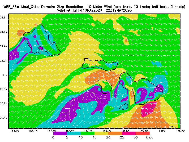
Wind map at noon (the other ones can be found at link n.-2 of GP's meteo websites list in the right column).
N/A this morning.
North Pacific fetches map (about 4 days travel time from the NW corner):

South Pacific fetches map (about 7 days travel time from east of New Zealand):

Morning sky.


