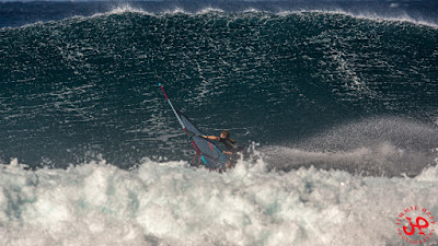
This is my pick of Jimmie Hepp's album of the windsurfing action. I guess the big sets kept pouring in all day.

6am significant buoy readings and discussion
South shore
No southerly energy at Barbers, the Lahaina webcam shows a little leftover energy from the south, but onshore conditions.
North shore
NW001
7.8ft @ 15s from 291° (WNW)
3.9ft @ 12s from 294° (WNW)
3.8ft @ 10s from 301° (WNW)
Waimea
N/A
Pauwela
4.8ft @ 14s from 319° (NW)
3.8ft @ 9s from 74° (ENE)
3.8ft @ 7s from 73° (ENE)
1.6ft @ 12s from 323° (NW)
New NW swell on the rise all day, let's how Pat Cladwell described the evolution of the fetch:
The next low pressure in the series occluded on Saturday 1/25 within the parent Aleutian low filling the NW to central N Pacific. Winds were strongest 1/25 to severe gales, with an exceptionally long, broad fetch of gales covering within 25-45N and the Kuril Islands to the Date Line. The pattern is slowly weakening 1/27-28 with an eastward shift. Near gales have reached to within 1000 nm of Hawaii by 1/27. This pattern is expected to hold about the same into 1/29.
Surf is predicted to rebuild above average Tuesday night and continue to rise Wednesday from 290-320 degrees. Heights should hold at elevated levels on Thursday. The more WNW to NW surf generated within 1/25-29 should be long-lived in Hawaii, holding Friday into Sunday 1/31-2/2 with a slow downward trend. More NNW surf is due to dominate by mid Friday into Saturday 1/31-2/1.
Below is the collage of the maps of Jan 25, 26, 27 and 28.

Below are the graphs of NW001 and Pauwela together with the Surfline forecast. I circled in red the rise at the NW buoy, a similar rise should happen during the day locally. We start with 5ft, it might be up to 8ft by sunset. Hookipa should be overhead already in the morning, I will report later. Clean conditions with no wind until around noon.
The Volcom Pipe Pro starts at 8am, I don't see a link for the live stream on the WSL page, but it seems there should be one here. It should a cracker of a day, judging by this screen shot.

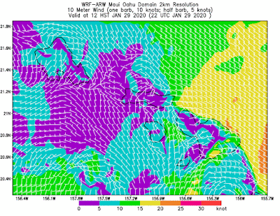
Wind map at noon

Kahului Tides
High Tide High Tide Low Tide Low Tide Sunrise Sunset
5:10a +2.1 5:07p +1.3 11:49a +0.6 10:44p +0.5 7:05a 6:16p
North Pacific has the fetches highlighted on the map.
Nothing from the south.
Morning sky.


No comments:
Post a Comment