Thursday, January 06, 2022

Thursday 1 6 22 morning call

Harbor mid day yesterday.


The waves at Hookipa at sunset were in the double to triple overhead range and yet there were 30 surfers at The Point. The surfing they produced was extremely exciting to watch.
Logan Bediamol had the highest scores on my sheet. He got a few barrels like this and ripped the hell out of each wave he rode.

Forgot the name of this older gentleman.

Jackson Bunch.

Paige Alms.

Michelle Larronde.

The northerly direction made the end bowl of Lanes close out most times (so it was empty), but occasionally there were gems like this set.

5am Surfline significant buoy readings and discussion.
South shore
No southerly energy at Barbers, check the Lahaina webcam if interested, for size, conditions and consistency. There's still some wrap from the N.


North shore
NW101
11.9ft @ 15s from 316° (NW)

Hanalei

11.9ft @ 15s from 312° (NW)

Hilo

6.8ft @ 14s from 356° (N)

Kaneohe Bay
5.3ft @ 14s from 3° (N)

While the N swell is still present at Kaneohe Bay and Hilo (also because of their position that doesn't favor NW swells), NW and Hanalei now show the even bigger new NW swell which will characterize the day. The extra large size will ignite all the outer reefs (Jaws included), and very few spots will be surfable by the common mortals. Paia Bay and harbor are the usual default desperation spots on the north shore.

Forecast of Pauwela from this PACIOOS page.


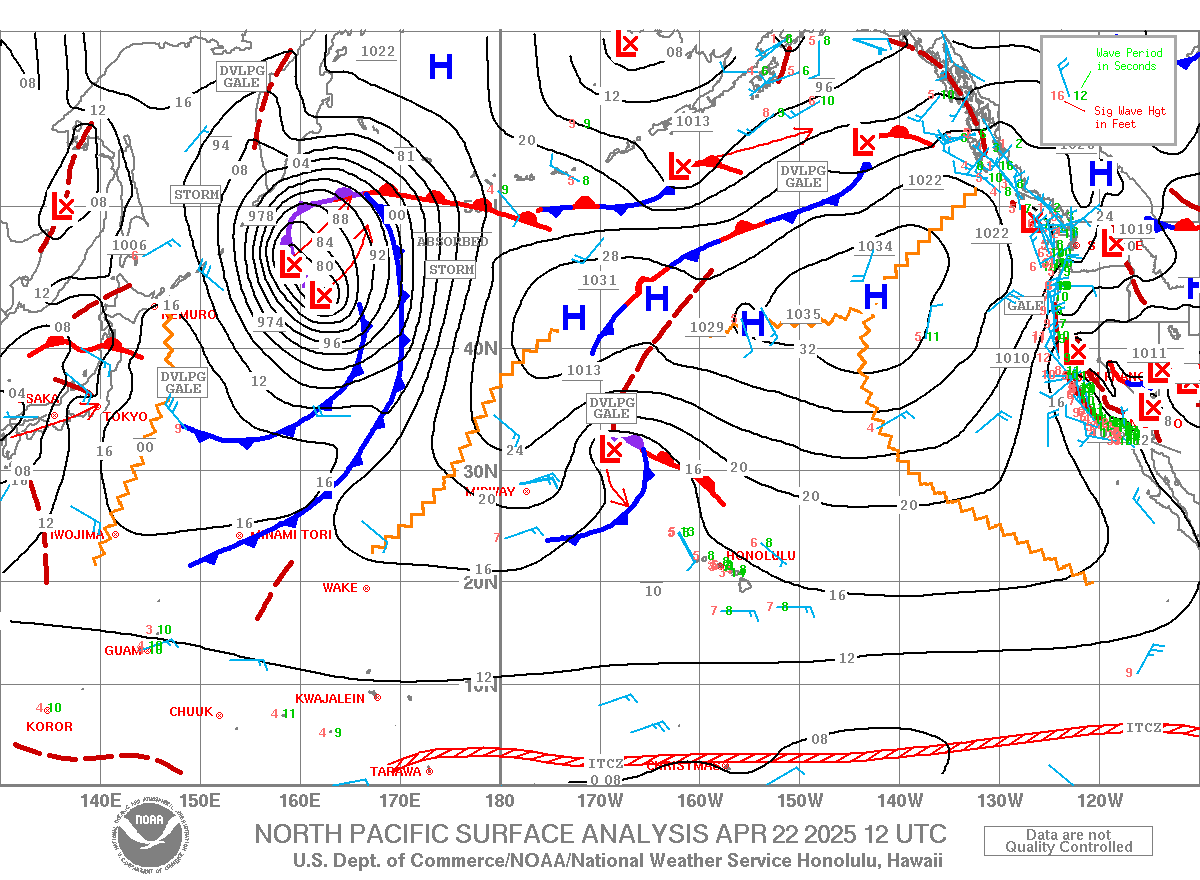
Wind map at noon
. The other ones can be found here.


Fetches map
(circles legend: red: direct aim, blue: angular spreading, black: blocked, yellow: possibly over the ice sheet) from Windy.

North Pacific (about 4 days travel time from the NW corner of the North Pacific):


South Pacific
(about 7 days travel time from east/west of New Zealand):


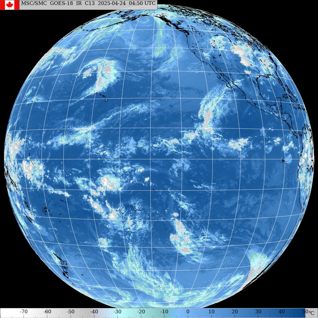
Morning sky.


Wednesday, January 05, 2022

Wednesday 1 5 22 morning call

Hookipa yesterday mid day.


4am Surfline significant buoy readings and discussion.
South shore
No southerly energy at Barbers, check the Lahaina webcam if interested, for size, conditions and consistency.

North shore
NW101
7.5ft @ 15s from 332° (NNW)

N

7ft @ 16s from 359° (N)

Hanalei

8.6ft @ 17s from 11° (NNE)

Hilo

8.2ft @ 17s from 3° (N)

Kaneohe Bay
6.2ft @ 17s from 1° (N)

Long period N swell picked up strong at all the buoys and should be pumping all day (it was already yesterday at sunset). Not sure if the 332 direction at the NW buoys is a different NNW swell than the N one, if it is, the afternoon will see the overlapping of that too. Either way, the waves on the north shore will be too big for most surfers, with Hookipa in the double overhead plus range and clean conditions. Seek for sheltered places, unless you're a pro.

Forecast of Pauwela from this PACIOOS page.


Wind map at noon
. The other ones can be found here.


Fetches map
(circles legend: red: direct aim, blue: angular spreading, black: blocked, yellow: possibly over the ice sheet) from Windy.

North Pacific (about 4 days travel time from the NW corner of the North Pacific):


South Pacific
(about 7 days travel time from east/west of New Zealand):


Morning sky.


Tuesday, January 04, 2022

Tuesday 1 4 21 morning call

Hookipa yesterday afternoon.

That's how a small Destroyer can turn.


My body demanded a rest and I'm off the water for a bit (hence the late calls) and I finally found the time to finish editing this video that I started back in November.

4am Surfline significant buoy readings and discussion.
South shore
No southerly energy at Barbers, check the Lahaina webcam if interested, for size, conditions and consistency.


North shore
N
1.9ft @ 20s from 24° (NNE)

Hanalei

3.5ft @ 9s from 34° (NE)
2.7ft @ 11s from 324° (NW)
1ft @ 22s from 12° (NNE)

Hilo

4.6ft @ 8s from 87° (E)
1.5ft @ 13s from 339° (NNW)
1.1ft @ 11s from 5° (N)
0.5ft @ 22s from 354° (N)

Kaneohe Bay

4.1ft @ 8s from 74° (ENE)
1.1ft @ 12s from 360° (N)
0.5ft @ 22s from 13° (NNE)

At least four different swells in the water today. One is the declining short period NE to E windswell that we've been surfing for the last two weeks. Another one is the declining NW energy that peaked on Sunday. A new long period N swell is starting to show at the buoys with unusually high periods (20-22s). It comes from the intense Gulf of Alaska fetch I marked with a black arrow in the collage of the maps of Dec 30 through Jan 2 below. As you can see, the fetch was mostly aiming well east of us, so we'll mostly get angular spreading energy, notoriously difficult to predict. It should increase in the afternoon, as you can notice on the PACIOOS forecast below (light blue dotted line).
The last energy (recorded by other buoys than the ones reported) is a WNW one generated by the fetch(es) marked by the red arrows. Because of its direction, locally it won't have as big of an effect as the aforementioned N swell.


Home guess for Hookipa is around head high (occasionally bigger) and clean in the morning, with an upward trend in the afternoon.

Forecast of Pauwela from this PACIOOS page.


Wind map at noon
. The other ones can be found here.


Fetches map
(circles legend: red: direct aim, blue: angular spreading, black: blocked, yellow: possibly over the ice sheet) from Windy.

North Pacific (about 4 days travel time from the NW corner of the North Pacific):


South Pacific
(about 7 days travel time from east/west of New Zealand):


Morning sky.


Monday, January 03, 2022

Monday 1 3 22 morning call

Hookipa yesterday mid day.

6am Surfline significant buoy readings and discussion.
South shore
Barbers
2.5ft @ 8s from 203° (SSW)

Tiny windswell energy at Barbers, check the Lahaina webcam if interested, for size, conditions and consistency.


North shore
NW101
3.6ft @ 12s from 305° (WNW)

Hanalei

4.2ft @ 8s from 68° (ENE)
4ft @ 12s from 304° (WNW)

Hilo

5.3ft @ 8s from 66° (ENE)
2ft @ 14s from 336° (NNW)

Kaneohe Bay
4.5ft @ 8s from 69° (ENE)

NW swell down in size and period at the buoys, just like the ENE windswell. Consequently the waves should be smaller than yesterday, probably in the head to head and a third range at Hookipa. Good conditions thanks to the lack of wind.

Forecast of Pauwela from this PACIOOS page.


Wind map at noon
. The other ones can be found here.


Fetches map
(circles legend: red: direct aim, blue: angular spreading, black: blocked, yellow: possibly over the ice sheet) from Windy.

North Pacific (about 4 days travel time from the NW corner of the North Pacific):


South Pacific
(about 7 days travel time from east/west of New Zealand):


Morning sky.


Sunday, January 02, 2022

9am nw swell is showing inconsistent head and a half sets at hookipa. Clean conditions with a bit of wobble. 
7

Sunday 1 2 22 morning call

Hookipa yesterday afternoon. Clearly still mostly NE windswell.

6am Surfline significant buoy readings and discussion.
South shore
Barbers
3.5ft @ 7s from 221° (SW)

Southerly windswell at Barbers, check the Lahaina webcam if interested, for size, conditions and consistency.


North shore
NW001
5.7ft @ 13s from 314° (NW)

Hanalei

5.7ft @ 13s from 307° (WNW)
4.5ft @ 9s from 59° (ENE)

Hilo
6.4ft @ 8s from 59° (ENE)

Kaneohe Bay
5.5ft @ 9s from 55° (ENE)

New NW swell is at the NW buoys and Hanalei. Below is the graph of NW001, the red dotted line being how I think it will be in Maui. NE windswell is declining but still decent size. The mix of the two should give Hookipa waves in the head and a half range.


Forecast of Pauwela from this PACIOOS page.


Wind map at noon
. The other ones can be found here.


Fetches map
(circles legend: red: direct aim, blue: angular spreading, black: blocked, yellow: possibly over the ice sheet) from Windy.

North Pacific (about 4 days travel time from the NW corner of the North Pacific):


South Pacific
(about 7 days travel time from east/west of New Zealand):


Morning sky.


Saturday, January 01, 2022

7am hookipa has sloppy head high ne windswell waves. 
3.8

Saturday 1 1 2022 morning call

Thanks to Adam and Gale for the donations.

Dave Kalama at the harbor yesterday.


4am Surfline significant buoy readings and discussion.
South shore
Barbers

3.2ft @ 6s from 190° (S)
2ft @ 8s from 184° (S)

Barbers records very short period windswell from the Kona flow. Check the Lahaina webcam if interested, for size, conditions and consistency.

North shore
NW101

9.7ft @ 10s from 82° (E)
5.2ft @ 12s from 325° (NW)

Hanalei

6.9ft @ 9s from 63° (ENE)
5.4ft @ 13s from 308° (WNW)

Hilo
8.8ft @ 9s from 51° (ENE)

Kaneohe Bay
7.7ft @ 9s from 48° (NE)

ENE windswell continues to be elevated although in slight decline. NW and Hanalei show 5ft 12-13s from the NW, without Waimea and Pauwela it's hard to guess how much we get of that. Surfline calls for a couple of feet 13s only, with a longer period swell slowly picking up in the background and predicted to peak tomorrow at around 4ft 13s. Home guess for Hookipa is for head to head and a half and clean windless conditions.

Forecast of Pauwela from this PACIOOS page.


Wind map at noon
. The other ones can be found here.


Fetches map
(circles legend: red: direct aim, blue: angular spreading, black: blocked, yellow: possibly over the ice sheet) from Windy.

North Pacific (about 4 days travel time from the NW corner of the North Pacific):


South Pacific
(about 7 days travel time from east/west of New Zealand):


Morning sky.