Friday, March 20, 2015

3 20 15 morning call

Yesterday's recap: amazing surf session in the morning (I gave it a 9) with glassy clean waves till around 8. After that, more onshore than usual trades picked up and ruined the waves.
The afternoon saw some windsurfing action, the slog and surf kind. It's my favorite, but only if the wind is side or sideoff. Slog and surf onshore is pretty horrible and that's how it looked when I ate my lunch at Hookipa (I did post an update).

The only one able to pull some serious maneuvers in that time frame was Brawsinho, who is here pictured in a photo by Jimmie Hepp.
I did sail in the late afternoon, but the wind was still too onshore to be decent. Told you, I'm demanding.

At 8am Pauwela reads:
3.6ft @ 11s from 332° (NNW)
3.3ft @ 7s from 354° (N)
1.5ft @ 5s from 36° (NE)

and, as shown in the report from the beach below this post, the early morning had a fair deal of morning sickness on it. When I left it looked a bit better, but as you can see from the readings, the windswell is on it and there's nothing you can do about it (other than going to Honolua, which I believe is going to be very small).
Below is the noon map from MC2km and it shows some pink (15-20 knots), so Hookipa will be packed with windsurfers. Many pros are already here for the photoshoot season.
Fun to watch, not so much to sail.


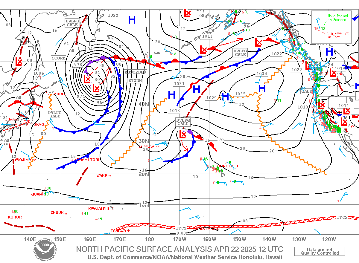
Wind map below shows the NW fetch now shooting NE of us. Waves will be bigger in the weekend (the fetch looked pretty good the past few days), but getting smaller after that until Thursday when Surfline is calling for a 6f 12s NW swell out of a fetch that is not on the maps yet.
Also the fetch down south has moved and today is going to be the last day of wave generation (thanks to the angular spreading) for Hawaii.


3.6f 11s with sets up to head high at 6am and quite a bit of morning sickness courtesy of the return of the trades.

Thursday, March 19, 2015

Light sideon wind, head high + waves, 20 sailors out. Looks like a 4 to me, but i'm high maintenance when it comes to windsurfing.

3 19 15 morning call

Fantastic day of surfing yesterday.
We had a really good strip of few days of no to light wind and beautiful mid period head high waves.
I took some surf photos after my session, but the beauty of this girl beats them all.


The close to shore buoys all went up during the night (I circled the rise) and this early morning's conditions were pristine, as the report from the beach (below this post) shows.
I gave it a 9. I surfed the point and middles and had a blast. Even received some compliments from a friend for a right, which is probably the first time ever.
Everything is possible you guys. I might even became a decent backside surfer one day.
4.6ft @ 11s from 330° (NW) at the Pauwela buoy at 9am in the meantime.


Below is the north Pacific wind map. I circled the main NW fetch, but there's at least 5 more small ones. I also put a line to indicate the position of a front that is between Kauai and Oahu right now.
Also notice the NNE direction of the winds following it.


Despite the fact that iWindsurf is already reading 14mph at 9.45am, and despite the decent direction shown in the noon MC2km map below, the flow seems to me to be too onshore to be a regular trade wind day.
Windsurfing (in my favorite form of slog and surf) might still happen though. We'll have to wait and see. Stay tuned for mid day updates from the beach. I promise.


Still a decent fetch going on down under, next week should be fun on the south shore, which btw is not flat either now.


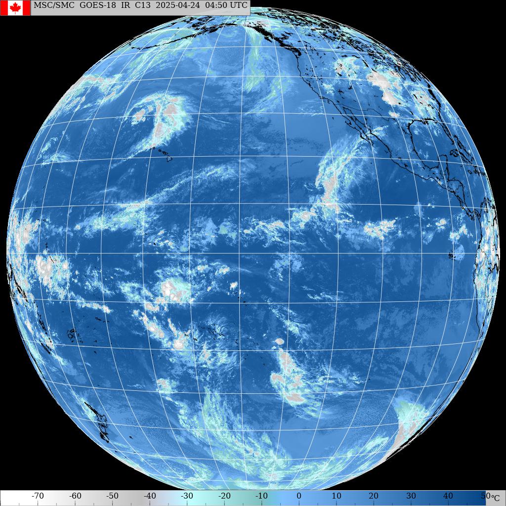
That's the water vapor thing at 8.30am. The radar shows some rain on Oahu's north shore.


Buoy says 4.5f 12s and that's a beautiful 2f OH set at Middles which is already packed at 7am!

Wednesday, March 18, 2015


Fantastic day of surfing all day yesterday. The wind stayed very light and that's pretty much all it takes to have good surf in Maui.
The photo below was taken yesterday and it shows the Butterfly Effect organizer Tatiana Howard underwater while someone is bottom turning over her head. Very well timed shot by photographer Paul of Fish Blow Diaries.
The Maui BE will happen on April 25th and you can sing up here.


Today I posted a report around 6.30 already (scroll down) and then I surfed hookipa.

It was exactly the opposite of what I said on yesterday's call: smaller this morning than yesterday at sunset. But I'm in good company in this case: surfline calls for 5s 11s, uncle Pat for 6f 12s in Oahu, but at the buoy there's much less than that.
4f 12 at the waimea buoy and barely 3f 12s at the maui one.
No complains though, because the lack of wind of these days is making for some glassy conditions that us Mauians dream about. It looks like California with tropical water temperature.
And that should be the case today too, you can see in the map below how the islands are in middle of lovely no wind zone.
I circled the fetches that will make me sleeping serene and life is great in the 808.


3f 12s at the buoy and pretty slow. Chest to head glassy. Smaller than yesterday at sunset.

Tuesday, March 17, 2015

Super clean chest to occasionally head high.

3 17 15 morning call

Gorgeous day of surfing yesterday. No wind till noon and shoulder to aslightly overhead waves at Hookipa made for a high crowd advisory, so I surfed somewhere else.
This is Isaac Stunt in a photo of Jimmie Hepp


Today the wind should be again delightfully absent in the morning and sea breezy in the afternoon.
The waves will be smaller, as the Pauwela buoy graph and 6am reading indicate:
2.7ft @ 11s from 19° (NNE)
2.3ft @ 10s from 34° (NE)
1.0ft @ 4s from 67° (ENE)
 
 
But that's just until tomorrow when the first pulse of the series of the NW swells I referred to in yesterday's call will arrive. Surfline actually call it for this afternoon, but I don't see it at the NW buoy, so I'll call it tomorrow.
Below the wind map that shows the moderate strengh vast fetch NW of us and the Pam cyclone that has now assumed a much more common position just east of New Zealand. As we saw yesterday, that thing has been sending waves to our south shore already throughout its less favorable for Hawaii (moving SE and shadowed by a bunch of islands) journey. So I expect a nice moderate swell a week from now.


That's because, despite the compactness of the fetch and the non-capturedness (might as well be the first time such a word gets used in human history), the weather map below shows a value of below 949 and that's not even in the middle.
When it passed of the island of Vanuatu a few days ago, it was around 920 and it had winds of 165mph. No wonder it caused some damage there.


Photo report from Hookipa coming up soon, sorry if I'm late this morning.

Monday, March 16, 2015

3 16 15 morning call

Good waves yesterday at Hookipa, but bad surfing from the blog author. Not by Hookipa ripper Will Hunt though. He loves getting barreled. Photo by Jimmie Hepp.


In the afternoon I tought a SUP lesson on the south shore and the waves were good over there too.
Talking about which, in yesterday's call I wrote:"I posted the Lanai buoy readings because uncle Pat called for 2f 16s from the SW. This below is the map of 7 days ago (march 8) and you can see the small fetch just east of New Zealand. But I don't see how the swell coming from that  area can come from 235. Those 2f 14s at the Lanai buoy are clearly the wrap of the NNW swell."
Well, I was right about the small fetch east of NZ, but I was wrong about the wrap of the NNW swell (which seemed weird anyway... I just didn't know what to guess).

I did think about the cyclone Pam, but I remembered the fetch aimed to Hawaii to be too small to make those kind of waves. And I was right about that.

Well, the solution to the enigma is, like always, provided by Pat Caldwell (shoulda read it before!), who last Friday wrote:
Pam was slow-moving 3/9-11 in an area about 2400 nm away from Hawaii. The fetch aimed eastward was longer and stronger than the fetch aimed at Hawaii. Likely the swell for Hawaii is from angular spreading. Models show similar low swell holding Saturday into Monday 3/14-16.

Let's see what that means. The map below is from March 11. It was such a beauty that I made a whole post dedicated to it. This is the link to it, if you're too lazy to scroll down.
The one thing I didn't think, was what Uncle Pat described. So now I added a couple of black lines to show you what he meant. That tiny circle just below the start of the black lines is the small fetch of wind oriented towards Hawaii. But right on top of it, you can see a well bigger fetch of winds oriented towards east. Once those easterly going waves leave the fetch area, they start to spread both left and right (should be north and south). Of course the more they spread angularly, the more they lose energy. In other words, a place that is 2400nm right in front of the fetch will have waves bigger and more consistent than Hawaii. But nonetheless, there were some beautiful waist to chest high lines yesterday on the south shore.
I find those things fascinating. If you're reading this blog, maybe you do too.


Well today Lanai is reading at 7am:
2.2ft @ 14s from 235° (WSW)
1.4ft @ 9s from 268° (W)
0.8ft @ 11s from 261° (W)
0.5ft @ 3s from 184° (S)
and that means that there's still waves. Which is confirmed by the lahaina webcam.


Pauwela instead is reading:
4.1ft @ 12s from 358° (N)
2.4ft @ 6s from 52° (ENE)
2.4ft @ 9s from 6° (N)
 

and as you can see from the photo report (post below this), it's pretty good out there, specially thanks to the early morning lack of wind.
There actually shouldn't be much wind at all all day, as the lovely light ESE flow indicated with an arrow in the map below seems to suggest.
Also notice the vast but not particularly intense fetch NW of us. That area should provide waves of 4-6f 10-12s out of around 320-330 for the whole week.
It's mid March, that's exactly what you would expect.