Wednesday, January 12, 2022

Wednesday 1 12 22 morning call

A bit of wind came back yesterday.

5am Surfline significant buoy readings and discussion.
South shore
Check the Lahaina webcam if interested, for size, conditions and consistency.

North shore
NW101

11.2ft @ 14s from 311° (NW)
4.5ft @ 10s from 306° (WNW)

Hanalei

14.2ft @ 14s from 312° (NW)

Solid NW swell continues at the buoys. Hookipa still too big for most, seek for sheltered places.

Forecast of Pauwela from this PACIOOS page.


Wind map at noon
. The other ones can be found here.


Fetches map
(circles legend: red: direct aim, blue: angular spreading, black: blocked, yellow: possibly over the ice sheet) from Windy.

North Pacific (about 4 days travel time from the NW corner of the North Pacific):


South Pacific
(about 7 days travel time from east/west of New Zealand):


Morning sky.


Tuesday, January 11, 2022

Tuesday 1 11 22 morning call

Thanks Brandon for the donation.

Couple of waves I caught yesterday. Board is an 8.6 Jimmy Lewis HP and I will put a back foot pad on it, as I feel I need to be more precise with the back foot placement in the turns.


I'll take the opportunity to answer one of the most common questions I receive:"what is your favorite discipline?"
Although I might have temporary crushes on any of them (depending on what the conditions offer in that time frame), I don't have one.
I like them all.

And thanks to a soon to be documented stroke of genius and a bit of luck, I made room for one more board in my car and I'm going to have the following permanent car quiver:
- 2 shortboards
- 2 longboards
- 2 SUP's
- 2 foil boards with mast and fuse already mounted on
- 3 wingfoil wings
- several foil front and back wings
- a ton of wetsuits
- plenty room for the occasional addition of windsurf gear or a step-up surfboard, if it looks like I'm going to need them.

After my session I went to Hookipa and took some pics.


Later in the day, some windsurfers tackled Lanes. Photo by Jimmie Hepp from this album.


5am Surfline significant buoy readings and discussion.
South shore
Check the Lahaina webcam if interested, for size, conditions and consistency.

North shore
NW101
14.3ft @ 13s from 303° (WNW)

NW001

15.2ft @ 13s from 316° (NW)
Hanalei

10.8ft @ 13s from 306° (WNW)
7.3ft @ 10s from 309° (WNW)

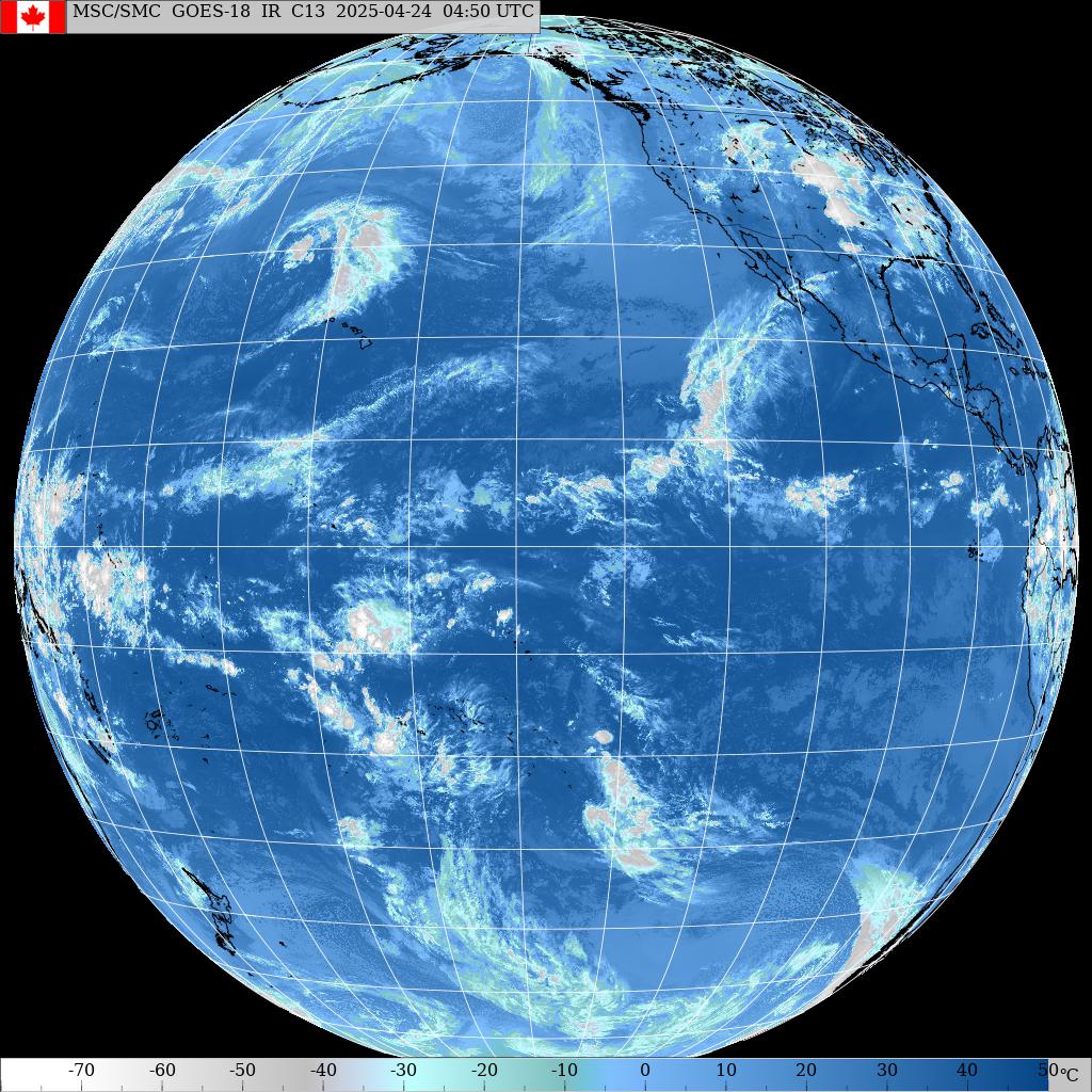
NW buoys picked up a notch again, sign that a new pulse is on its way (graph of NW101 below). Waves are going to be in the extra large category again, although not as clean as they've been, because the wind is going to turn northerly after the pass of the weak front you can see in the satellite photo at the end. Hookipa too big for most, seek for sheltered places.


Forecast of Pauwela from this PACIOOS page.


Wind map at noon
. The other ones can be found here.


Fetches map
(circles legend: red: direct aim, blue: angular spreading, black: blocked, yellow: possibly over the ice sheet) from Windy.

North Pacific (about 4 days travel time from the NW corner of the North Pacific):


South Pacific
(about 7 days travel time from east/west of New Zealand):


Morning sky.


Monday, January 10, 2022

Monday 1 10 22 morning call

As I was hoping, the westerly direction of the extra large swell kept some spots on the north shore surfable. Here's a selection of pictures.


3am Surfline significant buoy readings and discussion.
South shore
Check the Lahaina and Kihei webcams if interested, for size, conditions and consistency.

North shore
NW101
12.8ft @ 13s from 289° (WNW)

Hanalei

11.3ft @ 14s from 297° (WNW)

Extra large WNW continues at the buoys. Might be a bit smaller today, but at this size, the difference will be barely noticeable. Pretty much same as yesterday, Hookipa most likely too big, some Kahului spots hopefully surfable and Kihei might have waves again.

Forecast of Pauwela from this PACIOOS page.


Wind map at noon
. The other ones can be found here.


Fetches map
(circles legend: red: direct aim, blue: angular spreading, black: blocked, yellow: possibly over the ice sheet) from Windy.

North Pacific (about 4 days travel time from the NW corner of the North Pacific):


South Pacific
(about 7 days travel time from east/west of New Zealand):


Morning sky.


Sunday, January 09, 2022

Sunday 1 9 22 morning call

Thanks to Kristofer for the donation.

Hookipa yesterday late afternoon. The new swell had not hit yet. Today and for the whole next week it's going to be much different and most likely unsurfable up there.

5am Surfline significant buoy readings and discussion.
South shore
No southerly energy at Barbers, check the Lahaina webcam if interested, for size, conditions and consistency.


North shore
NW101
15ft @ 15s from 290° (WNW)

NW001

14.4ft @ 16s from 297° (WNW)

Hanalei

11.7ft @ 14s from 302° (WNW)
5.1ft @ 9s from 322° (NW)
3.8ft @ 11s from 308° (WNW)

New extra large WNW swell is at the buoys. Directions at the NW buoys are 290 and 297 which is hopefully west enough to give the Kahului area some shelter and make some spots still surfable. Kihei has waves (below). Hookipa too big.


Below are the maps of Jan 5 through 8 that show the fetch that generated the current swell.

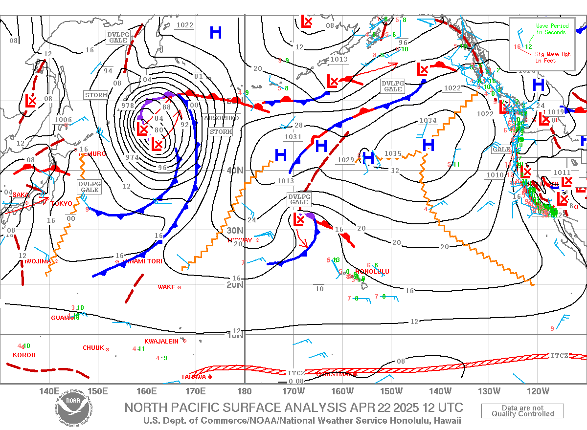
This morning's weather map shows the north Pacific embedded by a massive area of low pressures. Extra large waves for days.


Forecast of Pauwela from this PACIOOS page.


Wind map at noon
. The other ones can be found here.
N/A

Fetches map
(circles legend: red: direct aim, blue: angular spreading, black: blocked, yellow: possibly over the ice sheet) from Windy.

North Pacific (about 4 days travel time from the NW corner of the North Pacific):


South Pacific
(about 7 days travel time from east/west of New Zealand):


Morning sky.


Saturday, January 08, 2022

8.30am hookipa has head and a half relatively clean waves. 
8

Saturday 1 8 22 morning call

 Hookipa yesterday morning. Photo by Patrick Wardle.


I often get questions about leashes for foils. Here's my very personal opinion.
The risk of having the board ricochet at you because of a fully extended coiled leash (like mine in the photo) is extremely low. Unlike what happens with a regular surfing board, in fact, the foil offers so much drag to significantly slow it down. If the foil is up, the edge of the tail will do the same. In 4 years of foiling, I was never hit by the board pulled back at me by the extended leash.
That's why I use a coiled DaKine bodyboard leash of only 4 feet. It originally comes with a bicep cuff, so I replace it with a ankle cuff (yes, you need two leashes to come up with one).

Actually, after I saw this picture taken by Tomoko, I realized that even with such a short leash, when I use my Foil Drive (I got only one left in stock at Hi-Tech, if someone is interested), there is still a risk of damaging the prop blades with it. So I now have a knee cuff on my SUP foiling board. That way the leash never hits the water while flying, which is something extremely annoying, imo.
Everything I said applies to SUP foiling and it doesn't really work for prone foiling (for that little that I tried it). I'm not aware of any satisfying solution for prone foiling. A 5 foot thin comp straight leash is what I would use, but it would still hit the water while foiling.

6am Surfline significant buoy readings and discussion.
South shore
No southerly energy at Barbers, check the Lahaina webcam if interested, for size, conditions and consistency.


North shore
NW001

9.8ft @ 12s from 318° (NW)
5.6ft @ 10s from 313° (NW)

Hanalei

5.2ft @ 13s from 306° (WNW)
3.2ft @ 9s from 351° (N)

Hilo

4.6ft @ 9s from 86° (E)
2.6ft @ 13s from 327° (NW)
2.6ft @ 11s from 348° (NNW)

Kaneohe Bay

2.7ft @ 10s from 15° (NNE)
2.3ft @ 13s from 349° (NNW)

NW swell came down as predicted. Today it's going to be a transition day, as a new larger NW swell should rise quite quickly in the late afternoon. NW001 shows 10ft 12s at 6am, travel time is 20 hours at that period, but I think the longer period energy from more back in the fetch is still travelling.
The PACIOOS forecast below shows a peak of 12ft 15 around midnight locally.
As for the start of the day, my home guess for Hookipa is for waves around head and a half.

Forecast of Pauwela from this PACIOOS page.


Wind map at noon
. The other ones can be found here.

Fetches map
(circles legend: red: direct aim, blue: angular spreading, black: blocked, yellow: possibly over the ice sheet) from Windy.
N/A

North Pacific (about 4 days travel time from the NW corner of the North Pacific):


South Pacific
(about 7 days travel time from east/west of New Zealand):


Morning sky.


Friday, January 07, 2022

Friday 1 7 22 morning call

Yesterday morning both the NW and the Hanalei buoys were reading 12ft 15s (from 316 and 312 respectively). That's why I called for most north shore spots to be unsurfable. Well, that was not true. This is from my first session. Well overhead, but not 12ft 15s.

Hookipa at sunset was again in the double to triple overhead range, which, again, is not 12ft 15s.


Same guy I didn't remember the name yesterday.

5am Surfline significant buoy readings and discussion.
South shore
No southerly energy at Barbers. check the Lahaina webcam if interested, for size, conditions and consistency.

North shore
NW101
9.1ft @ 14s from 311° (NW)

Hanalei
6.2ft @ 13s from 303° (WNW)
4.8ft @ 15s from 315° (NW)
4ft @ 10s from 325° (NW)

Hilo

4.7ft @ 13s from 351° (N)
4.4ft @ 9s from 89° (E)

Kaneohe Bay

3.6ft @ 13s from 360° (N)
2.9ft @ 9s from 50° (NE)

So why was it less than 12ft 15s in Maui? Let's have a look at the fetch that generated this swell in the collage below (Jan 2 through 4). It started between 290 to 300 on the 2nd and then it moved north between 300 to 320 on the 3rd and 310 to 325 on the 4th. Directions at NW and Hanalei were around 314 and the only thing I can think of is that it was only 314 up there and not down here. That seems to be confirmed by the fact that Kihei had waves, which takes a lot more west than 314. Whatever it was, it was a pleasant surprise to find out that it wasn't closing out everywhere.


This morning the swell seems to have declined significantly at the buoys, Hanalei only reads 6ft 13s, but we're about 8-9 hours away from it. Home guess for Hookipa is for double to triple overhead, slowly declining throughout the day before a new bigger swell will start rising tomorrow. Hopefully the north shore will be surfable again, but in these times of uncertainty (it sure would be nice to have the Pauwela buoy back), the usual spot check drive reacquires the importance it used to have in the old days.

Forecast of Pauwela from this PACIOOS page.


Wind map at noon
. The other ones can be found here.


Fetches map
(circles legend: red: direct aim, blue: angular spreading, black: blocked, yellow: possibly over the ice sheet) from Windy.

North Pacific (about 4 days travel time from the NW corner of the North Pacific):


South Pacific
(about 7 days travel time from east/west of New Zealand):


Morning sky.