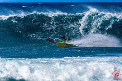
Here's a couple of photos by Jimmie Hepp from this gallery. Easterly trades don't bring as much rain as ENE trades, the light is perfect and Jimmie is a happy camper these days.


3am significant buoy readings
South shore
Lanai
2.9ft @ 13s from 262° (W)
2.5ft @ 9s from 174° (S)
More westerly wrap, there should still be waves in Kihei and Lahaina.Most days I write my call and don't have much time to review it because I'm off to surfing, of course. Yesterday I didn't quite like the way I illustrated the wrap of westerly swells, so here's a better explanation. The second illustration was what was missing.
Ukumehame and Lahaina on West swells
The map below shows that any westerly swell that comes from more north than 286 will be blocked by Ni'iahu. Once a WNW swell makes it to the channel between Molokai and Lanai, the range to hit Lahaina is 283 to 290. But straight lines are not a correct representation of reality. Waves refract around not only emerged lands, but also submerged ones too, as long as they are shallow enough (the longer the period, the deeper the waves will feel the bottom), so those angles I calculated are just an indication.
If they're more west than 286, as long as they're big/long period enough, some swells might also hit the Lahaina side by either wrapping around the north or the south tip of Lanai or both. Below is an illustration of what I think a straight west swell would do. See that last swell line I drew hitting Ukumehame (big red arrow)? That's exactly the direction the sets were coming from yesterday. The west peaks were 1.5 times bigger than the east ones and it was all about the rights.

And these are the angles the swell needs to have to hit directly (or the ones it will have after the refraction over Lanai).

North shore
NW101
8.3ft @ 13s from 314° (NW)
NW001
6.9ft @ 15s from 321° (NW)
4.9ft @ 12s from 324° (NW)
Waimea
3.7ft @ 13s from 316° (NW)
2ft @ 16s from 324° (NW)
Pauwela
3.9ft @ 13s from 319° (NW)
3.3ft @ 10s from 59° (ENE)
2.1ft @ 5s from 74° (ENE)
Both NW buoys went back up, below is the graph of NW001 (which shows better the increment in size and period, circled in red), Waimea (which already feels a bit of the increase, circled in red) and Pauwela (which instead still has to feel it). Also, notice how much more from a NW direction (as opposed to WNW) the new pulse is, which means Maui's north shore is not going to be as blocked as it was in the first days of this powerful swell.
So the morning will start with moderate sizes (4f 13s), but there will be a noticeable increase throughout the day.

MC2km maps still stuck at Sunday (Woodie, the notorious big red UPDATE button technician must be sick), here's the HRW model from the Windguru page that shows another day of strong easterly trades. Tomorrow looks just the same. The iWindsurf Hookipa sensor shows 6(3-11)mph from 107 at 4.20am, so not too bad at all for the early morning session.

Some clouds, but nothing major. Should be another stunning day.

Current wind map shows:
1) the fetch of Friday's swell that Surfline forecasts to peak at 11.6f 16s from 312 at 8pm.
2) this one will make waves that will never make it to us, but they're going to hit Margaret River instead where contest n.2 of the WSL season started. I'm still watching Snapper Rocks at my own pace, very entertaining contest.


No comments:
Post a Comment