7am Hookipa is waist high and crumbling. Going south.
Friday, May 04, 2018


Friday 5 4 18 m orning call
Longboard session for me yesterday. Here's an example of a small wave on the Lahaina side, but, as reported in the second beach report, there were occasional sets twice as big.

4am significant buoy readings
South shore
W
1.9ft @ 12s from 137° (SE)
SW
2.5ft @ 11s from 126° (ESE)
SE
2.2ft @ 13s from 174° (S)
Interesting numbers at the outer buoys. As you guys know, I believe that the direction those buoys indicate is totally unreliable (unless there's absolutely nothing else in the water), so I don't even look at it anymore. But I would expect the period to be much more consistent and instead today it isn't. Whatever the period is, there's still energy from the south. Unfortunately, I don't think I'll have the time this morning to go that side, so no reports from there, but there should be waves.
North shore
Pauwela
4.3ft @ 8s from 74° (ENE)
Tell you what, if those 4f 8s were from 45 (for example) instead of 74, Hookipa would be pretty fun. It might still be, I'll post a report as soon as I see it.
Wind map at noon.

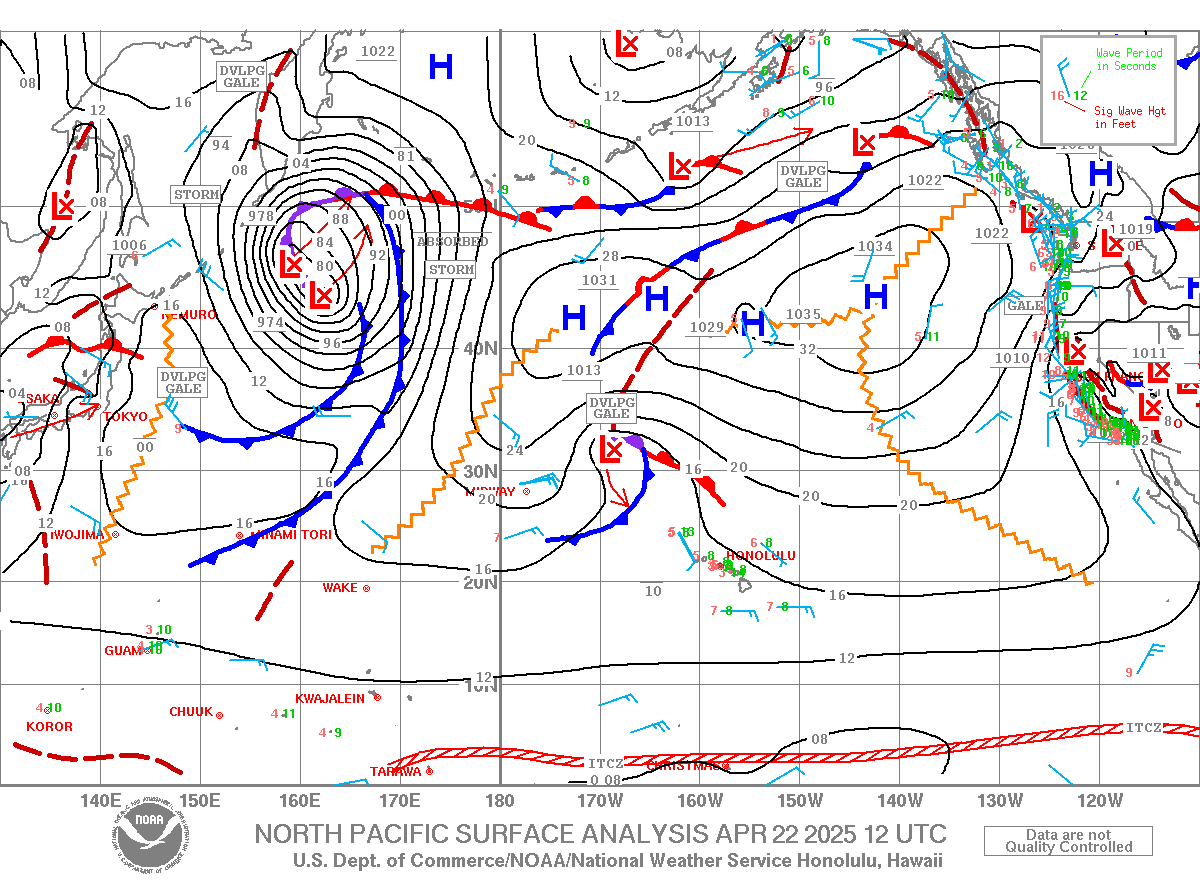
North Pacific starts to show the first signs of the counter clockwise circulation that, while moving closer and closer to us, will create another close by northerly fetch that will generate another big swell like last weekend. 8f 14s from 354 on Monday night and three back to back moderate but longer period NW swells after that. Winter has gone to overtime. Cheers to that.

South Pacific has a couple of micro fetches that won't do much for us.

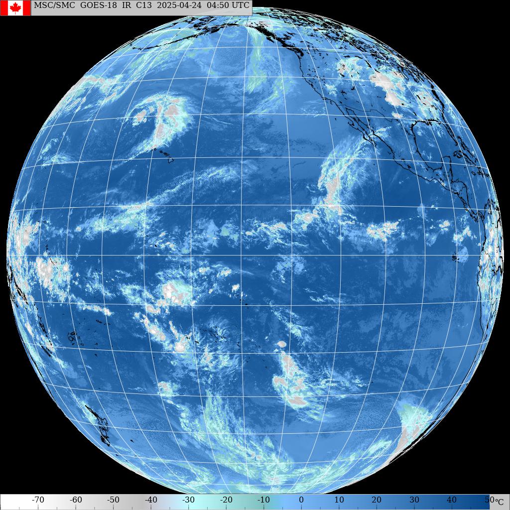
Morning sky. That front is taking a record time to move over the islands. Kauai must be getting slammed by the rain again.


4am significant buoy readings
South shore
W
1.9ft @ 12s from 137° (SE)
SW
2.5ft @ 11s from 126° (ESE)
SE
2.2ft @ 13s from 174° (S)
Interesting numbers at the outer buoys. As you guys know, I believe that the direction those buoys indicate is totally unreliable (unless there's absolutely nothing else in the water), so I don't even look at it anymore. But I would expect the period to be much more consistent and instead today it isn't. Whatever the period is, there's still energy from the south. Unfortunately, I don't think I'll have the time this morning to go that side, so no reports from there, but there should be waves.
North shore
Pauwela
4.3ft @ 8s from 74° (ENE)
Tell you what, if those 4f 8s were from 45 (for example) instead of 74, Hookipa would be pretty fun. It might still be, I'll post a report as soon as I see it.
Wind map at noon.

North Pacific starts to show the first signs of the counter clockwise circulation that, while moving closer and closer to us, will create another close by northerly fetch that will generate another big swell like last weekend. 8f 14s from 354 on Monday night and three back to back moderate but longer period NW swells after that. Winter has gone to overtime. Cheers to that.

South Pacific has a couple of micro fetches that won't do much for us.

Morning sky. That front is taking a record time to move over the islands. Kauai must be getting slammed by the rain again.

Thursday, May 03, 2018
Thursday 5 3 18 morning call
Two shortboard and one prone foiling session for me yesterday, probably the very first one in which I managed to have a very minimal amount of fun. But my brain can't avoid the comparison to the strapped SUP foiling and that's still a losing one at the moment. I should wait until I get (a lot) better, but in the meantime I'm probably gonna put a strap on my prone foiling board.
I saw Pete Cabrinha (member of the "strapped" crew back in the days) with some inserts on his board and inquired him about it. He's enjoying riding his prone board strapless, but he understands how I feel about it:
"You feel disconnected without the straps, uh?"
"That's right", I answered. "I pump the board with the intensity I'm used to and the front foot comes off the deck!"
Below is Yasu aiming for the beach in a day in which the lovely cloud cover made the winds stay light all day on the south shore.

3am significant buoy readings
South shore
W
1.7ft @ 14s from 173° (S)
SW
2.2ft @ 14s from 171° (S)
SE
2.4ft @ 14s from 182° (S)
South swell still up at the buoys, one second shorter than yesterday, which saw knee to waist high with occasional belly high sets and long lulls between them. Should be similar today, stay tuned for a beach report.
North shore
Pauwela
Wind map at noon calls for NE winds and a possible Kihei downwind run. Have fun you guys, would love to join you, but I got to rest those triggered fingers.

North Pacific only shows a small/weak N fetch.

South Pacific has nothing of relevance.

Morning sky. Absolutely loving the lack of sun.

I saw Pete Cabrinha (member of the "strapped" crew back in the days) with some inserts on his board and inquired him about it. He's enjoying riding his prone board strapless, but he understands how I feel about it:
"You feel disconnected without the straps, uh?"
"That's right", I answered. "I pump the board with the intensity I'm used to and the front foot comes off the deck!"
Below is Yasu aiming for the beach in a day in which the lovely cloud cover made the winds stay light all day on the south shore.

3am significant buoy readings
South shore
W
1.7ft @ 14s from 173° (S)
SW
2.2ft @ 14s from 171° (S)
SE
2.4ft @ 14s from 182° (S)
South swell still up at the buoys, one second shorter than yesterday, which saw knee to waist high with occasional belly high sets and long lulls between them. Should be similar today, stay tuned for a beach report.
North shore
Pauwela
3.4ft @ 9s from 47° (NE)
2.9ft @ 5s from 87° (E)
With those numbers, my guess is that Hookipa will be waist to chest with occasional bigger sets, but I won't be able to confirm it with a beach report, as I plan of leaving in the dark. We'll see, plans are made to be changed.
Wind map at noon calls for NE winds and a possible Kihei downwind run. Have fun you guys, would love to join you, but I got to rest those triggered fingers.

North Pacific only shows a small/weak N fetch.

South Pacific has nothing of relevance.

Morning sky. Absolutely loving the lack of sun.

Wednesday, May 02, 2018
Wednesday 5 2 18 morning call
A SUP foiling session for me yesterday, in conditions that would have been a 2 for surfing while I had a 8 in terms of fun. With the foiling it's pretty much the other way around: onshore is the new offshore. And vice versa! (foiling in offshore wind sucks)
No photos of the day, here's one of those very heavy Tahitian lips in a photo by Ben Thouard.

7am significant buoy readings
South shore
W
2.1ft @ 15s from 166° (SSE)
SW
2.1ft @ 15s from 143° (SE)
SE
2.1ft @ 15s from 160° (SSE)
The outer buoys have pretty consistent readings of the new low long period swell, so that means that there are some waves on the south shore. I will probably post a beach report sometimes mid morning.
Let's have a look at the fetch that generated this swell with the help of Pat Caldwell's words: A severe gale further south to the S to SE of New Zealand 4/24-25 aimed highest SE of Hawaii. Long-period forerunners should slowly fill in late Tuesday. The event should peak on Wednesday within background to summer average levels then drop Thursday into Friday.
Below is the collage of the maps of April 23, 24 and 25. As you can see and as uncle Pat says, the fetch/swell is aimed well SE of us. We're getting the angular spreading and that means low frequency of sets arrival.

North shore
Hanalei
4.3ft @ 9s from 42° (NE)
Pauwela
5.1ft @ 8s from 37° (NE)
The low pressure that generated last weekend's big swell has weakened and is moving to the NE. The readings at the buoys reflect just that. I surfed Hookipa this morning and it was chest to head high and clean (as reported in the beach report, today posted before/below this call). The diminishing trend will continue in the next couple of days and take us to a nearly flat end of the week.
Wind map at noon.

North Pacific shows the low moving NE and the associated fetch getting smaller and weaker.

Couple of weak fetches in the South Pacific.

Morning sky.

Rain radar ending at 8.35am.

No photos of the day, here's one of those very heavy Tahitian lips in a photo by Ben Thouard.

7am significant buoy readings
South shore
W
2.1ft @ 15s from 166° (SSE)
SW
2.1ft @ 15s from 143° (SE)
SE
2.1ft @ 15s from 160° (SSE)
The outer buoys have pretty consistent readings of the new low long period swell, so that means that there are some waves on the south shore. I will probably post a beach report sometimes mid morning.
Let's have a look at the fetch that generated this swell with the help of Pat Caldwell's words: A severe gale further south to the S to SE of New Zealand 4/24-25 aimed highest SE of Hawaii. Long-period forerunners should slowly fill in late Tuesday. The event should peak on Wednesday within background to summer average levels then drop Thursday into Friday.
Below is the collage of the maps of April 23, 24 and 25. As you can see and as uncle Pat says, the fetch/swell is aimed well SE of us. We're getting the angular spreading and that means low frequency of sets arrival.

North shore
Hanalei
4.3ft @ 9s from 42° (NE)
Pauwela
5.1ft @ 8s from 37° (NE)
The low pressure that generated last weekend's big swell has weakened and is moving to the NE. The readings at the buoys reflect just that. I surfed Hookipa this morning and it was chest to head high and clean (as reported in the beach report, today posted before/below this call). The diminishing trend will continue in the next couple of days and take us to a nearly flat end of the week.
Wind map at noon.

North Pacific shows the low moving NE and the associated fetch getting smaller and weaker.

Couple of weak fetches in the South Pacific.

Morning sky.

Rain radar ending at 8.35am.


Tuesday, May 01, 2018

Tuesday 5 1 18 morning call
A SUP foiling session for me yesterday, here's how the waves looked like: fun.

Foil waist high equals chest high.

Here's how Honolua Bay looked instead, courtesy of a Hi-Tech rental customer.

5am significant buoy readings
South shore
No indication of southerly energy at the buoys, the Surfline forecast calls for 2.2f 12s. A new long period low swell is predicted for tomorrow.
North shore
Hanalei
5.1ft @ 9s from 352° (N)
Pauwela
5.6ft @ 9s from 354° (N)
The energy from the close by low is winding down and it's now purely short period. Still something to play with and to take advantage of, as the rest of the week looks pretty tiny. Below is the graph of the two reported buoys plus the Surfline forecast from three days ago, so we can compare if it was accurate or not. Not 100% in this occasion, as they got the Sunday night dip right, but unfortunately the bounce back wasn't as high.

Wind map at noon.

North Pacific doesn't look particularly exciting and that's why Pat Caldwell's summary read "Low spell". But this "extended" winter is not over just yet as May 8th might see a 9f 12s swell from the NNW.

South Pacific has a couple of fetches, but nothing to get particularly excited about.

Morning sky.


Foil waist high equals chest high.

Here's how Honolua Bay looked instead, courtesy of a Hi-Tech rental customer.

5am significant buoy readings
South shore
No indication of southerly energy at the buoys, the Surfline forecast calls for 2.2f 12s. A new long period low swell is predicted for tomorrow.
North shore
Hanalei
5.1ft @ 9s from 352° (N)
Pauwela
5.6ft @ 9s from 354° (N)
The energy from the close by low is winding down and it's now purely short period. Still something to play with and to take advantage of, as the rest of the week looks pretty tiny. Below is the graph of the two reported buoys plus the Surfline forecast from three days ago, so we can compare if it was accurate or not. Not 100% in this occasion, as they got the Sunday night dip right, but unfortunately the bounce back wasn't as high.

Wind map at noon.

North Pacific doesn't look particularly exciting and that's why Pat Caldwell's summary read "Low spell". But this "extended" winter is not over just yet as May 8th might see a 9f 12s swell from the NNW.

South Pacific has a couple of fetches, but nothing to get particularly excited about.

Morning sky.

Subscribe to:
Posts (Atom)