They moved their operation at 200 Waiehu Beach road (opposite of Jack in the Box). It's only 8 minutes from the airport, but you shouldn't worry about that, since they offer a convenient airport pickup and drop-off.
They have a fleet of more than 80 cars, so pretty easy to accommodate everyone's needs.
Yesterday I surfed the bays.
First the other one (Paia) one and later the proper one (Honolua). As you can imagine, the difference in the quality of the waves was quite noticeable, but, believe it or not, I had fun in both sessions.
That's the beauty of surfing (or at least of my approach to surfing): doesn't matter the conditions, as long as there's a challenge involved, it's fun.
When I arrived at Honolua, I saw this set on the horizon, pulled over, grabbed the camera and shot this wave, put the camera back and paddled out. The Cave was a bit much for me, but The point was fun. Just before getting in the water, I checked the Pauwela buoy and it read something like 7f 13s, if I remember right. The bombs coming through seemed a bit bigger than that, so I checked it again when I got out. When I saw that the 3pm reading was 9f 15s I loudly exclaimed in the dialect of my home town:"a facc ro cazz!". Which can be politely translated with something like "no wonder!", but it's waaaay more colorful than that.

These shots are from sunset time at Hookipa. This guy really closed his turn all the way. Look where he's looking.

Stylish bottom turn at Middles.

Nice SUP crack.

I pointed out a rise at the NW buoy, but that's because it's being engulfed in some NW winds and the short period energy went up. The same winds should reach our shores in the afternoon, so surf early is my strong recommendation.
At 5am, Pauwela reads:
5.0ft @ 13s from 329° (NW)
3.4ft @ 9s from 16° (NNE)
2.7ft @ 11s from 338° (NNW)
and even though Waimea shows a steady decline, that is still a really fun size with a mix of peaks from the different swells. Should go down all day, before a new solid NW swell picks up tomorrow (13f 15s from 325 at 8am, according to Surfline). That swell will be even bigger on Wednesday (18f 15s at 8am).
Once again I'll have the "problem" to find another spot to surf (Hookipa too big), but what a nice problem to have.

Wind map once again shows a solid NW fetch and a new one coming off Japan. Is this ever gonna end? Let's hope not.

That is a solid fetch down south. Write down Monday March 7 on your calendar if you like to surf the south shore.

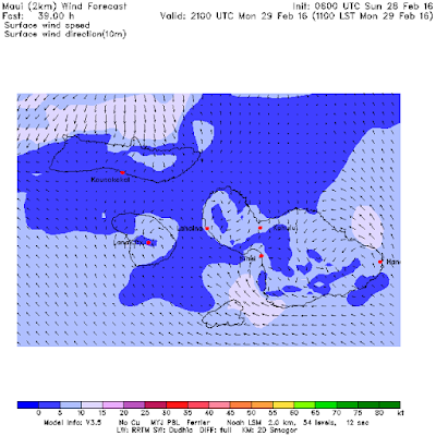
MC2km maps not updated yet, this is the 11am map but from yesterday's run. It shows the start of onshore winds that will ruin the waves in the afternoon. Again, that is an old map, check the link n.17 if you want to see the much more reliable updated ones.


No comments:
Post a Comment