The first hour of the first one was a 9 and thanks to my Little Rascal I produced my best surfing ever and that is a damn good feeling.
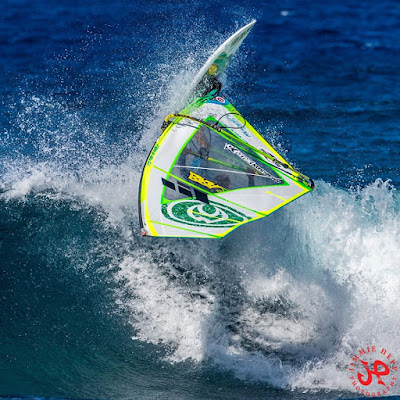
Meanwhile the WNW swell was hitting the north shore and as predicted Hookipa got plenty size in the afternoon. This is Kauli Seadi in a photo from this gallery by Jimmie Hepp. He stopped by the shop later and declared:"Hookipa was amazing this afternoon!"

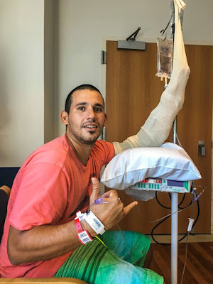
Jimmie also went to visit the shark attack victim at the hospital. He is doing great and he'll have another surgery Friday to reattach the tendons of the hand. Best luck to you hermano! I hope you'll be able to give left hand shaka signs very soon.

4am significant buoy readings
Lanai
1.8ft @ 13s from 191° (SSW)
The Barbers buoy is all confused by the wrap of the WNW swell and gives no indication of the south swell. We don't need it, we got it at the Lanai one.
There will be really good waves to surf this morning on the north shore, but I can't wait to catch a few more of those perfect shape shoulder high peelers in Lahaina, so call me weird, but I'll probably do the drive in the dark again. Those waves improve my surfing much more than the north shore ones. And that is something that I also know from 15 years of teaching water sports: the easier the conditions, the faster the improvement, without a doubt. But overall, I just have more fun over there!
Below is the wind map of 7 days ago. It's called: in the cock roach antennas we trust.

NW
5.5ft @ 14s from 310° (WNW)
Waimea
6.3ft @ 15s from 307° (WNW)
Pauwela
3.9ft @ 15s from 305° (WNW)
6.3ft @ 15s from 307° (WNW)
Pauwela
3.9ft @ 15s from 305° (WNW)
The graphs of the NW, Waimea and Pauwela buoys below deserve some comments. Notice how the blue line indicating the direction at the first one didn't change. As explained on yesterday's post, the fetch didn't move much and staying confined in the Kamchatka corner before being pushed up north over the Aleutians disappearing from the Hawaii swell window. As a result, the direction of this swell is staying steady from around 300-310.
Also notice how much more size Oahu got (and Kauai must have been even bigger). I was watching the Pipeline webcam and I saw some sets breaking at the second reef... lots of water moving. No wonder with 7f 17s in the water!
In Maui we only got up to 4f and that's because some of the energy got blocked by the upstream islands of Oahu and Molokai.

Current wind map shows scattered fetches all over. Remember, the fetches configuration will be reflected in the water a few days later. In this particular case, only the windswell fetch might do something noticeable for us as Pat Caldwell also points out: "Surf from windswell should build above average by late Thursday and remain elevated near to just above average through the weekend from 60-90 degrees"
The fetch associated with hurricane Seymore (straight east of us) is really minor at the moment.

HWR model at noon shows trades from a decent direction. Is it really gonna be only 13 knots? Of course not. If the sky is clear, the heating of the Haleakala will add the usual boost and it should be another good day of windsurfing/kitesurfing on the north shore.

----------------------------------------------------------------------------------
5.30am update
As I was about to leave, somehow my instinct told me to check the buoys on my phone one more time. Sure enough, the Lanai reading was different from what I remembered even though the time stamp was still 4am.
I still had the "old" screen open on my computer and below are the two different readings with the same time stamp.
The one I first saw (and copy/pasted above) is 1.8ft @ 13s from 191° (SSW). The "new" one is 1.4ft @ 13s from 193° (SSW). That's enough of a difference for me to make me choose to wait for the sun to come up and check the webcam before eventually going. I'll do that from Hookipa so expect a beach report from there.
That never happened before, I might have to send Surfline an email and ask for clarifications.


No comments:
Post a Comment