8.30am ukumehame is knee high and light onshore.
Friday, May 18, 2018


Friday 5 18 18 morning call
A prone foiling session for me yesterday.
Proper model for a proper photoshoot.

Guess he didn't check the tide.

Sunny Garcia's trainee likes Maui, so it can happen to randomly see him around.

And after I read this chapter, I went looking for the Tao of foiling and found it in a couple of rides.

4am significant buoy readings
South shore
W
3.2ft @ 11s from 188° (S)
SW
2.6ft @ 12s from 168° (SSE)
SE
2.9ft @ 12s from 150° (SE)
The very long lasting angular spreading south swell is still tenaciously at the outer buoys, now down to 11-12s. As reported, yesterday it was knee to waist high, might be knee to thigh today. I'll report as soon as I'll get there. New low long period swell should hit tomorrow.
North shore
NW101

That is confirmed by the Surfline forecast, below in its new look. I put a red arrow to indicate the swell I'm talking about (purple line). I'll get used to this new look, but I miss the old one.

Wonna know where is this swell coming from? Let's ask Pat Caldwell: A long fetch of strong to near gale breezes set up 5/15 and have held into 5/16 over the 330-350 degree band.
Below is the collage of the fetches of May 15 and 16. I put a black arrow to point to the fetch. The more you look at fetches and at their resulting swells, the less you're gonna need to check the "official" forecasts, as you will immediately have an idea of what kind of swell you can expect from a fetch like that.

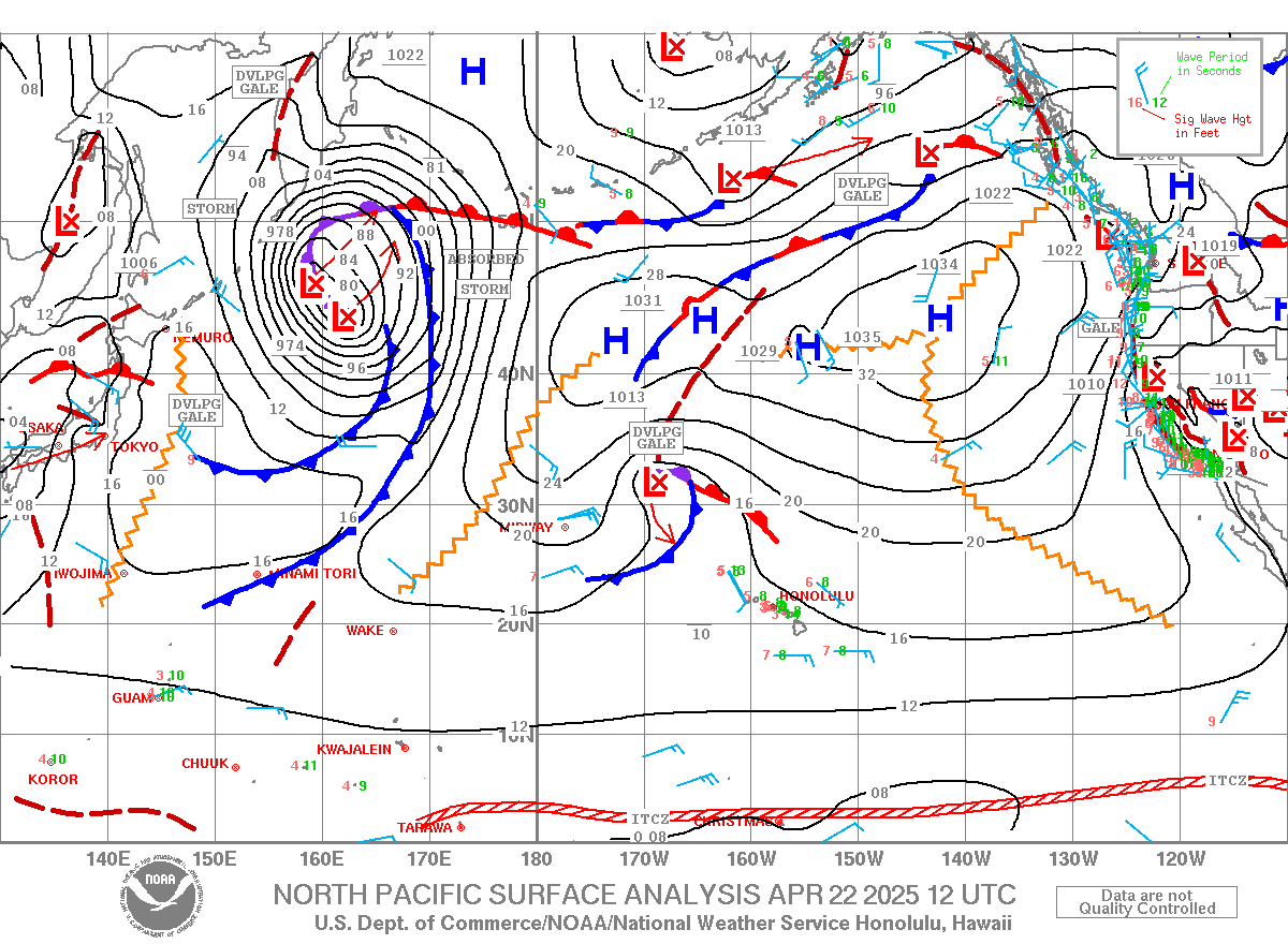
Wind map at noon.

North Pacific has a small fetch in the NW corner.

South Pacific shows a pretty decent fetch in the Tasman Sea. Get used to those, as there will be plenty more to come.

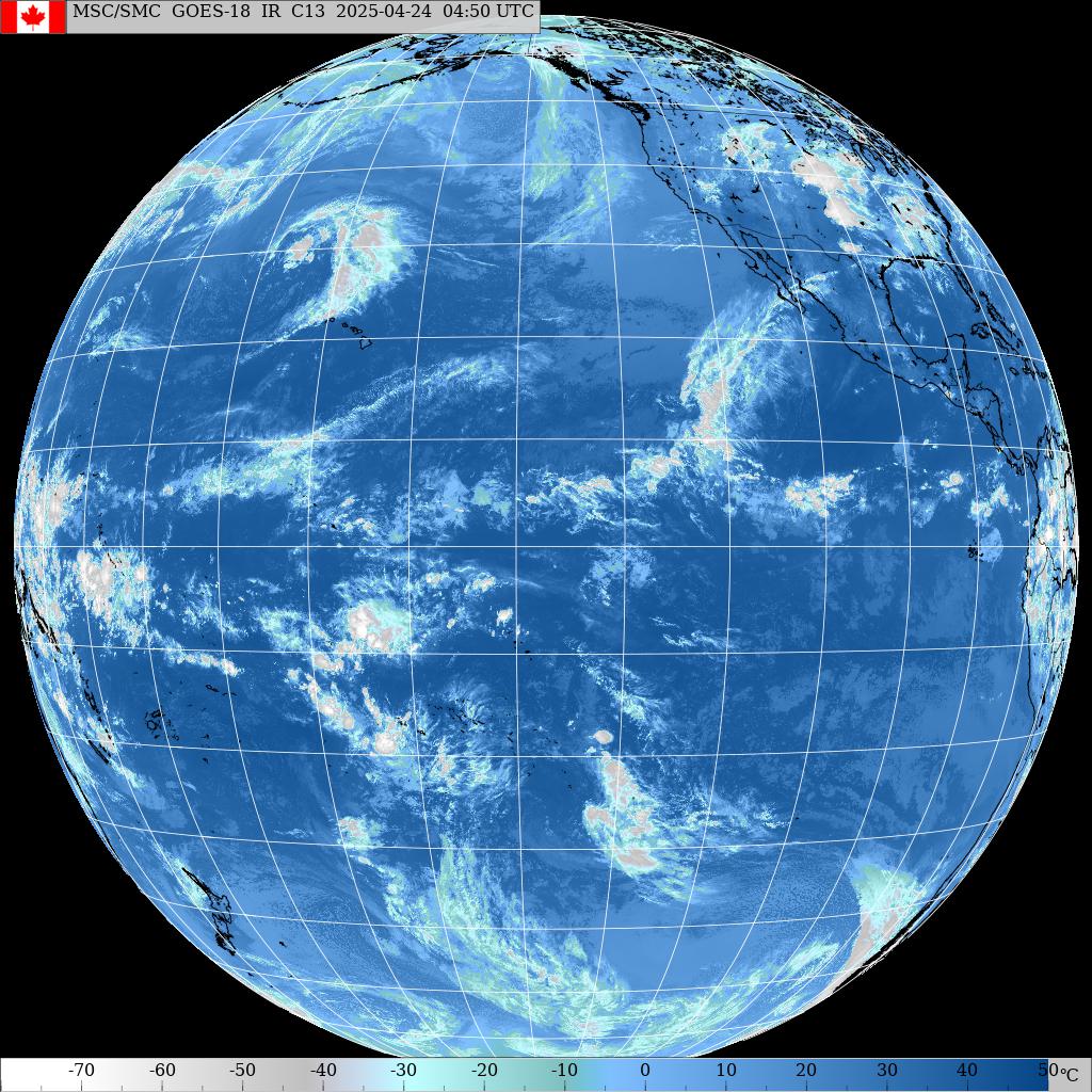
Morning sky.

Proper model for a proper photoshoot.

Guess he didn't check the tide.

Sunny Garcia's trainee likes Maui, so it can happen to randomly see him around.

And after I read this chapter, I went looking for the Tao of foiling and found it in a couple of rides.

4am significant buoy readings
South shore
W
3.2ft @ 11s from 188° (S)
SW
2.6ft @ 12s from 168° (SSE)
SE
2.9ft @ 12s from 150° (SE)
The very long lasting angular spreading south swell is still tenaciously at the outer buoys, now down to 11-12s. As reported, yesterday it was knee to waist high, might be knee to thigh today. I'll report as soon as I'll get there. New low long period swell should hit tomorrow.
North shore
NW101
4.8ft @ 11s
PACIOOS Waimea
4ft @ 12.5s from 330° (NNW)
Pauwela
3.7ft @ 6s from 69° (ENE)
2.5ft @ 7s from 71° (ENE)
1.7ft @ 11s from 332° (NNW)
New NNW pulse on the rise today. Below is the graph of the PACIOOS Waimea buoy, which I've never used before. I circled in red the rise of the swell between midnight and 4am. Assuming the buoy is not far from the old NOAA one, the epic post Buoys to Maui travel times and Maui's shadow lines (which interested new blog readers should most definitely learn), tells us that it takes about 5-6h for 12s energy to get from Oahu to Maui. As a matter of fact, Pauwela is barely feeling it and considering that Hookipa was pretty much flat at sunset yesterday, I don't expect it too be much bigger at sunrise. There will be some waves later in morning. And that's how I just decided to drive again to the south side for my sunrise session.

That is confirmed by the Surfline forecast, below in its new look. I put a red arrow to indicate the swell I'm talking about (purple line). I'll get used to this new look, but I miss the old one.

Wonna know where is this swell coming from? Let's ask Pat Caldwell: A long fetch of strong to near gale breezes set up 5/15 and have held into 5/16 over the 330-350 degree band.
Below is the collage of the fetches of May 15 and 16. I put a black arrow to point to the fetch. The more you look at fetches and at their resulting swells, the less you're gonna need to check the "official" forecasts, as you will immediately have an idea of what kind of swell you can expect from a fetch like that.

Wind map at noon.

North Pacific has a small fetch in the NW corner.

South Pacific shows a pretty decent fetch in the Tasman Sea. Get used to those, as there will be plenty more to come.

Morning sky.

Thursday, May 17, 2018
Thursday 5 17 18 morning call
A shortboard and a prone foiling session for me yesterday. A few photos in between.
Hanging ten in that section and in front of dry reef was a very ballsy move without a leash.

It ended up with a walk to vana land. Might as well enjoy the view.

Before catching the foiling bug, Gerry was mostly body surfing. You can tell he's fit.
He was foiling all by himself, so I had to join him for an arvo session. Best prone one for me so far.

W
2.6ft @ 13s from 149° (SE)
Severe gale to hurricane-force low pressure systems SW to SE of New Zealand spaced a day or two apart starting 5/7 has returned surf in Hawaii to near the average. The sources mostly aimed west to east, so swell is arriving through angular spreading. This leads to less consistent arrival of sets as has been the case the past two days.
The first event peaked Tuesday PM 5/15 and is slowly declining 5/16. Dispersion, or the spreading out of swell trains based on wave period, since longer waves travel faster, allows events from remote sources to linger for several days. The NOAA southern buoys 51003, 51002, and 51004 show the dominant wave period has shifted down from the 17 seconds at the peak to 15 seconds 5/16. It should continue a slow drop in wave period as breaker size declines toward background levels on Friday as a new event fills in.
North shore
Pauwela


Hanging ten in that section and in front of dry reef was a very ballsy move without a leash.

It ended up with a walk to vana land. Might as well enjoy the view.

Before catching the foiling bug, Gerry was mostly body surfing. You can tell he's fit.
He was foiling all by himself, so I had to join him for an arvo session. Best prone one for me so far.

4am significant buoy readings
South shoreW
2.6ft @ 13s from 149° (SE)
SW
2.2ft @ 13s from 159° (SSE)
SE
2.5ft @ 13s from 173° (S)
South swell doing what Pat Caldwell describes here.
The first event peaked Tuesday PM 5/15 and is slowly declining 5/16. Dispersion, or the spreading out of swell trains based on wave period, since longer waves travel faster, allows events from remote sources to linger for several days. The NOAA southern buoys 51003, 51002, and 51004 show the dominant wave period has shifted down from the 17 seconds at the peak to 15 seconds 5/16. It should continue a slow drop in wave period as breaker size declines toward background levels on Friday as a new event fills in.
We'll talk about that tomorrow, let's stay focused on today, as those numbers at the buoys will guarantee more fun waves for us to enjoy. I'll beach report before 6.30am.
North shore
Pauwela
3.7ft @ 8s from 42° (NE)
1.3ft @ 12s from 30° (NNE)
Pretty small energy at the Pauwela buoy for another very small day on the north shore. Size should increase tomorrow as a new/modest NW shifting NNW swell tops out, as reported by the Surfline forecast.
Wind map at noon (finally up to date).

North Pacific only has a tiny little fetch north of us.

South Pacific shows a solid SSW fetch aimeing at us, but unfortunately New Zealand will block most of that energy.

Morning sky.

Wednesday, May 16, 2018
Wednesday 5 16 18 morning call
A shortboard and a prone foiling session for me yesterday. In between, I took some photos of the fellow foilers. Hi-Tech manager Steve Roan gets the first shot for obvious reasons...

Here's Jason Hall freely opening up his arms and shoulders, as he likes.

See that gopro on the tail? Here's a shot from his instagram page.

Couple more from the beach.

Retired lifeguard Archie Kalepa is another passionate foiler.

4am significant buoy readings
South shore
W
2.9ft @ 14s from 112° (ESE)
SW
2.5ft @ 15s from 165° (SSE)
SE
2.8ft @ 15s from 180° (S)
South swell coming slowly down in period, but keeping the open ocean size up to almost three feet. Yesterday the bigger sets in Lahaina were about shoulder high, still long waits, but a little less than the day before. An increase in consistency is usually the trend when the period comes down a bit, but for an angular spreading swell like this, there is no guarantee about that either. There's going to be clean waves, that's pretty sure though. I'll beach report when I get there.
North shore
Pauwela
3.6ft @ 9s from 13° (NNE)
Short period energy from the NNE is what's on tap on the north shore. According to the Surfline forecast it seems that it should stay pretty steady all day, but someone at work pushed the "try the new Surfline" button and the new graphs are much harder to read than the old ones. I immediately emailed the question "how do go back to the old one?".
Wind model didn't update again and this time the noon wind map below is more than 2 days old. This trend is pretty worrying...

The morning should be calm everywhere as the 7am map shows.

North Pacific shows a couple of small NNW and NW fetches. Can't complain for this time of the year.

South Pacific and specifically the Tasman Sea is about to get stirred by some strong storms. This one has a couple of fetches oriented towards us. And that means another low long period SSW swell in a week.

Morning sky.


Here's Jason Hall freely opening up his arms and shoulders, as he likes.

See that gopro on the tail? Here's a shot from his instagram page.

Couple more from the beach.

Retired lifeguard Archie Kalepa is another passionate foiler.

4am significant buoy readings
South shore
W
2.9ft @ 14s from 112° (ESE)
SW
2.5ft @ 15s from 165° (SSE)
SE
2.8ft @ 15s from 180° (S)
South swell coming slowly down in period, but keeping the open ocean size up to almost three feet. Yesterday the bigger sets in Lahaina were about shoulder high, still long waits, but a little less than the day before. An increase in consistency is usually the trend when the period comes down a bit, but for an angular spreading swell like this, there is no guarantee about that either. There's going to be clean waves, that's pretty sure though. I'll beach report when I get there.
North shore
Pauwela
3.6ft @ 9s from 13° (NNE)
3.1ft @ 8s from 24° (NNE)
Short period energy from the NNE is what's on tap on the north shore. According to the Surfline forecast it seems that it should stay pretty steady all day, but someone at work pushed the "try the new Surfline" button and the new graphs are much harder to read than the old ones. I immediately emailed the question "how do go back to the old one?".
Wind model didn't update again and this time the noon wind map below is more than 2 days old. This trend is pretty worrying...

The morning should be calm everywhere as the 7am map shows.

North Pacific shows a couple of small NNW and NW fetches. Can't complain for this time of the year.

South Pacific and specifically the Tasman Sea is about to get stirred by some strong storms. This one has a couple of fetches oriented towards us. And that means another low long period SSW swell in a week.

Morning sky.

Tuesday, May 15, 2018
Tuesday 5 15 18 morning call
A longboard session for me yesterday. The waves at Hookipa went up to 6f 8s from the NNE, so I wasn't too surprised when I saw this photo by Jimmie Hepp in this gallery.

3am significant buoy readings
South shore
W
1.7ft @ 17s from 141° (SE)
SW
2.4ft @ 17s from 177° (S)
SE
2.7ft @ 17s from 196° (SSW)
South swell definitely went up a notch compared to yesterday, so today I'm expecting bigger sizes that the usual knee to waist. I will post a beach report, no idea what time, haven't finalized my plan yet. Let me just use Pat Caldwell's words to remind you that: Severe gale to hurricane-force systems have mostly focused ocean surface winds from west to east, thus minimal aim at Hawaii, leaving only angular spreading to deliver surf locally. This should keep these events over the coming week at common, near average levels dominant from near 190 degrees and spread within 180-220 degrees.
North shore
Pauwela
I'm having a hard time keeping up with all the little NW swells hitting the north shore (also because I have no interest in them, since it's windy and there's cleaner waves on the other side), so no discussion, just the buoy readings. That's all you need really.
Talking about which, here's the link to a PACIOOS Waimea buoy. It's obviously not the usual NOAA one, as that one still has no data. I'm gonna email Surfline and see if they can add it to their wonderful buoys page (link n.11).
Wind model didn't update again and this wind map at noon is more than one day old.

North Pacific still not dead with a couple of small NW fetches and a tiny NNE one.

South Pacific sees some serious storms coming up, let's hope they aim seas at us. Today we have a long fetch south of the Tasman Sea. That should keep things rolling (literally) next week.

Morning call.


3am significant buoy readings
South shore
W
1.7ft @ 17s from 141° (SE)
SW
2.4ft @ 17s from 177° (S)
SE
2.7ft @ 17s from 196° (SSW)
South swell definitely went up a notch compared to yesterday, so today I'm expecting bigger sizes that the usual knee to waist. I will post a beach report, no idea what time, haven't finalized my plan yet. Let me just use Pat Caldwell's words to remind you that: Severe gale to hurricane-force systems have mostly focused ocean surface winds from west to east, thus minimal aim at Hawaii, leaving only angular spreading to deliver surf locally. This should keep these events over the coming week at common, near average levels dominant from near 190 degrees and spread within 180-220 degrees.
North shore
Pauwela
4.5ft @ 8s from 21° (NNE)
3ft @ 10s from 330° (NW)
2.2ft @ 5s from 42° (NE)
I'm having a hard time keeping up with all the little NW swells hitting the north shore (also because I have no interest in them, since it's windy and there's cleaner waves on the other side), so no discussion, just the buoy readings. That's all you need really.
Talking about which, here's the link to a PACIOOS Waimea buoy. It's obviously not the usual NOAA one, as that one still has no data. I'm gonna email Surfline and see if they can add it to their wonderful buoys page (link n.11).
Wind model didn't update again and this wind map at noon is more than one day old.

North Pacific still not dead with a couple of small NW fetches and a tiny NNE one.

South Pacific sees some serious storms coming up, let's hope they aim seas at us. Today we have a long fetch south of the Tasman Sea. That should keep things rolling (literally) next week.

Morning call.

Subscribe to:
Posts (Atom)