Monday, April 23, 2018

Monday 4 23 18 morning call

A lesson gave me the opportunity to catch a few waves SUP foiling yesterday and that was really nice. The windsurfing action at Hookipa was captured as usual Jimmie Hepp. Photo from this gallery.


6am significant buoy readings.
South shore
No indication of southerly energy at the buoys, the Surfline forecast calls for 1.6f 12s.

North shore
Hanalei
3.8ft @ 9s from 76° (ENE)
3.6ft @ 14s from 309° (WNW)

Pauwela
3.8ft @ 8s from 69° (ENE)
3.3ft @ 6s from 66° (ENE)
2.4ft @ 10s from 327° (NW)
2.2ft @ 15s from 314° (NW)
 
New NW swell on the rise, but as I commented yesterday (about the fetches not looking impressive), it seems quite a bit smaller than the forecast. Below are the graphs of the two reported buoys and the Surfline forecast for the next three days. This last one is calling for almost 6f 14s at 8pm. Judging from the buoys, we'll be lucky if we get 4.
 
Hookipa looked pretty horrible this morning (beach report today below the call), and that's no surprise with a wave spectrum like the one below. In the 8s period, there's energy from 280 all the way to 110. Clean waves are impossible in these situation: too much chop. Plus the active wind.

Wind map at noon.


North Pacific shows a fetch in the NW corner and a couple of small windswell fetches just to keep to chop up.


South Pacific shows a nice but partially blocked by New Zealand fetch.


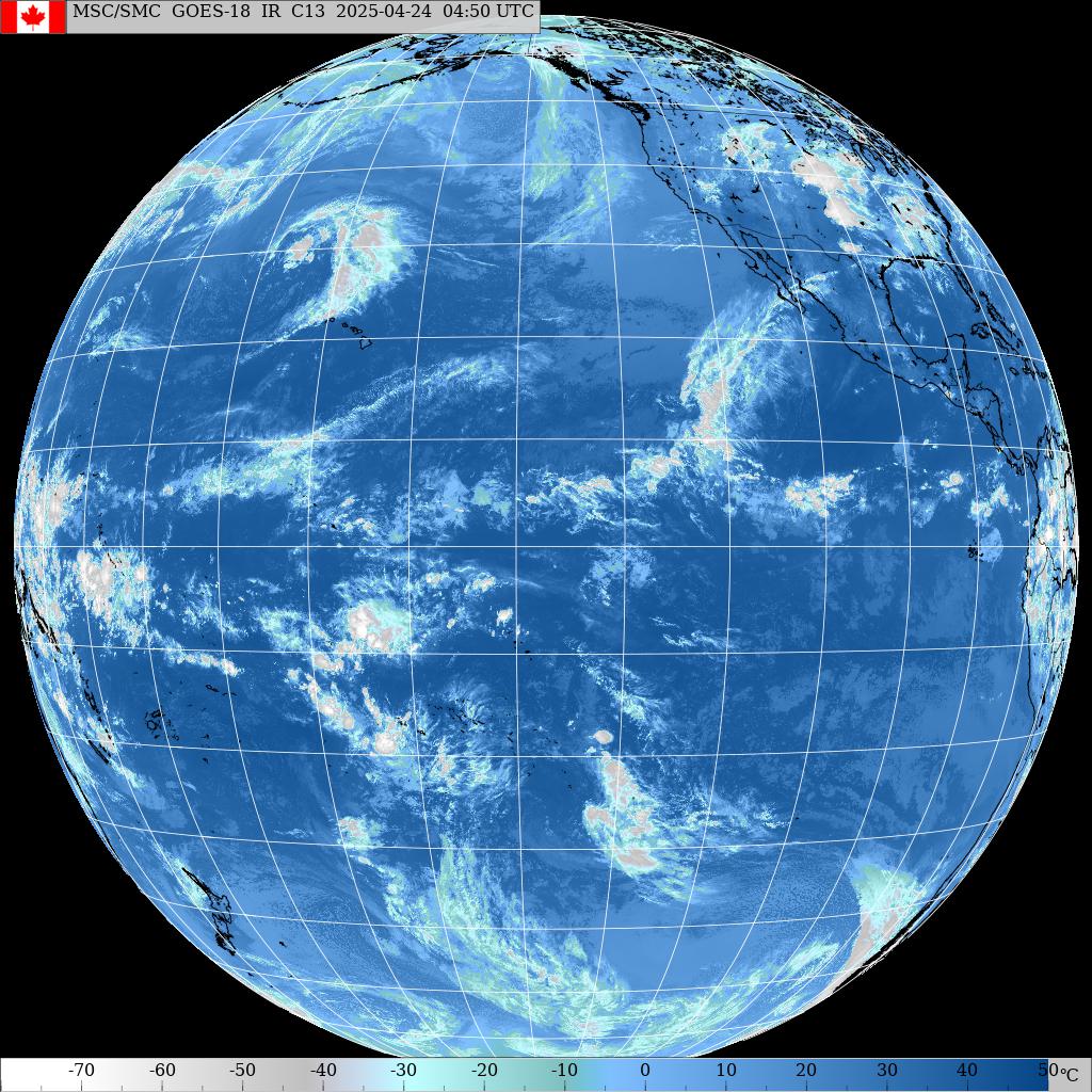
Morning sky.

Monday 4 23 18 beach report

6.15am beach report before call today. Hookipa has inconsistent chest to head high waves of poor shape with plenty wind.
2

Sunday, April 22, 2018

Sunday 4 22 18 morning call

A longboard and a prone foiling session for me yesterday.
This photo shows the size of the set waves on the south shore.


And if you feel that need for a more dynamic action shot, how's this one from GoFoil of Zane Schweitzer and Austin Kalama doing aerials (the former one strapless) on their SUP foiling boards using the wake of a boat?


3am significant buoy readings
South shore

No indication of southerly energy at the buoys, the Surfline forecast calls for 1.8f 11s.

North shore
Hanalei
3.4ft @ 11s from 328° (NW)

Pauwela
3.9ft @ 9s from 75° (ENE)
3.4ft @ 6s from 62° (ENE)
2.9ft @ 12s from 334° (NNW)
2.1ft @ 10s from 354° (N)
 
Below is the graph of the two reported buoys plus the Surfline forecast. The current small NW swell seems to have peaked (light blue line at Hanalei and red becoming orange at Pauwela) and today it should be slowly tapering down in size, as predicted by the forecast (purple line with the red arrow).

Tomorrow a new pulse should arrive (green line with black arrow) and reach almost 6f 14s at sunset. From what I remember from the unimpressive fetches of the past few days, that seems a bit optimistic to me, but it is going to be bigger than the last two ones (Friday and yesterday/today). In the end, size won't matter much because, as it's been the case for the last 2 weeks, the north shore will be windy and blown out.

Wind map at noon.


North Pacific only shows a small fetch in the NW corner.


South Pacific's main fetch is the very tail of a stronger one that now is aiming at Americas, but I think we'll get some angular spreading of it. Plus it was much better oriented yesterday.


Morning sky.

Saturday, April 21, 2018

7.30am lahaina side is knee to thigh, inconsistent but very clean. Ukumehame light onshore

6.30am Hookipa has inconsistent head high sets with some wind on it.
Still a 3 in my scale.

Saturday 4 21 18 morning call

A longboard session for me yesterday.
This is the colorful sunset in a photo by Jimmie Hepp.


5am significant buoy readings
South shore

SW
1.8ft @ 14s from 158° (SSE)

That's the only southerly energy reading I could spot at the outer buoys (always a challenge to interpret the rarely reliable directions) and I like it because it signals a new low long period swell. The surfline forecast calls for 1.8f 11s (old swell) plus 0.7f 15s (new swell).

Pat Caldwell wrote: A severe gale just north of Antarctica to the SE of New Zealand 4/12-14 has potential to bring in a low, long-period swell for the weekend of 4/21-22 locally from 180-190 degrees. Heights should remain at background levels.

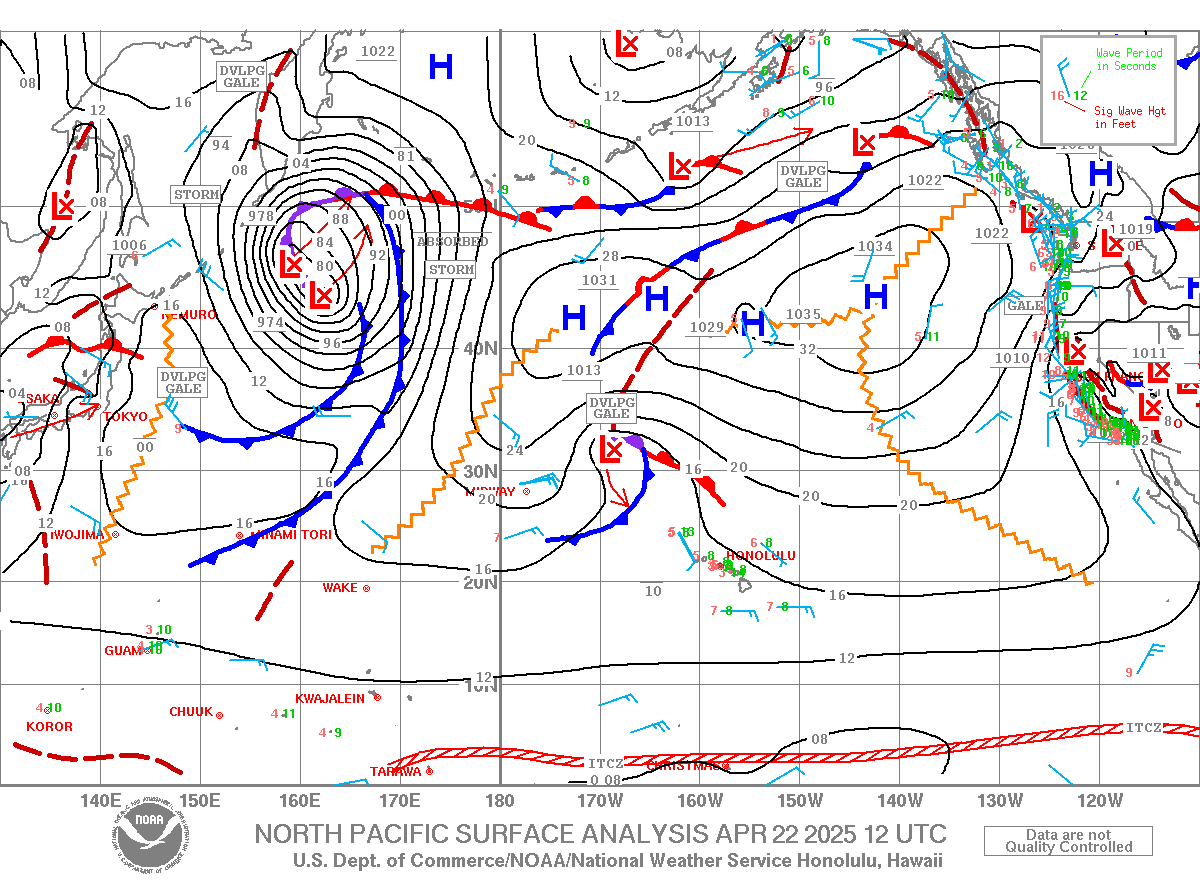
And these are the maps/fetches he refers to (April 12, 13 and 14). Btw, when he says background level, for Maui that's knee high.


North shore
Hanalei
3ft @ 13s from 316° (NW)

Pauwela
3.8ft @ 8s from 73° (ENE)
2.7ft @ 13s from 328° (NW)
 
Very little to be excited about on the north shore, as the predicted weekend swell is slower and smaller than modelled by the Wave Watch III. It feels a bit less windy than usual at my house this morning though, so stay tuned for an Hookipa beach report before 7am.

Wind map at noon.


North Pacific only shows a windswell fetch as the one north of us is now only aiming at the mainland.


Much better situation in the South Pacific as yesterday's fetch moved east a bit and it's less blocked by New Zealand.


Morning sky.

Friday, April 20, 2018

7.30am Hookipa chest to head high waves. A mix of windswell and the occasional nw set. Wind is not too strong at the moment, but conditions are still poor in my opinion.
3

Friday 4 20 morning call

A shortboard and a longboard session for me yesterday. That's how clean the waves were.


The foiling frog instead was at Hookipa.


5am significant buoy readings
South shore
No indication of southerly energy at the buoys anymore, the Surfline forecast looks pretty steady instead with 1.8f 12s.

North shore
Hanalei
4.9ft @ 6s from 74° (ENE)
3.8ft @ 9s from 72° (ENE)
2.1ft @ 11s from 320° (NW)
1.6ft @ 15s from 333° (NNW)
 
Pauwela
5.6ft @ 9s from 73° (ENE)
3.6ft @ 5s from 72° (ENE)
1.1ft @ 16s from 354° (N)
 
Yesterday's NW pulse was pretty small, but there were some fun waves at Hookipa. Today there's another one on the rise, as the longer period readings at the buoys confirm. Here's Pat Caldwell's explanation of the fetches:
 
A severe gale formed east of the Kuril Islands 4/15 with a NE track. The center entered the Bering Sea 4/16 with storm-force winds. A long fetch south of the Aleutians 4/15-17 aimed highest seas at the Americas. Long-period forerunners are expected locally Thursday PM from 320-330 degrees. Heights are expected to reach near the April average for the peak of the event on Friday.
The fetch width spread 4/17-18 with a large area of marginal gales north of 40N within 160-180W. With the tail of the fetch 2000 nm away, this should make for a long-lived event. The event should linger over the weekend from 325-340 degrees at levels under the average. A new episode is due Sunday PM.

Below is the collage of the maps of April 16, 17 and 18 and that might help you trying to follow what uncle Pat described in words. Nothing to be too excited about if you're a north shore surfer, as the wind will keep blowing relentlessly.


Wind map at noon.


North Pacific shows a NW fetch and the windswell one.


South Pacific shows a large and well oriented fetch, unfortunately greatly blocked by New Zealand.


Morning sky.

Thursday, April 19, 2018

7am lahaina side is down to knee to waist high. occasionally bigger sets and clean in town. Ukumehame wasn't windy, but it looked like it was going to.

Thursday 4 19 18 morning call

A shortboard session for me yesterday.

This photo was posted by my friend Bart and it's Hanavave Bay, Fatu Hiva. He's on another of his crazy expeditions paddling/sailing on a Starboard board (btw, we just got in a big shipment of those yesterday), this time in the Marquesas Island.


Waves down to summer size according to Jimmie Hepp yesterday at Hookipa. Photo from this gallery.


4am significant buoy readings
South shore

W
3ft @ 12s from 170° (S)

SW
2.4ft @ 12s from 147° (SE)

SE
2.2ft @ 12s from 165° (SSE)

Southerly energy down to 12s, but still up in size, so there should be plenty waves also today. Stay tuned for a beach report.

North shore
Hanalei
5.0ft @ 7s from 64° (ENE)
4.1ft @ 9s from 80° (E)
2.9ft @ 12s from 319° (NW)
 
Pauwela
5.7ft @ 9s from 73° (ENE)
4.2ft @ 6s from 69° (ENE)
 
Just 3f 12s of NW energy at Hanalei for a tiny pulse that should also arrive in Maui today. Here's Pat Caldwell's description of the fetch that made it: A marginal gale near the Date Line hugging the Aleutians 4/14-15 is expected to give small surf for Thursday from 320-330 degrees.
Here's the fetch in the maps of April 14 and 15.
 
He also adds that a new event is on its heels. We'll analyze the fetch tomorrow, in the meantime, have a look at how small today's one is (blue line) in the Surfline forecast. Nothing huge tomorrow either, mo' bettah Monday.
Size doesn't really matter, actually, as the wind will blown out everything, small or big.


Wind map at noon.


North Pacific shows a small NW fetch and the windswell one.


South Pacific shows a fetch deep down SW of the Tasman Sea.


Morning sky. Getting gloomy.