Hookipa yesterday afternoon.
This is my post on the Foil Drive Owners Facebook group yesterday evening:
Plenty more "you got to be kidding!" moments today, thanks to the epic SUP foiling downwinder conditions we're having this week in Maui.
For the first time, I did a longer 5 miles run to Kanaha and got exposed to much better conditions than my previous 3 miles one that I used to tune up gear and skills. I was on my 5.0x26.5x90L board with an Armstrong HA725, 85 mast, 50 fuse, chopped V200 tail and +1 titanium shim, not exactly a setup optimized for easy gliding and pumping... but with a Foil Drive Plus onboard, I didn't have to worry about that!
The mile graph shows the two longest stretches of continuous foiling: 1 mile each. The time graph showed that they both lasted 4 minutes (average speed 15 mph, top speed 18.3 mph). At the end of the run, the medium battery I was using had 53% charge left, which means that tomorrow I'm going to use the small battery and love it even more.Not sure this is really happening, but just in case... please don't pinch me.
6am Surfline significant buoy readings and discussion.
South shore
Barbers
0.3ft at 17s SSW 195º
Barbers records a smidget of long period SSW energy, but better the Lahaina and Kihei webcam if interested, for
size, conditions and consistency.
North shore
Hanalei
2.9ft @ 11s from 324° (NW)
Waimea
2.1ft @ 11s from 315° (NW)
0.4ft @ 15s from 338° (NNW)
Mokapu
5.6ft @ 7s from 81° (E)
4.3ft @ 9s from 75° (ENE)
2-3ft 11s NW energy at Waimea and Hanalei. Together with the easterly windswell that should give Hookipa waves in the waist to head high range.
Wind map at noon. The other ones can be found here.
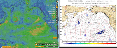
Fetches map (circles legend: red: direct aim, blue: angular spreading, black: blocked, yellow: possibly over the ice sheet) from Windy.
North Pacific (about 4 days travel time from the NW corner of the North Pacific):
South Pacific (about 7 days travel time from east/west of New Zealand):
Morning sky.


No comments:
Post a Comment