Friday, July 31, 2020

Friday 7 31 20 morning call

Things you can do with a wing: cruise one hand cool as cat...

...boost massive airs...


...carve on a wave. Speed runs and downwinders are other applications of a sport that is revealing to be a very multifaceted one thanks to the efficiency of the foils.


4am significant buoy readings and discussion.
South shore
Barbers
1.3ft @ 15s from 191° (SSW)            

Lanai
1.3ft @ 15s from 187° (S)       
1.2ft @ 12s from 192° (SSW)
 
Small 12s and 15s southerly energy at the buoy will make for inconsistent but occasionally decent breakers on the south shore, like the one in the 5:31am picture below. Check the Lahaina webcam if interested, for size, conditions and consistency.
 

North shore
Pauwela
4.2ft @ 8s from 61° (ENE)      
1ft @ 11s from 342° (NNW)
 
Three things worth noting:
1) that sliver of 11s NW energy comes from a fetch in the NW corner that happened about a week ago. It took so long to get here because the fetch was small/weak and the waves generated only had a relatively short period, hence travelled slowly. I would not expect that energy to be visible at all times, but there might be a very small set here and there. Below is the collage of the maps of July 24 through 26.
          
 
2) yesterday the waves at Hookipa were surprisingly up to head high. Well, surprisingly for me at least, because I overlooked the 5.2ft 8s from 53 reading in yesterday's call and the fetch that generated it. Below is the collage of the maps of July 27 through 30. I put a red arrow on the post Douglas fetch which had a good direction and decent length. Today that energy is down to 4.2ft 8s, but still from an unblocked direction, so there might still be chest high waves at Hookipa, possibly bigger on eastern exposures. This energy is on its way down, as the fetch got shorter and shorter afterwards.

3) in the last couple of days there was a low in the Gulf of Alaska (black arrow) which generated some small NNE energy that is on its way. Pat Caldwell calls for 1ft 13s on late Saturday, 2ft 11s on Sunday and 2ft 9s on Monday. Nothing major, but it might actually end up being a bit bigger than that. Hookipa loves that direction.
 

Wind map at noon
(the other ones can be found at link n.-2 of GP's meteo websites list in the right column).


Fetches map (circles legend: red: direct aim, blue: angular spreading, black: blocked, yellow: apparent direct aim, but out of the great circle ray map, so not 100% sure).
North Pacific (about 4 days travel time from the NW corner of the North Pacific):


South Pacific (about 7 days travel time from east/west of New Zealand):


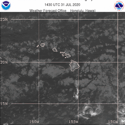
Morning sky.
Thursday, July 30, 2020

Thursday 7 30 20 morning call

Best wingfoiling freestyle video I've seen so far. Those guys are moving fast. I expect the foil industry to come up with wingfoiling dedicated profiles anytime soon. For example, Gofoil has just announce the NL (Next Level) line.

Wing Foiling_Mikeslab_June 2020 from mikeslab on Vimeo.


6am significant buoy readings and discussion.
South shore
Barbers
1.3ft @ 12s from 184° (S)        
0.7ft @ 16s from 196° (SSW)

Lanai
1.4ft @ 11s from 199° (SSW)      
0.8ft @ 16s from 198° (SSW)

The Tasman Sea energy didn't make for many breakers in the past couple of days and it's now down to 11-12s. Pat Caldwell also noticed:
Gales nosed into the subtropics of the Tasman Sea 7/20-21 and was expected to become the dominant background swell locally 7/28-29 from 208-220 degrees. But it never grew beyond tiny. The PacIOOS/CDIP southern buoys did slow a slither of this energy, though not enough to manifest into breakers beyond tiny.

Today the buoys are feeling the new 16s energy from the fetch when it moved east of New Zealand (collage of the fetch maps posted a couple of days ago) and in fact there's inconsistent but nice waves once in a long while. Tomorrow should be better.  Check the Lahaina webcam if interested, for size, conditions and consistency.


North shore
Pauwela
5.2ft @ 8s from 53° (ENE)

Small waves at Hookipa, bigger on eastern exposures.

Wind map at noon
(the other ones can be found at link n.-2 of GP's meteo websites list in the right column).


Fetches map (circles legend: red: direct aim, blue: angular spreading, black: blocked, yellow: apparent direct aim, but out of the great circle ray map, so not 100% sure).
North Pacific (about 4 days travel time from the NW corner of the North Pacific):


South Pacific (about 7 days travel time from east/west of New Zealand):


Morning sky.

Wednesday, July 29, 2020

Wednesday 7 29 20 morning call

My first winging video.


The lovely Lou.


5am significant buoy readings and discussion.
South shore
Barbers
1.2ft @ 13s from 201° (SSW)            

Lanai
1.2ft @ 14s from 206° (SSW)

Very small SSW energy at the buoys, pretty flat everywhere. Check the Lahaina webcam if interested, for size, conditions and consistency.


North shore
Pauwela
5.4ft @ 8s from 60° (ENE)            

Small waves at Hookipa, bigger on eastern exposures.

Wind map at noon
(the other ones can be found at link n.-2 of GP's meteo websites list in the right column).


Fetches map (circles legend: red: direct aim, blue: angular spreading, black: blocked, yellow: apparent direct aim, but out of the great circle ray map, so not 100% sure).
North Pacific (about 4 days travel time from the NW corner of the North Pacific):


South Pacific (about 7 days travel time from east/west of New Zealand):


Morning sky.

Tuesday, July 28, 2020

Tuesday 7 28 20 morning call. SUP foiling downwind attempt n.23 part one.

Thanks to blog reader Jodel for the donation.

Wonderful conditions for downwinders yesterday, I did my attempt n.23 at SUP foiling. I first recorded this video on the beach about what I learned so far and then filmed the water action with the gopro. It will take me a few days to edit those, I'm just going to anticipate that it was my best ever with 90% of the distance covered while foiling! That translates in only 10% of the time foiling. What was I doing the rest of the time? Resting and sitting on the board for 5 minutes after the 6-7 semi-long flights and after that, standing on the board in surfer stance waiting for the right take-off opportunity. Meanwhile here's 15 minutes of monologue about the technicalities of this incredibly difficult discipline. Obviously, you need to be very interested in the topic (or in me, lol!) to get to the end. Fyi, when I say "I measure my pressure" I mean "I measure my heart beat".


4am significant buoy readings and discussion.
South shore
Barbers
1ft @ 12s from 173° (S)       
0.7ft @ 15s from 199° (SSW)

Lanai
0.8ft @ 12s from 176° (S)            
0.7ft @ 15s from 192° (SSW)  

Barbers is back online and both buoys register a touch of that Tasman Sea energy I was announcing yesterday. Let's see how Pat Caldwell described the evolution of the fetch:

Gales nosed into the subtropics of the Tasman Sea 7/20-21 and should become the dominant background swell locally 7/28-29 from 208-220 degrees.
The Tasman low moved east of New Zealand 7/22-24. It aimed mostly at the Americas, except for a short-lived fetch centered on 190 degrees within 45-55S, 170W 7/23. The PacIOOS/CDIP American Samoa buoy 7/26 did agree with the Wave Watch III showing low swell in the 14-16 second band. This buoy location is likely west of the main swath, so there are still low odds for some surf in Hawaii. The onset stage should start 7/30, peaking 7/31 at most near average, then dropping 8/1 from 180-200 degrees.

Below are the maps of July 20 through 23 that will help follow.


Tasman Sea swells can be particularly inconsistent and this is one of them, as I haven't seen anything worth on the Lahaina webcam, which you should anyway check if interested, for size, conditions and consistency.


North shore
Pauwela
4.1ft @ 8s from 83° (E)            

Windswell trending down, small waves at Hookipa, bigger on eastern exposures.

Wind map at noon
(the other ones can be found at link n.-2 of GP's meteo websites list in the right column).


Fetches map (circles legend: red: direct aim, blue: angular spreading, black: blocked, yellow: apparent direct aim, but out of the great circle ray map, so not 100% sure).
North Pacific (about 4 days travel time from the NW corner of the North Pacific):


South Pacific (about 7 days travel time from east/west of New Zealand):


Morning sky.

Monday, July 27, 2020

Monday 7 27 20 morning call

Douglas brought us a winter day in the middle of the summer, with summer water and air temperatures. The epic waves in the harbor prediction 60 hours in advance (Friday morning) was an easy one based on the predicted path, to which the storm fortunately stuck.


In the harbor, the period was mostly 7-9 seconds and probably NE to N direction. None of the easterly 13s energy was getting in there.


"How are we going to arrest them all?". Fortunately common sense prevailed and they didn't.


Outside the harbor was a different story (size) and there were some moments of epicness too.


Can't recognize the guy, Vans sticker, might be Imai. I just missed Albee, who got out of the water when I was setting up. The swell had already started to decline by then.


Kai Lenny's last wave at this spot must have felt like a micro-Nazare to him. He got dropped there by his jet-ski, who knows where he surfed before.


I first surfed the harbor on a longboard while the swell was peaking and then Waiehu when it was declining and head and a half. It was triple overhead and barreling (no thanks!) just a couple of hours earlier. Timing was everything yesterday.
The one time I didn't wax the board in front of the pad, my back foot slipped right off. Not gonna do that mistake again.


I struggled a bit at the beginning, as I mostly foiled lately. It was nice to be back on a surfboard with overhead waves though. I had a 2 waves hold down (probably about 12-14 seconds total) that, believe it or not, brought a smile on my face (after I realized that I was still alive).
Here's a lovely right hander.


Hookipa at sunset, well on its way down.


4am significant buoy readings and discussion.
South shore
Lanai
0.8ft @ 11s from 180° (S)      
0.7ft @ 13s from 171° (S)
 
Tiny numbers at the buoys, today we can call it ALMOST flat. Next swell will be a Tasman Sea one, I'll collage the maps tomorrow. Check the Lahaina webcam if interested, for size, conditions and consistency.

North shore
Pauwela
5.4ft @ 9s from 60° (ENE)       
5.1ft @ 7s from 72° (ENE)
 
Below is Pauwela's graph that clearly show the "Christmas tree" nature of the hurricane swell. You either were on it at the peak and when the wind turned from the south, or you missed it. That time frame was 2 to 6 pm. Today we're back to regular windswell heights, which should still provide Hookipa with waves up to head high and possibly bigger on eastern exposures, but the trades are already back.


Wind map at noon
(the other ones can be found at link n.-2 of GP's meteo websites list in the right column).


Fetches map (circles legend: red: direct aim, blue: angular spreading, black: blocked, yellow: apparent direct aim, but out of the great circle ray map, so not 100% sure).
North Pacific (about 4 days travel time from the NW corner of the North Pacific):


South Pacific (about 7 days travel time from east/west of New Zealand):


Morning sky.

Sunday, July 26, 2020

Sunday 7 26 20 morning call

Yesterday evening's hurricane preparation: a third peg. It worked, still there this morning!


This is the latest satellite pic (6:38am as I post).


Latest cone prediction.


I did quite a beginner mistake yesterday when I based my "epic surf" prediction on the Windy.com maps. I forgot that the model at link n.-2 is much more reliable. Those ones show 3pm like the time when the winds will start clocking from the south and potentially cleaning up the otherwise extremely stormy surf. Still a prediction with a high degree of uncertainty.
--PS. Sorry, I erroneously posted the 2pm map earlier, this is the 3pm one. Corrected at 9.40am.--


4am significant buoy readings and discussion.
South shore
Lanai
1.6ft @ 13s from 184° (S)

That would have been a fun small waves day, but the northerly wind wrapping down the Lahaina coast will make for poor conditions. Looks like it even moved the webcam a bit.


North shore
Pauwela
7.3ft @ 13s from 97° (E)      
6ft @ 8s from 73° (ENE)
 
Pauwela getting much more 13s E energy than I thought. 13s wrap more than a windswell, so Hookipa will definitely have waves, but much bigger on the eastern exposures. Very stormy and dangerous though.           

Wind map at noon
(the other ones can be found at link n.-2 of GP's meteo websites list in the right column).


Fetches map (circles legend: red: direct aim, blue: angular spreading, black: blocked, yellow: apparent direct aim, but out of the great circle ray map, so not 100% sure).
North Pacific (about 4 days travel time from the NW corner of the North Pacific):


South Pacific (about 7 days travel time from east/west of New Zealand):


Morning sky.

Saturday, July 25, 2020

Saturday 7 25 20 morning call

Opening pictures all dedicated to Douglas. This is the satellite picture at 6.34am.


Here's the latest cone prediction.


This is the Euro model latest prediction of the position of the storm. I chose Sunday 2pm because that's when the winds should turn offshore on the north shore and possible epic surfing could be scored. Unfortunately, it's also when I start my working shift.


So, where will the epic surfing be? With hurricanes it's almost impossible to predict, as the local winds can change last minute depending on the trajectory of the storm. But here's a few pointers I can give.

Hana and the Kaupo side will see the biggest waves because the will receive the ESE longer period ones that have been generated in the past few days (Hilo starting to feel 15s energy, see below). None of that will reach the north shore (or anywhere else on Maui). For your convenience, below I reported the position of Koki (red dot) and Hamoa beach (yellow line shows 90 degrees). The waves will be big, extremely consistent and very dangerous, so I would just leave them to Ola, Hank and the Hana buoys. But if you really want to challenge yourself, you better get in your car now and be prepared to spend a long weekend there. I don't think it will be a good idea to drive on the Hana Highway until the rain is gone.


The north shore and the Waiehu coast will only see the short period waves generated when the storm passes north of us (if it does) which will last only a short period of time (possibly 24 hours). They will be extremely stormy and dangerous and most likely surfable only inside the Kahului harbor when the wind shifts from the south (Sunday afternoon).

What is going to make the whole thing more difficult is the decision of the Mayor to close all county parks. For that reason, Hi-Tech had to cancel today's keiki contest at Launiupoko, they're trying to reschedule for August 9th.
FYI, since so many people are willing to embrace the new wing craze, we just received a bunch of F-One, Ozone and WingRide M3 wings.

4am significant buoy readings and discussion.
South shore
Lanai
1.2ft @ 15s from 180° (S)   
1.1ft @ 11s from 179° (S)

Small 15s and 11s energy at Lanai, it should be a fairly small day (but not flat). Check the Lahaina webcam if interested, for size, conditions and consistency.


North shore
Pauwela
5.2ft @ 8s from 55° (ENE)     

Hilo
6.1ft @ 8s from 76° (ENE)      
1.6ft @ 15s from 102° (ESE)
   
Up to head high waves at Hookipa, bigger on eastern exposures.

Wind map at noon
(the other ones can be found at link n.-2 of GP's meteo websites list in the right column).


Fetches map (circles legend: red: direct aim, blue: angular spreading, black: blocked, yellow: apparent direct aim, but out of the great circle ray map, so not 100% sure).
North Pacific (about 4 days travel time from the NW corner of the North Pacific):


South Pacific (about 7 days travel time from east/west of New Zealand):


Morning sky.