Monday, May 14, 2018

Monday 5 14 18 morning call

No water action for me yesterday and no photo of the day, so here's my coworker Russ showing off a lovely board from his new sponsor Quatro. "Best production board I've ever ridden!", he said.


3am significant buoy readings
South shore

SE
1.4ft @ 20s from 135° (SE)

Lovely long period energy at one of the outer buoys. As always the case with south swells, there has been way too much hype for this swell. Pat Caldwell puts it into the right perspective: primary fetches aimed west to east so no large surf is expected locally. But there should be an uptick relative to the low conditions the first half of May. Which won't take much, I add.

Here's his more complete explanation of what happened.
The mid latitudes SE to SW of New Zealand entered an active late austral Fall cyclonic pattern 5/7. A series of hurricane-force systems tracked east near 60S from south of Tasmania to south of French Polynesia spaced about a day apart. Primary fetches aimed west to east so no large surf is expected locally. But there should be an uptick relative to the low conditions the first half of May.
The first system was exceptionally strong in the southern Tasman Sea with central pressure below 950 mb. A buoy south of New Zealand measured seas to 23 m or about 75 feet. Wave Watch III suggested these were the peak seas, with a weakening as the system moved into the Hawaii swell window SE of New Zealand 5/8. It tracked rapidly east.
Given the wide fetch and immense height of seas, angular spreading should bring swell locally to Hawaii. The onset is expected on Sunday with wave periods in the 20-25 second band. There should be a slow rise into Monday with inconsistent set waves above the summer average from 185-220 degrees.
The event should be more consistent and peak in size late Monday through Tuesday. It should drop to near the summer average by Wednesday from 180-220 degrees.

Below is the collage of the maps of May 6, 7 and 8. As usual, the red circles are the fetches oriented towards us. This time I also circled in black the much stronger fetches oriented more zonally (west to east). I will post a report at one point in the morning as I have a business appointment at 5.30am... my clients are crazier than me!


Why so early? Because I care for their safety and this is the time of the year when full/new moons make for bigger tide swings. Below is the Lahaina tide chart for this week taken by link n.12, which is great since you can select the specific Maui location. Unfortunately it doesn't work on my phone (it gives me the San Francisco tides!), so I recently added another one (n.13) which is only Kahului, but it's pretty cool since it puts a small "+" to show where we are in that graph. Make sure you refresh if you check it from your phone.


North shore
Pauwela
4.6ft @ 8s from 30° (NNE)
1.8ft @ 3s from 69° (ENE)

Just NNE windswell from the fetch we see in the fetches map below. Hookipa will be small, weak and windy. But not flat.

The wind model didn't update and the wind map at noon is more than 24 hours old.


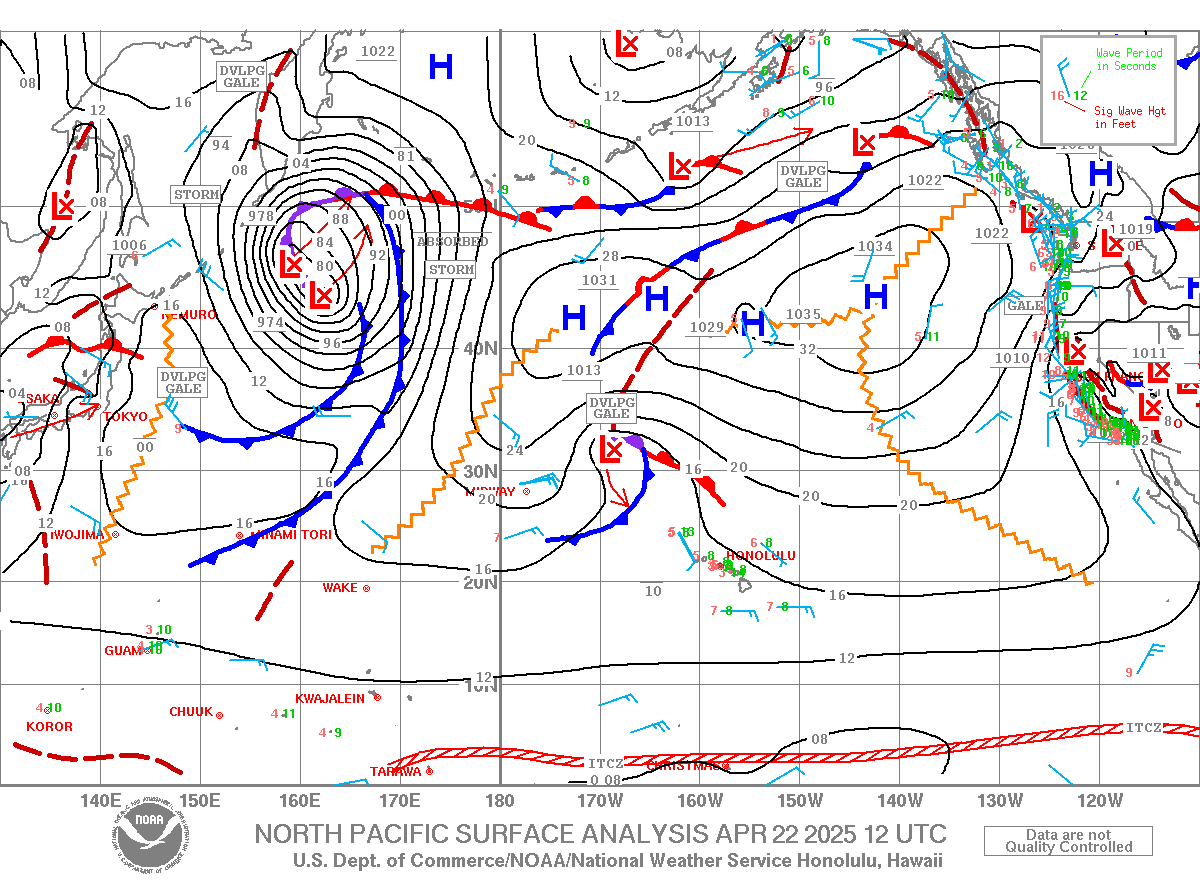
North Pacific shows a couple of weak fetches.


I am not sure if that fetch is oriented towards us, because it just out of the great circle rays map on the right, but I circled it anyway. Nothing else other than that in the South Pacific.


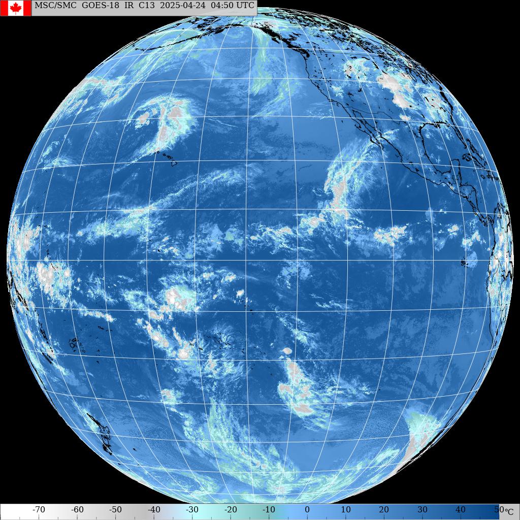
Morning sky.

Sunday, May 13, 2018

Sunday 5 13 18 morning call

A short shortboard session for me yesterday, as the conditions at Hookipa were quite poor (still better than this morning though, as the beach report below shows). In the afternoon, the waves picked up a notch and the windsurfers had a fun day. Photo by Jimmie Hepp from this gallery.


5am significant buoy readings
South shore

W
1.5ft @ 14s from 148° (SE)

Bit of southerly energy at the W buoy, while the Surfline forecast calls for 0.9f 15s + 1.3f 10s. Yesterday I got reports of the usual knee to occasionally waist high and I'm gonna guess today is going to be similar. A much longer period low swell is predicted for tomorrow (1.2f 22s).

North shore
NW101
5.5ft @ 8s
4.6ft @ 10s
 
Pauwela
4.1ft @ 8s from 78° (ENE)
2.1ft @ 5s from 59° (ENE)
2ft @ 11s from 341° (NNW)
 
The energy of that wide fetch I posted yesterday (specially May 10th) did arrive in the form of a small reinforcement mid day yesterday (red arrow in the collage below). Suspiciously, it didn't last long though and today Pauwela has pretty small numbers, reflected by the small size of the waves at Hookipa (see beach report below this post). The Surfline forecast on the right of the collage below looks like a pick-a-stick game and that's not a good thing. But it does show a new small swell peaking tomorrow at 2pm at 4.2f 11s from 334 (green line). Honestly, I'm a bit confused about the origin of this last one. Maybe that's the swell from the fetch of May 10th while yesterday's reinforcement was from another source? Hopefully Pat Caldwell analysis will shed light upon us as usual.


Wind map at noon.


North Pacific shows small scattered fetches, typical of the season.


South Pacific has not kicked in gear just yet. Nothing of relevance down under.


Morning sky.

6am beach report before call today. Pauwela reads
4.1ft @ 8s from 77° (ENE)

2.2ft @ 6s from 66° (ENE)

1.9ft @ 11s from 344° (NNW

and Hookipa is small and windy. The photo shows a 11s set.
2

Saturday, May 12, 2018

Saturday 5 12 18 morning call

FYI: yesterday I wrote an article called "Foiling: SUP or prone?". This morning instead I already posted a Hookipa beach report before/below this call.

A shortboard session for me yesterday as Hookipa finally had decent conditions for that after a long time. Later in the day the windsurfers hit the water, photo by Jimmie Hepp from this gallery.

5am significant buoy readings
South shore
No indication of southerly energy at the buoys, the Surfline forecast calls for 1.5f 11s and I got a report of the usual knee to occasionally waist high yesterday.

North shore
NW101
4.1ft @ 12s
3ft @ 10s
2.6ft @ 8s

Pauwela
3.7ft @ 8s from 80° (E)
2.1ft @ 5s from 67° (ENE)
2.1ft @ 12s from 336° (NNW)

Smaller than yesterday is what the buoys say at the moment and that's what I saw at Hookipa. But it is predicted to come up a bit again. Here's how Pat Caldwell explains why: The main source from the new pattern 5/9-11 was a large fetch of strong to near gale breezes from the Aleutians to near 40N. ASCAT satellite showed a direct aim at Hawaii 5/9. Shorter-period waves of 8-12 seconds from 325-345 degrees should fill in locally early Saturday (late Saturday in Maui) and peak late Saturday.
Below are the maps of May 9, 10 and 11. I do like the fetch on the 10th, let's hope that energy doesn't arrive and peak during the night.


Wind map at noon.


North Pacific starting to look pretty grim with only a small/weak fetch.


South Pacific not really kicking in either, but that fetch will keep the background energy going.


Morning sky.

5.45am beach report before call today. Only 2f 12s at the buoy and Hookipa is down to waist to shoulder high, occasionally still head high. Light wind.
4.5

Friday, May 11, 2018

Foiling: SUP or prone?

I estimate that at least 80 % of the current prone foil lineups are made by surfer that are more comfortable prone surfing than SUP surfing. That is true also the other way around. That makes total sense and it's the way it should be. In fact, here's what Dave Kalama commented when I first posted this article on Facebook.

Foiling alone creates a high level of discomfort initially, when you can minimize that by putting yourself in a familiar body position, you have more confidence. Confidence is everything when it comes to maximizing performance potential. So, whichever version creates the highest level of comfort for you is best.

But there's some surfers that are equally comfortable SUP and prone surfing, and that's the ones who might benefit from reading this article. Or get confused by it.

In fact, my friend Jason Hall and I belong to this "equally comfortable" category and have completely different foiling preferences.

Dave Kalama obviously belongs to the "equally comfortable" category from the skill point of view, but I think his back likes SUP over prone better


Here's my take.

The main reason why I like SUP foiling much better is pretty simple: you can catch so many more waves. That comes from the following sub-reasons:
- Visibility. Just like regular SUP surfing, you see the wave sooner because you're standing.
- Mobility. Just like regular SUP surfing, you can move towards the peak or ideal take off spot sooner and faster.
- Paddle back out speed. This is massive, as the prone paddling speed when paddling back out after a wave is painfully slow, due to the drag induced by the foil. Obviously you feel a similar drag also on a SUP board, but thanks to the leverage of the paddle, you can still paddle back out at a decent speed. And don't forget that foiling rides can be extraordinary long.

Those points are pretty objective and universally applicable. What follows next, is very personal instead.

I love using footstraps when foiling. I now also have them on my prone board, but I'm no Rush Randle so I can't pop right into them (just yet). In other words, I waste a bit of the initial ride to set up. I'm also forced to wear a tank top with a foam padding on the chest, otherwise laying down on the front footstrap would be too uncomfortable.

On the SUP instead, sometimes I can be in the footstraps even before catching the wave, and that can actually help me catch it when it's really soft, as I start pumping the board up and down and make it foil into the wave. In other words, with the right technique, a strapped foil SUPboard can catch smaller/softer waves than a prone foil board.

with his aggressive style, Junior is a master at catching small waves by pumping early into them

As far as the quality of the ride goes, there is no doubt that the smaller/lighter the board is, the better. I'd love to foil a wave on a tiny 5.0 prone board, but someone needs to tow me back to the take off spot after it! The big advantage of having a tiny board is, IMO and with my paddling skill/strengh, completely erased by the cost of the paddle back out. AND, as long as your SUP board is small/light enough, once foiling you don't have the main disadvantage of regular SUP surfing: that huge tail/rail that is so hard to sink into the water compared to a regular surfboard.

A very last reason is that I like leaning on the paddle in the cutbacks. Even if the blade doesn't physically touch the water every time, the fact that I know that it's right there and that I can use it in case of an emergency balance adjustment, gives me much more confidence to lean into the turns.

Austin Kalama hitting a lip and leaning into a turn leveraging on the paddle touching the water.


This is Jason's view instead:

I prefer foil surfing over SUP foiling (I don't use the word "prone") for many reasons. SUP foiling is physically restrictive when it comes to the natural movements of your upper body when turning and pumping (with the paddle in your hands). Carving a big turn requires you opening your shoulders and arms, if you're holding a paddle you can't do this.


Kane is free to place his arms wherever he wants without a paddle in his hands. As a result, he can look as casual as John John.


Another reason I prefer foil surfing over SUP is the size of the equipment. The size of the board you have to ride SUP foiling requires you to ride a bigger wing when foiling. Bigger wings are slower and less maneuverable. I usually fly the Kai wing from GoFoil, it's their second smallest wing, and by far the most lively. Turning the Kai, it's pretty hard to have the wing tip come out of the water, but on the bigger wings you have to limit your turns to keep the wing tips from breaching the surface and stalling the wing.

And last point, the board size. My current board is a 6'2 x 19.5". The foil SUPs are coming down in length, but still 28" wide. Again, the size of the equipment is restrictive when surfing. I've not seen anyone turn a SUP foilboard as hard as I've seen a foil surfboard turn. It's physically impossible to lean the board over in a turn as far as a smaller board. The ONLY benefit (in my opinion) to riding a SUP foil is the paddle back out. Foiling allows you to ride a wave farther than anything I've done. Which means the paddle back out is longer. It's easier to paddle long distances standing upright with a paddle in hand.


Jason Hall putting his board as much as "on the rail" as his relatively small Kai foil allows him to do. A wider foil would break the water before that. And even with the same Kai foil, the inside rail of a wider SUP board would touch the water before that

My conclusion is that, like everything else in life, there is no better or worse. It's all about personal preferences, making the most of what you have and just "loving what is".

Photo sources:
Tomoko Okazaki, Destination 360, Jason Hall.

6am Hookipa has inconsistent head high 13s nw sets (like the one at middles in the photo), mixed with much more consistent 8s energy from the ene. Light sideoff and relatively clean.
6

Friday 5 11 18 morning call

One long prone foiling session for me yesterday, as I'm finally starting to like the discipline. Still not even close to SUP foiling though. The reasons for the improvement are the footstraps pictured below. My good old foam rib shield came handy to avoid the major bother that paddling with a footstrap under your chest would cause.


I'm preparing an article with a detailed explanation of why I like SUP foiling better. Maybe I'll post it here later today, so come back and check if interested


4am significant buoy readings
South shore

No indication of southerly energy at the buoys, the Surfline forecast calls for 1.7f 12s.

North shore
NW101
4ft @ 13s

Pauwela
5.8ft @ 8s from 73° (ENE)
2.6ft @ 13s from 333° (NNW)

NW swell holding steady at the NW101 buoy in the graph below (left), so we can expect Pauwela to do the same. The Surfline forecast (on the right, cleaned up of all the other swell lines) seems to confirm that. I'm guessing head high and very clean conditions this morning, but I'll post a beach report at 6am.


Wind map at 6am shows a classic lack of wind down the coast when the trades have a bit of south in them like today.


Wind map at noon looks quite different, as the wind seems to always find its way down the coast later in the day. That happens because the Haleakala gets heated up and sucks colder air from the ocean, so the effect is stronger when there's no clouds.


North Pacific shows that the long and wide NW fetch we saw yesterday is a little smaller, but still in place. Still weak winds though, but that should male for a fairly long lasting mid size, mid period swell starting next week.


South Pacific shows a decent but very remote fetch. It's gonna move E of New Zealand and be closer to us, and Surfline has 2.8f 18s predicted for Saturday 19 night, the biggest numbers of the south swell season so far. We'll see if it happens.


Morning sky.

Thursday, May 10, 2018

6am Hookipa has inconsistent head to overhead high sets of the long period swell (not in the photo), unfortunately ruined as usual by the other shorter period swells in the water.
Wind not too bad just yet.
4

Thursday 5 10 18 morning call

A prone foiling and a longboard session for me yesterday. Honolua was beautiful as usual.


At Hookipa the windsurfers enjoyed some pretty good conditions too. Photo by Jimmie Hepp from this gallery.


4am significant buoy readings
South shore

SE
1.9ft @ 14s from 185° (S)

Lovely reading at the SE buoy, the surfline forecast calls for 1.5f 14s. Yesterday was pretty small on the Lahaina side, but not flat. Possibly knee to waist also today.

North shore
NW101
5ft @ 6s
3.6ft @ 13s
 
Pauwela
4.6ft @ 7s from 57° (ENE)
3.8ft @ 9s from 2° (N)
1.7ft @ 15s from 332° (NNW)
 
We lost the Hanalei buoy too (it's been a tough year for the buoys). Pat Caldwell informs us that the NW101 buoy is adrift 250 nm NNE of Oahu (there goes GP's rule of thumb for calculating the travelling time, which is now not applicable anymore). He also mentions a Waimea buoy reading, but that doesn't seem to be back online on the NOAA page.

The closely generated big swell of the last two days is down to 3.8f 9s, but there's a new long period one on the rise. Here's uncle Pat's description of the fetch (I strongly recommend to always read his whole discussion if you want to learn about waves).
"The source was a storm-force low pressure system just west of the Date Line near the Aleutians 5/6. The low center slowly tracked into the Bering Sea 5/7 as the fetch aimed at Oahu became shorter and the highest seas were aimed at the Americas. Seas grew to 25 feet. The system moved out of the Hawaii swell window by 5/8."

Below is the collage of the maps of May May 6,7 and 8 that show that fetch up in the NW corner (pointed by a black arrow).

Early observation of the Hookipa webcam shows at least head high and possibly decent shape, but I wouldn't get too excited about it just yet. Maybe wait for a proper beach report that I should be able to post before 6.30am.

Wind map at noon.


North Pacific shows a long and wide but not particularly intense NW fetch. Given its size, if that fetch would have had winds 10 knots stronger, it would have been a seriously big swell. Instead Surfline only predicts 4f 12s on Sat (lasting till Wednesday, though).


South Pacific has a similarly wide, but even weaker fetch.


Morning sky.