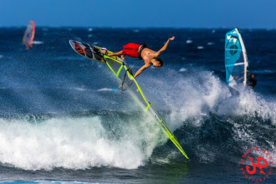
Someone who doesn't have any problem with strong/gusty wind appears to be Graham Ezzy, here pictured in this photo by Jimmie Hepp taken from this gallery.

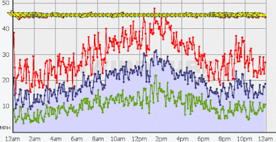
I need an alternative for these super windy days, for there will be plenty also this week and, being a la Nina winter, plenty more also this winter. The alternative is there, I can see it pretty clearly, but it requires skills and gear that I don't have yet. I'll talk about it more in the near future.
3am significant buoy readings
South shore
Lanai
1.5ft @ 15s from 219° (SW)
Barbers
2.1ft @ 15s from 196° (SSW)
A small south swell is here. Yesterday the lahaina webcam looked good all morning and I should have dawn patrolled it before work, but it's hard to pull that off with the sunrise happening an hour later than in summer time. The only way is to leave in the dark, like at 5.30, but without checking the webcam there's the risk of getting there and finding an onshore flow created by the strong trades. It has been the case pretty much every day last week. It wasn't the case yesterday. And there no model that can predict that, it's too much of a localized thing.
North shore
NW
3.5ft @ 13s from 348° (NNW)
Hanalei
2.2ft @ 15s from 320° (NW)
Pauwela
10.3ft @ 9s from 79° (ENE)
1.7ft @ 16s from 351° (N)
Windswell still pumping locally, while the graph of the NW buoy below shows the slow rise of the new small NW swell, which might get up to 3f 14s late this afternoon locally. The direction is all over the place at the three buoys I reported above, but the buoys can be quite not precise with that, specially at the beginning of a swell.
Looking at the wind map of Nov 24 below will help us understand where that swell is really coming from.
On Nov 25 it moved south, so the swell should actually turn more west for us on its second day.
4am significant buoy readings
North shore
NW
North shore
NW
3ft @ 13s from 286° (WNW)
Hanalei
2.6ft @ 15s from 340° (NNW)
Pauwela
Hanalei
2.6ft @ 15s from 340° (NNW)
Pauwela
8.7ft @ 9s from 78° (ENE)
1.7ft @ 16s from 344° (NNW)
Here we go, above are the 4am readings that in the meantime became available and the directions got all shuffled up. Look how west the swell is at the NW buoy now! Again, I saw this happening very often at the beginning of a swell, so I'm not too surprised.
And I thought that maybe it's whatever Surfline does to separate the energy of the different swells from the raw data provided by the buoy that can be wrong. So I went on the "old" NOAA NW buoy website to double check the direction there and... there's no even a sign of the new NW swell! So, even the Surfline buoy page does screw up the direction a bit at the beginning of a new swell, it still tells us much more information than the extremely poor and deceiving information provided by the table below by the NOAA.
Link n.8 is called the Bible for a reason. You just got to trust it.
Link n.8 is called the Bible for a reason. You just got to trust it.
On the map there's also a weak NNW fetch, the windswell fetch (turning more easterly) and a partially blocked fetch just south of New Zealand that I forgot to circle.

NAM3km map at noon shows strong easterly trades.


No comments:
Post a Comment