Everything went like predicted, Jaws did break, Honolua was Double Over Head (DOH), Lahaina had some wrap, the HIC Pro started at Sunset and at Hookipa the Aloha Classic competitors put up quite a show with waves that were mast to two masts high (4-8 meters, 14 to 26 feet faces).
Below is Robby Swift on a mast and half, 20 feet face one (photo by Si Crowther). More action from the pro's probably today and you can watch it live on the AWT page.

4am significant buoy readings
South shore
No southerly energy readings at the Lanai and Barbers buoys, but check the Lahaina webcam to see if the wrap is still getting there.
North shore
NW
6.8ft @ 13s from 344° (NNW)
3.7ft @ 10s from 351° (N)
N
9.7ft @ 14s from 322° (NW)
Waimea
6.1ft @ 13s from 331° (NNW)
3.2ft @ 9s from 353° (N)
2.6ft @ 11s from 342° (NNW)
Pauwela
6.7ft @ 13s from 326° (NW)
4.1ft @ 9s from 351° (N)
Current wind map shows that yesterday's massive fetch is already done making waves for us (the lows are steaming on that jet stream... literally!), but next fetch is already on the convey belt up in the NW corner.

The Windguru table below shows that we might finally get a glassy day or two next week. I still have to compete in the Amateur category in the Aloha Classic, but I'd trade that for a glassy day anytime.
I NEVER use that table to check the wave forecast (as it only shows the biggest swell in size, with no regards to the period), but in this case it illustrates nicely the 2 to 3 days spacing between the arrival of massive NW swells.
In this particular case you can ready 10f 19s in two different moments (Monday 5pm and Thursday 5am) and that does not happen very often (thank god!). Jaws broke small yesterday, it'll be proper those days. Both swells will have good directions for Honolua too.

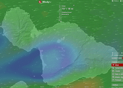
NAM3km map at noon shows decent trades. Other models predict a slitghtly more onshore direction which of course would not be ideal for sailing.


No comments:
Post a Comment