Kiter at Hookipa yesterday late afternoon.

Below I grouped the wind maps at noon of January (left) and February (right). You can see how radically different the two months were: heaven and hell if you only surf. March should bring a change with Kona winds starting around the 6th.

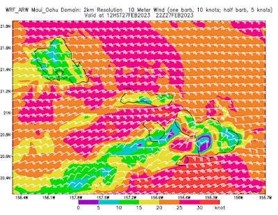
My way to enjoy the strong wind is to do wingfoil downwinders, but yesterday's one wasn't particularly fun, as I was mostly worried not get caught on the inside of breaking waves. As you can see from the map below, once I got to Camp One I had to go out to sea much more than usual to avoid double to triple overhead NE breaking peaks. I drew a black circle to show the danger zone. Don't think I'm going to do one today, as the windswell should be even bigger.

South shore
Lanai
- 2.6ft, 8s, S 175º
- 0.7ft, 17s, SW 215º
- 0.5ft, 13s, SSW 205º
Mix of southerly windswell and small long period SW energies at Lanai.
Check the Lahaina webcam if interested,
for size, conditions and consistency.

North shore
Mokapu
- 11.3ft, 12s, NE 45º
- 4.7ft, 6s, ENE 70º
NE windswell up to 11ft 12s at Mokapu and that's all we're going to have on the north shore. Home guess for Hookipa and eastern exposures is around head and a half to double and stormy.
Fetches map (circles legend: red: direct aim, blue: angular spreading, black: blocked, yellow: possibly over the ice sheet) from Windy.
North Pacific (about 4 days travel time from the NW corner of the North Pacific):
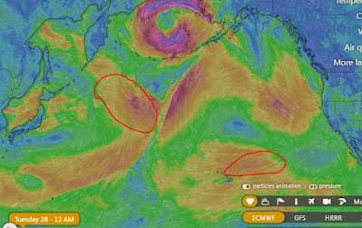
South Pacific (about 7 days travel time from east/west of New Zealand):


No comments:
Post a Comment