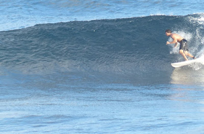
Hookipa yesterday morning.
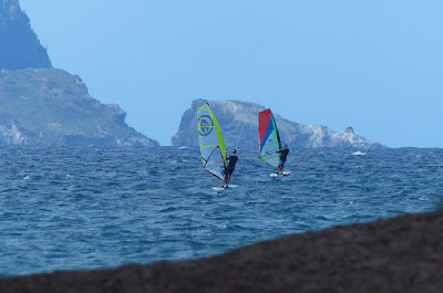
Kanaha in the afternoon.
5am Surfline significant buoy readings and discussion.
South shore
No southerly energy at the buoys.
Check the Lahaina webcam if interested,
for size, conditions and consistency.

North shore
NW001
- 13.6ft, 13s, N 355º
- 9.4ft, 8s, NE 40º
Hanalei
- 10.1ft, 14s, NNW 330º
- 12.6ft, 10s, NNW 345º
Waimea
- 6.1ft, 14s, NNW 330º
- 7.2ft, 11s, NNW 330º
Mokapu
- 4.9ft, 9s, E 80º
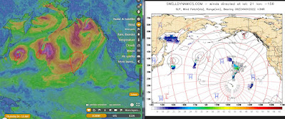
A front has reached the islands (see satellite picture below) and is going to bring rain, northerly winds and stormy seas. Below are the maps of November 22 though 24 that show the fetch that generated the short and medium NNW energies at the buoys.

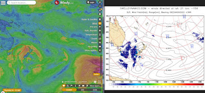
Below is the Surfline forecast showing more than 15ft 14s from the north.


Wind map at noon. The other ones can be found here.

Fetches map (circles legend: red: direct aim, blue: angular spreading, black: blocked, yellow: possibly over the ice sheet) from Windy.
North Pacific (about 4 days travel time from the NW corner of the North Pacific):
South Pacific (about 7 days travel time from east/west of New Zealand):
Morning sky.


No comments:
Post a Comment