Hookipa yesterday mid day.

Some epic windsurfing happened between 2 and 3pm. The sailors were at Middles and I had the perfect angle from the lookout, but my camera had a wrong white balance setting and I couldn't figure it out quickly enough, so these shots all have a blue tint. Better than nothing, I think.


6am Surfline significant buoy readings and discussion.
South shore
Lanai
- 6.6ft, 11s, W 275º
- 4.1ft, 15s, WNW 295º
- 3.7ft, 7s, W 280º
Plenty W to WNW wrap at Lanai, but it's probably very stormy.
Check the Lahaina webcam if interested,
for size, conditions and consistency.

North shore
NW001
- 13.3ft, 14s, NW 310º
- 11.6ft, 11s, NW 320º
- 5ft, 6s, WNW 295º
The previous reading at the NW buoy was 16.7ft 14s so expect the XL swell to be pumping all day locally. As I pointed out yesterday, the kona wind will clean up the faces, but this swell is stormy by nature and the wind should clock to a more westerly direction in the second half of the day and that will make the conditions even worse. So hit it early and find a sheltered place, as it'll be too big in the direct exposure spots (including Hookipa, of course).

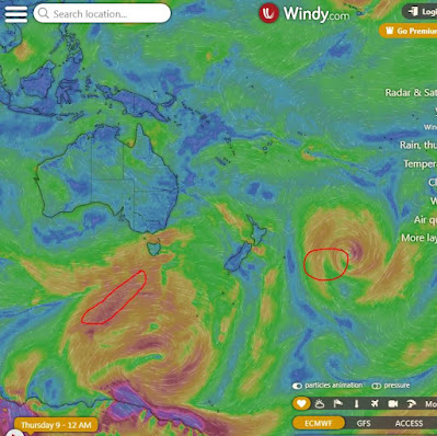
Fetches map (circles legend: red: direct aim, blue: angular spreading, black: blocked, yellow: possibly over the ice sheet) from Windy.
North Pacific (about 4 days travel time from the NW corner of the North Pacific):

South Pacific (about 7 days travel time from east/west of New Zealand):
Morning sky.


No comments:
Post a Comment