4am significant buoy readings and discussion.
South shore
Barbers
1.9ft @ 15s from 210° (SSW)
Lanai
1.6ft @ 15s from 199° (SSW)
Good numbers at the local buoys, the Tasman Sea swell did fill in nicely. Check the Lahaina webcam if interested, for size, conditions and consistency.
North shore
NW101
2.7ft @ 13s from 288° (WNW)
Hanalei
1.6ft @ 14s from 307° (WNW)
Waimea
1.1ft @ 15s from 304° (WNW)
Pauwela
5.6ft @ 9s from 79° (ENE)
1ft @ 15s from 326° (NW)
Plenty ENE 9s windswell still in the water, while a new low long period WNW energy fills in. This is a classic example of a case where if you check the the NOAA Pauwela buoy page, you wouldn't know about the secondary swell, as the primary is much bigger. That's why I check the buoys on the Surfline page instead (link n. 11).
Below is the collage of the fetches maps of March 26 thourgh 30. As you can see (click on the image to enlarge it), the WNW fetch is strongest on the first one (the 15s energy we're receiving today), but the rest of days it's pretty weak. Considering how west it is (around 310, based on its position on the map), no spots other than Hookipa should see much at all from it. And considering that the windswell is still pretty high, not even there it's going to be particularly noticeable. I would then recommend to chase the easterly energy on east exposures, also because the wind should finally be good in this morning (and in the next few mornings).

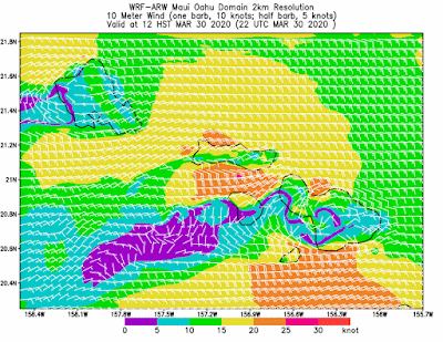
Wind map at noon (the other ones can be found at link n.-2 of GP's meteo websites list in the right column).

North Pacific fetches map (about 4 days travel time from the NW corner):
a couple of tiny/weak NW fetches, plus the windswell fetch.

South Pacific fetches map (about 7 days travel time from east of New Zealand):
a rare SSE fetch SE of Chile.

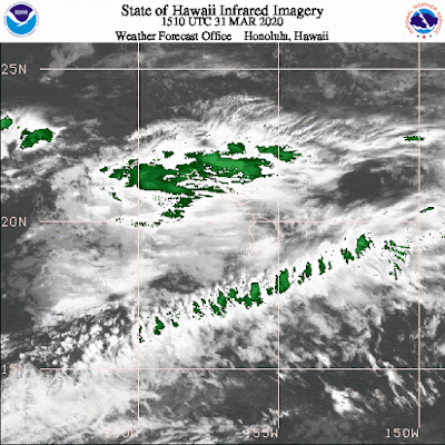
Morning sky. Thanks to this lovely clouds, the thermal onshores should be less than usual today.


