Two shortboard sessions and a windsurfing one for me yesterday and yet another gorgeous day of waves was in the books.
After the first session I wanted to take some pictures at Hookipa, but sadly my camera died shortly after I started shooting. This is the last picture you'll see from it and it will be a little while before I get another one. I use it pretty much exclusive for the blog and, as stated above, I could use some help.
Think about those pictures of Sunny Garcia yesterday. Worth a buck or two?

2am significant buoy redings
South shore
No southerly energy at the buoys, the Surfline forecast calls for 0.6f 15s, but only starting at 2pm. It should be a little bigger the next couple of days.
North shore
NW101
6.2ft @ 11s from 334° (NNW)
Waimea
7.9ft @ 13s from 347° (NNW)
Pauwela
5.6ft @ 13s from 346° (NNW)
3.6ft @ 9s from 53° (ENE)
3.1ft @ 5s from 64° (ENE)
The predicted NNW reinforcement pulse did arrive yesterday afternoon (some sets at Hookipa were pushing mast high) and the energy should be pretty steady all day. Below is the collage of the three reported buoys that shows just that.

Three wind maps today. You can check them yourself with link n. -4. Just play with the "tau" parameter in the address to obtain different times of the day. Example: tau=38 takes you the map of 16Z, which is 6am HST, tau=40 will be 8am and so on.
The first one is 10am and it shows a southerly flow everywhere.

The second one is noon and it shows an onshore very light flow on the north shore. The red circle indicates the offshore wind direction. You want to look on the map upwind of the island and offshore enough for that. When it gets closer to the mountains, the wind wraps around them and can greatly change direction and intensity, like it does in this case right at the easternmost tip.

This one is at 2pm and shows the southerly flow squeezing between the two mountains and shooting out with moderate speed on the north shore.

North Pacific shows a distant WNW fetch and the northerly one responsible for the current swell moving away from us.

Weak pretty insignificant fetch down south.

Big Blue shows those two lows you can see in the fetches maps and I put arrows to indicate the directions where they're moving.

I'm missing the closeup image quite a bit, since it had animation. If someone finds an alternative to that (link n.6), please let me know.

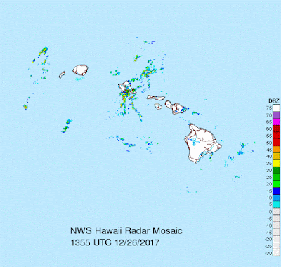
Radar shows some rain n Oahu.


No comments:
Post a Comment